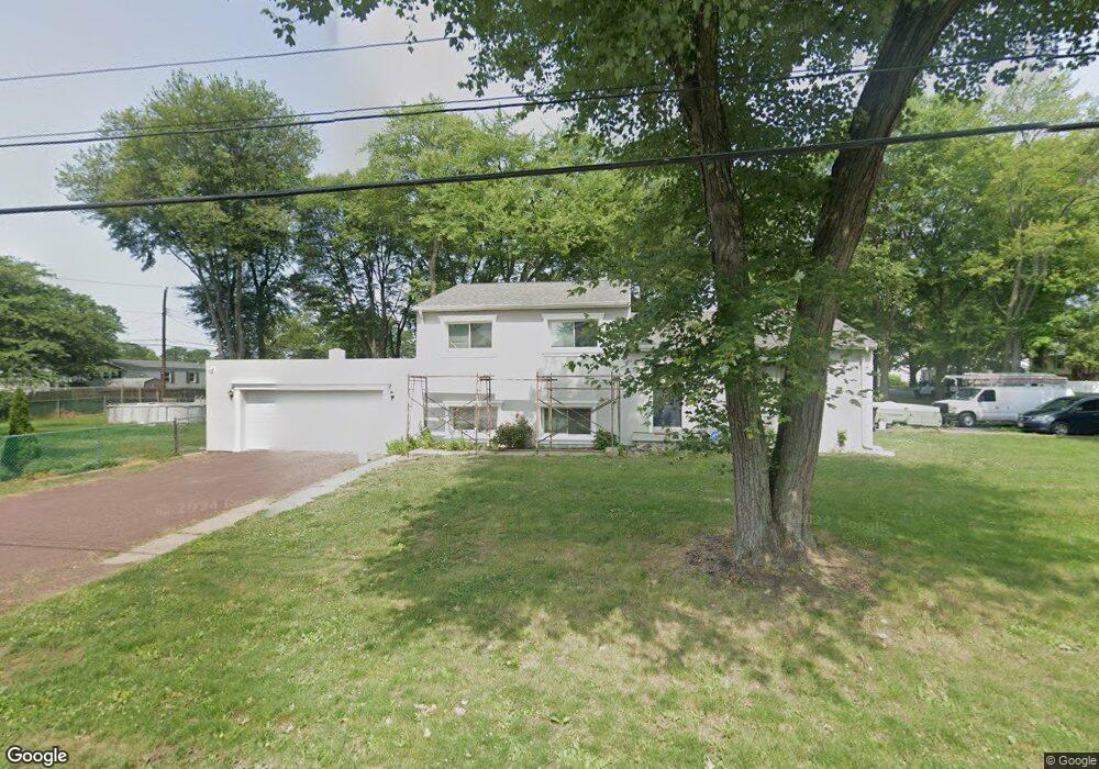
4736 Bensalem Blvd Bensalem, PA 19020
Estimated Value: $327,000 - $476,000
3
Beds
2
Baths
1,926
Sq Ft
$221/Sq Ft
Est. Value
About This Home
This home is located at 4736 Bensalem Blvd, Bensalem, PA 19020 and is currently estimated at $426,062, approximately $221 per square foot. 4736 Bensalem Blvd is a home located in Bucks County with nearby schools including School Lane Charter School, St. Ephrem School, and De La Salle Vocational School.
Ownership History
Date
Name
Owned For
Owner Type
Purchase Details
Closed on
Sep 25, 2009
Sold by
Fannie Mae
Bought by
Estrada Saloman and Estrada Erick
Current Estimated Value
Purchase Details
Closed on
Jul 31, 2009
Sold by
Kelly John P and Kelly Heather
Bought by
Federal National Mortgage Association
Purchase Details
Closed on
Aug 13, 2004
Sold by
Conner Grace E
Bought by
Kelly John P and Kelly Heather
Create a Home Valuation Report for This Property
The Home Valuation Report is an in-depth analysis detailing your home's value as well as a comparison with similar homes in the area
Home Values in the Area
Average Home Value in this Area
Purchase History
| Date | Buyer | Sale Price | Title Company |
|---|---|---|---|
| Estrada Saloman | $174,000 | None Available | |
| Federal National Mortgage Association | $942 | None Available | |
| Kelly John P | $237,000 | -- |
Source: Public Records
Mortgage History
| Date | Status | Borrower | Loan Amount |
|---|---|---|---|
| Closed | Kelly John P | $0 |
Source: Public Records
Tax History Compared to Growth
Tax History
| Year | Tax Paid | Tax Assessment Tax Assessment Total Assessment is a certain percentage of the fair market value that is determined by local assessors to be the total taxable value of land and additions on the property. | Land | Improvement |
|---|---|---|---|---|
| 2025 | $5,676 | $26,000 | $4,640 | $21,360 |
| 2024 | $5,676 | $26,000 | $4,640 | $21,360 |
| 2023 | $5,516 | $26,000 | $4,640 | $21,360 |
| 2022 | $5,483 | $26,000 | $4,640 | $21,360 |
| 2021 | $5,483 | $26,000 | $4,640 | $21,360 |
| 2020 | $5,428 | $26,000 | $4,640 | $21,360 |
| 2019 | $5,307 | $26,000 | $4,640 | $21,360 |
| 2018 | $5,184 | $26,000 | $4,640 | $21,360 |
| 2017 | $5,152 | $26,000 | $4,640 | $21,360 |
| 2016 | $5,152 | $26,000 | $4,640 | $21,360 |
| 2015 | -- | $26,000 | $4,640 | $21,360 |
| 2014 | -- | $26,000 | $4,640 | $21,360 |
Source: Public Records
Map
Nearby Homes
- 953 Farley Rd
- 938 Ashton Rd
- 4783 Meeting Rd
- 1100 Wayland Ave
- 580 S Mount Vernon Cir
- 446 N Mount Vernon Cir Unit 446
- 419 Rutgers Ct
- 393 Rutgers Ct Unit 393
- 435 N Mount Vernon Cir Unit 435
- 389 Rutgers Ct Unit 389
- 801 Cliff Rd
- 5110 Bay Rd
- 5107 Leeward Rd
- 4744 Dunston Rd
- 5102 Lighthouse Ln
- L:15 Dunston Rd
- 5217 Bay Rd
- 1440 Atterbury Way
- 0 Newportville Rd Unit PABU487252
- 906 Stephen Ave
- 1022 Harwood Rd
- 1036 Harwood Rd
- 4737 Bensalem Blvd
- 4704 Bensalem Blvd
- 990 Ashton Rd
- 4760 Bensalem Blvd
- 4715 Bensalem Blvd
- 1023 Harwood Rd
- 1048 Harwood Rd
- 989 Ashton Rd
- 981 Farley Rd
- 1045 Ford Rd
- 1037 Harwood Rd
- 4778 Bensalem Blvd
- 966 Ashton Rd
- 4786 Bensalem Blvd
- 4779 Bensalem Blvd
- 1049 Harwood Rd
- 1062 Harwood Rd
- 973 Ashton Rd