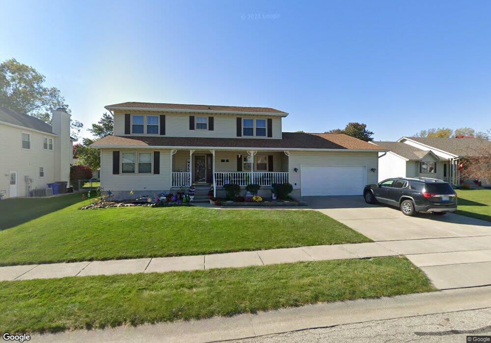
4737 Mission Dr Decatur, IL 62526
Cresthaven NeighborhoodEstimated Value: $223,000 - $276,000
--
Bed
2
Baths
1,117
Sq Ft
$225/Sq Ft
Est. Value
About This Home
This home is located at 4737 Mission Dr, Decatur, IL 62526 and is currently estimated at $251,694, approximately $225 per square foot. 4737 Mission Dr is a home located in Macon County with nearby schools including Maroa-Forsyth Grade School, Maroa-Forsyth Middle School, and Maroa-Forsyth Senior High School.
Ownership History
Date
Name
Owned For
Owner Type
Purchase Details
Closed on
Sep 22, 2022
Sold by
Buenting Gary L and Buenting Linda S
Bought by
Rotz Joseph and Rotz Elizabeth
Current Estimated Value
Home Financials for this Owner
Home Financials are based on the most recent Mortgage that was taken out on this home.
Original Mortgage
$181,600
Outstanding Balance
$173,456
Interest Rate
5.22%
Mortgage Type
New Conventional
Estimated Equity
$78,238
Purchase Details
Closed on
Mar 1, 1996
Create a Home Valuation Report for This Property
The Home Valuation Report is an in-depth analysis detailing your home's value as well as a comparison with similar homes in the area
Home Values in the Area
Average Home Value in this Area
Purchase History
| Date | Buyer | Sale Price | Title Company |
|---|---|---|---|
| Rotz Joseph | $227,000 | -- | |
| Rotz Joseph | $227,000 | None Listed On Document | |
| -- | $20,000 | -- |
Source: Public Records
Mortgage History
| Date | Status | Borrower | Loan Amount |
|---|---|---|---|
| Open | Rotz Joseph | $181,600 | |
| Closed | Rotz Joseph | $181,600 |
Source: Public Records
Tax History Compared to Growth
Tax History
| Year | Tax Paid | Tax Assessment Tax Assessment Total Assessment is a certain percentage of the fair market value that is determined by local assessors to be the total taxable value of land and additions on the property. | Land | Improvement |
|---|---|---|---|---|
| 2024 | $6,454 | $74,145 | $8,946 | $65,199 |
| 2023 | $5,998 | $68,161 | $8,224 | $59,937 |
| 2022 | $5,605 | $63,217 | $7,628 | $55,589 |
| 2021 | $5,303 | $58,596 | $7,132 | $51,464 |
| 2020 | $5,074 | $57,385 | $6,985 | $50,400 |
| 2019 | $5,074 | $57,385 | $6,985 | $50,400 |
| 2018 | $5,034 | $57,795 | $7,035 | $50,760 |
| 2017 | $4,990 | $57,536 | $7,003 | $50,533 |
| 2016 | $5,043 | $57,675 | $7,020 | $50,655 |
| 2015 | $4,893 | $56,991 | $6,937 | $50,054 |
| 2014 | $4,689 | $56,991 | $6,937 | $50,054 |
| 2013 | $4,727 | $56,991 | $6,937 | $50,054 |
Source: Public Records
Map
Nearby Homes
- 4682 Cresthaven Ln
- 4606 Wisteria Ct
- 4643 Nicklaus Ct
- 4444 N Adams Dr
- 4499 Lawson Dr
- 4636 Lawson Dr
- 0 Route 51 Unit 6241333
- 1110 W Ash Ave
- 16 Surrey Ln
- 1190 Wedgewood Ct
- 810 Sarah Dr
- 4074 Sheffield Ct
- 365 W Ash Ave
- 880 W Frank Dr
- 235 W Ash Ave
- 933 W Frank Dr
- 416 Southampton Dr
- 3981 N Northbrook Dr
- 204 Newcastle Dr
- 4057 N Constant View Dr
- 4730 Beechwood Trail
- 4727 Mission Dr
- 4747 Mission Dr
- 4720 Beechwood Trail
- 4740 Beechwood Trail
- 4750 Beechwood Trail
- 4715 Mission Dr
- 4757 Mission Dr
- 4734 Mission Dr
- 4760 Beechwood Trail
- 4710 Beechwood Trail
- 4724 Mission Dr
- 4744 Mission Dr
- 963 Aspen Trail
- 4714 Mission Dr
- 4707 Mission Dr
- 4752 Mission Dr
- 960 Arbor Trail
- 932 Aspen Trail
- 995 Ashwood Trail