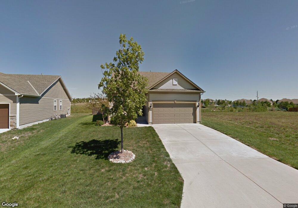
4737 SW Davis Dr Raymore, MO 64083
Estimated Value: $408,408 - $475,000
3
Beds
2
Baths
1,582
Sq Ft
$274/Sq Ft
Est. Value
About This Home
This home is located at 4737 SW Davis Dr, Raymore, MO 64083 and is currently estimated at $433,102, approximately $273 per square foot. 4737 SW Davis Dr is a home located in Cass County with nearby schools including Timber Creek Elementary School, Raymore-Peculiar East Middle School, and Raymore-Peculiar Senior High School.
Ownership History
Date
Name
Owned For
Owner Type
Purchase Details
Closed on
Aug 20, 2018
Sold by
Brunson David A
Bought by
Gross Rick
Current Estimated Value
Home Financials for this Owner
Home Financials are based on the most recent Mortgage that was taken out on this home.
Original Mortgage
$183,585
Outstanding Balance
$158,770
Interest Rate
4.5%
Mortgage Type
FHA
Estimated Equity
$274,332
Purchase Details
Closed on
Mar 30, 2016
Sold by
Brunson David A
Bought by
Brunson David A and David Brunson Trust
Purchase Details
Closed on
Nov 25, 2011
Sold by
Bickford Denise and Horn James
Bought by
Brunson David A
Home Financials for this Owner
Home Financials are based on the most recent Mortgage that was taken out on this home.
Original Mortgage
$147,250
Interest Rate
3.44%
Mortgage Type
Adjustable Rate Mortgage/ARM
Purchase Details
Closed on
Apr 7, 2009
Sold by
Baw Investments Lc
Bought by
Bickford Denise and Horn James
Create a Home Valuation Report for This Property
The Home Valuation Report is an in-depth analysis detailing your home's value as well as a comparison with similar homes in the area
Purchase History
| Date | Buyer | Sale Price | Title Company |
|---|---|---|---|
| Gross Rick | -- | Continental Title | |
| Brunson David A | -- | None Available | |
| Brunson David A | -- | None Available | |
| Bickford Denise | -- | None Available |
Source: Public Records
Mortgage History
| Date | Status | Borrower | Loan Amount |
|---|---|---|---|
| Open | Gross Rick | $183,585 | |
| Previous Owner | Brunson David A | $147,250 |
Source: Public Records
Tax History
| Year | Tax Paid | Tax Assessment Tax Assessment Total Assessment is a certain percentage of the fair market value that is determined by local assessors to be the total taxable value of land and additions on the property. | Land | Improvement |
|---|---|---|---|---|
| 2025 | $3,656 | $51,560 | $5,910 | $45,650 |
| 2024 | $3,656 | $45,540 | $5,370 | $40,170 |
| 2023 | $3,644 | $45,540 | $5,370 | $40,170 |
| 2022 | $3,365 | $40,410 | $5,370 | $35,040 |
| 2021 | $3,365 | $40,410 | $5,370 | $35,040 |
| 2020 | $3,397 | $39,940 | $5,370 | $34,570 |
| 2019 | $3,334 | $39,940 | $5,370 | $34,570 |
| 2018 | $3,157 | $35,790 | $4,520 | $31,270 |
| 2017 | $2,922 | $35,790 | $4,520 | $31,270 |
| 2016 | $2,922 | $33,920 | $4,520 | $29,400 |
| 2015 | $2,921 | $33,920 | $4,520 | $29,400 |
| 2014 | $2,933 | $33,920 | $4,520 | $29,400 |
| 2013 | -- | $33,920 | $4,520 | $29,400 |
Source: Public Records
Map
Nearby Homes
- 1128 SW Whitby Dr
- 1136 SW Whitby Dr
- 1100 SW Blackpool Dr
- 1144 SW Whitby Dr
- 4628 SW Robinson Dr
- 4624 SW Robinson Dr
- 917 SW Soldier Ct
- 1153 SW Whitby Dr
- 4756 SW Leafwing Dr
- 1173 SW Whitby Dr
- 4528 SW Berkshire Dr
- 4801 SW Soldier Dr
- 4729 SW Soldier Dr
- 4520 SW Berkshire Dr
- 4647 SW Olympia Place
- 4516 SW Berkshire Dr
- 1021 SW Cheshire Dr
- 908 SW Olympia Ct
- 1022 SW Cheshire Dr
- 4641 SW Soldier Dr
- 4733 SW Davis Dr
- 4741 SW Davis Dr
- 4729 SW Davis Dr
- 1100 SW Whitby Dr
- 4801 SW Davis Dr
- 4725 SW Davis Dr
- 4805 SW Davis Dr
- 1104 SW Whitby Dr
- 4721 SW Davis Dr
- 4514 SW Fenwick Rd
- 1106 SW Whitby Dr
- 4809 SW Davis Dr
- 1108 SW Whitby Dr
- 4804 SW Davis Dr
- 4717 SW Davis Dr
- 1112 SW Whitby Dr
- 4813 SW Davis Dr
- 4812 SW Davis Dr
- 4713 SW Davis Dr
- 1116 SW Whitby Dr
Your Personal Tour Guide
Ask me questions while you tour the home.