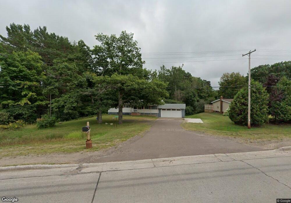
47376 State Highway M26 Atlantic Mine, MI 49905
Estimated Value: $247,639 - $310,000
3
Beds
1
Bath
1,104
Sq Ft
$259/Sq Ft
Est. Value
About This Home
This home is located at 47376 State Highway M26, Atlantic Mine, MI 49905 and is currently estimated at $285,410, approximately $258 per square foot. 47376 State Highway M26 is a home with nearby schools including Houghton Elementary School, Houghton Middle School, and Houghton Central High School.
Ownership History
Date
Name
Owned For
Owner Type
Purchase Details
Closed on
Jan 17, 2024
Sold by
Massie Melinda K
Bought by
Vanklompenberg Walter and Vanklompenberg Sharon
Current Estimated Value
Purchase Details
Closed on
Jul 16, 2018
Sold by
Wesa Phyllis K Trust
Bought by
Massie Melinda K
Home Financials for this Owner
Home Financials are based on the most recent Mortgage that was taken out on this home.
Original Mortgage
$117,837
Interest Rate
4.75%
Mortgage Type
Construction
Purchase Details
Closed on
May 9, 2007
Sold by
Wesa Phyllis K Trust
Create a Home Valuation Report for This Property
The Home Valuation Report is an in-depth analysis detailing your home's value as well as a comparison with similar homes in the area
Home Values in the Area
Average Home Value in this Area
Purchase History
| Date | Buyer | Sale Price | Title Company |
|---|---|---|---|
| Vanklompenberg Walter | $190,000 | M&M Title | |
| Massie Melinda K | $121,482 | Attorney Only | |
| -- | -- | -- |
Source: Public Records
Mortgage History
| Date | Status | Borrower | Loan Amount |
|---|---|---|---|
| Previous Owner | Massie Melinda K | $117,837 |
Source: Public Records
Tax History Compared to Growth
Tax History
| Year | Tax Paid | Tax Assessment Tax Assessment Total Assessment is a certain percentage of the fair market value that is determined by local assessors to be the total taxable value of land and additions on the property. | Land | Improvement |
|---|---|---|---|---|
| 2025 | $3,233 | $110,848 | $0 | $0 |
| 2024 | $1,856 | $112,410 | $0 | $0 |
| 2023 | $1,769 | $101,764 | $0 | $0 |
| 2022 | $2,942 | $89,474 | $0 | $0 |
| 2021 | $2,887 | $90,313 | $0 | $0 |
| 2020 | $2,653 | $78,573 | $0 | $0 |
| 2019 | $2,606 | $76,852 | $0 | $0 |
| 2018 | $2,387 | $76,529 | $0 | $0 |
| 2017 | $2,278 | $74,465 | $0 | $0 |
| 2016 | -- | $72,309 | $0 | $0 |
| 2015 | -- | $71,301 | $0 | $0 |
| 2014 | -- | $64,836 | $0 | $0 |
Source: Public Records
Map
Nearby Homes
- TBD-1 Green Acres Rd
- 47302 Janovosky Rd
- 2103 Balsam Ln
- TBD-undeveloped Oak Ridge Ln
- TBD Razorback Dr Unit Part of Lot 22, Enti
- 1906 White Oak Ln
- 1905 Poplar Dr
- 1506 Sugar Maple Ln
- 1504 Sugar Maple Ln
- 46396 Maple St
- 19336 W Edwards Ave
- 19990 Henry St
- 503 W Baraga Ave
- 810 W Douglass Ave
- 707 W Douglass Ave
- TBD 16 & 17 Calverley Ave
- 47594 1st St
- 310 W Douglass Ave
- 108 Calverley Ave
- TBD A B C Navy Stream
- 47451 Michigan 26
- 47376 Michigan 26
- 47295 Green Acres Rd
- 47368 State Highway M26
- 47362 State Highway M26
- 47350 State Highway M26
- 47350 Michigan 26
- 47216 Green Acres Rd
- 47420 State Highway M26
- 47341 State Highway M26
- 47420 Michigan 26
- 47338 State Highway M26
- 47338 State Highway M26
- 47338 State Highway M26
- 47190 Green Acres Rd
- 47310 Edgewood Rd
- 47310 Edgewood Rd
- 47310 Edgewood Rd
- 47156 Green Acres Rd
- 47431 Michigan 26