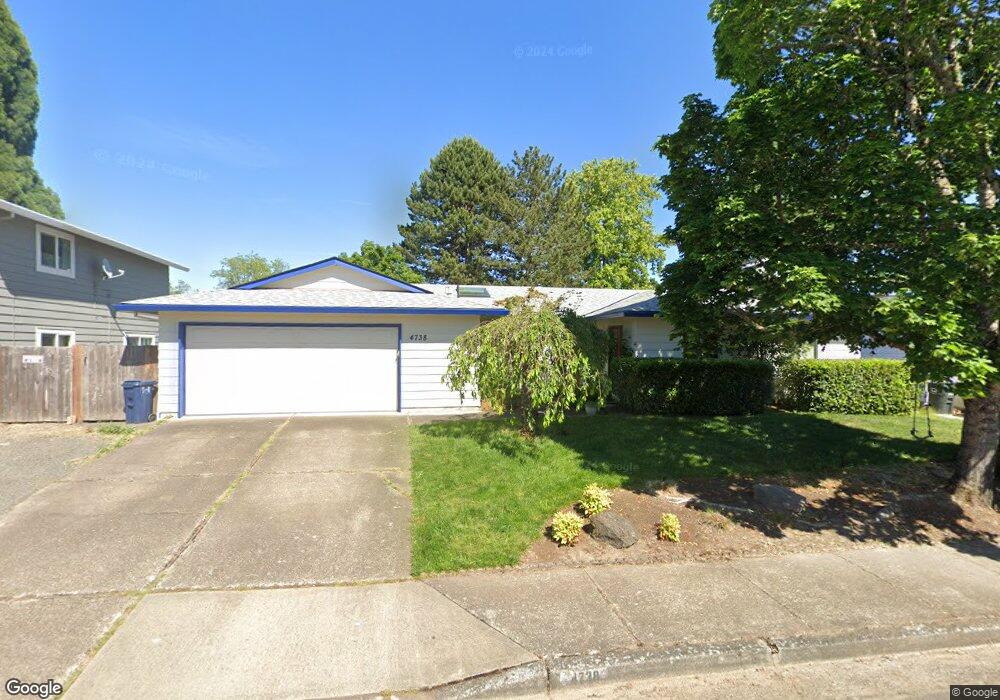
4738 SW 201st Ave Beaverton, OR 97007
Estimated Value: $474,000 - $566,000
3
Beds
3
Baths
1,844
Sq Ft
$290/Sq Ft
Est. Value
About This Home
This home is located at 4738 SW 201st Ave, Beaverton, OR 97007 and is currently estimated at $534,081, approximately $289 per square foot. 4738 SW 201st Ave is a home located in Washington County with nearby schools including Butternut Creek Elementary School, R.A. Brown Middle School, and Century High School.
Ownership History
Date
Name
Owned For
Owner Type
Purchase Details
Closed on
Aug 11, 2021
Sold by
Ober Timothy D and Ober Josiah K
Bought by
Brown Tyler and Brown Angela
Current Estimated Value
Home Financials for this Owner
Home Financials are based on the most recent Mortgage that was taken out on this home.
Original Mortgage
$344,000
Outstanding Balance
$310,813
Interest Rate
2.77%
Estimated Equity
$223,268
Purchase Details
Closed on
Oct 1, 2010
Sold by
Ober Susan M
Bought by
Ober Susan M and Susan M Ober Revocable Living Trust
Create a Home Valuation Report for This Property
The Home Valuation Report is an in-depth analysis detailing your home's value as well as a comparison with similar homes in the area
Home Values in the Area
Average Home Value in this Area
Purchase History
| Date | Buyer | Sale Price | Title Company |
|---|---|---|---|
| Brown Tyler | -- | First American | |
| Brown Tyler | $334,933 | First American | |
| Ober Susan M | -- | Chicago Title Insurance Co |
Source: Public Records
Mortgage History
| Date | Status | Borrower | Loan Amount |
|---|---|---|---|
| Open | Brown Tyler | $344,000 | |
| Closed | Brown Tyler | $344,000 |
Source: Public Records
Tax History Compared to Growth
Tax History
| Year | Tax Paid | Tax Assessment Tax Assessment Total Assessment is a certain percentage of the fair market value that is determined by local assessors to be the total taxable value of land and additions on the property. | Land | Improvement |
|---|---|---|---|---|
| 2026 | $4,310 | $296,610 | -- | -- |
| 2025 | $4,310 | $287,980 | -- | -- |
| 2024 | $4,189 | $279,600 | -- | -- |
| 2023 | $4,189 | $271,460 | $0 | $0 |
| 2022 | $4,028 | $271,460 | $0 | $0 |
| 2021 | $3,952 | $255,890 | $0 | $0 |
| 2020 | $3,869 | $248,440 | $0 | $0 |
| 2019 | $3,751 | $241,210 | $0 | $0 |
| 2018 | $3,589 | $234,190 | $0 | $0 |
| 2017 | $3,455 | $227,370 | $0 | $0 |
| 2016 | $3,365 | $220,750 | $0 | $0 |
| 2015 | $3,241 | $214,330 | $0 | $0 |
| 2014 | $3,191 | $208,090 | $0 | $0 |
Source: Public Records
Map
Nearby Homes
- 4895 SW 202nd Ave
- 19901 SW Meadowbrook Ct
- 4650 SW Southview Terrace
- 19753 SW Celebrity St
- 4658 SW Stoddard Dr
- 20020 SW Walquin Ct
- 20385 SW Shelley Ct
- 19560 SW Madeline St
- 19735 SW Rosa Rd
- Morgan Plan at Butternut Creek - The Ember Collection
- 20675 SW Rosa Dr
- 19055 SW Butternut St
- 3980 SW 208th Ct
- 5820 SW 206th Ave
- 3683 SW 209th Ave
- 3627 SW 209th Ave
- 6050 SW Cross Creek Dr
- 8473 SE Apricot Ln
- 4150 SW 191st Ave
- 18830 SW Butternut St
- 4768 SW 201st Ave
- 4708 SW 201st Ave
- 4735 SW 200th Ave
- 4765 SW 200th Ave
- 4705 SW 200th Ave
- 4753 SW 201st Ave
- 4798 SW 201st Ave
- 4668 SW 201st Ave
- 4723 SW 201st Ave
- 4798 SW 201st Ave
- 4795 SW 200th Ave
- 4693 SW 201st Ave
- 4783 SW 201st Ave
- 4675 SW 200th Ave
- 4663 SW 201st Ave
- 4638 SW 201st Ave
- 4813 SW 201st Ave
- 4828 SW 201st Ave
- 20035 SW Meadowbrook Way
- 4700 SW 202nd Ave