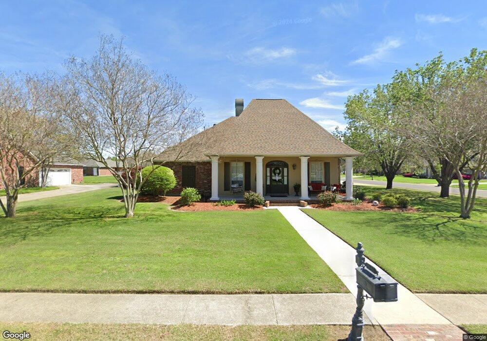
4739 Shelter Ct Port Allen, LA 70767
West Baton Rouge Parish NeighborhoodEstimated Value: $397,000 - $453,000
--
Bed
--
Bath
2,349
Sq Ft
$179/Sq Ft
Est. Value
About This Home
This home is located at 4739 Shelter Ct, Port Allen, LA 70767 and is currently estimated at $420,131, approximately $178 per square foot. 4739 Shelter Ct is a home located in West Baton Rouge Parish with nearby schools including Brusly Elementary School, Lukeville Upper Elementary School, and Brusly Middle School.
Ownership History
Date
Name
Owned For
Owner Type
Purchase Details
Closed on
Jan 31, 2017
Sold by
Dupont Stephen O and Dupont Becky L
Bought by
Gilbreath Stephen and Gilbreath Jennifer
Current Estimated Value
Home Financials for this Owner
Home Financials are based on the most recent Mortgage that was taken out on this home.
Original Mortgage
$160,000
Outstanding Balance
$132,473
Interest Rate
4.2%
Mortgage Type
New Conventional
Estimated Equity
$287,658
Create a Home Valuation Report for This Property
The Home Valuation Report is an in-depth analysis detailing your home's value as well as a comparison with similar homes in the area
Home Values in the Area
Average Home Value in this Area
Purchase History
| Date | Buyer | Sale Price | Title Company |
|---|---|---|---|
| Gilbreath Stephen | $345,000 | None Available |
Source: Public Records
Mortgage History
| Date | Status | Borrower | Loan Amount |
|---|---|---|---|
| Open | Gilbreath Stephen | $160,000 |
Source: Public Records
Tax History Compared to Growth
Tax History
| Year | Tax Paid | Tax Assessment Tax Assessment Total Assessment is a certain percentage of the fair market value that is determined by local assessors to be the total taxable value of land and additions on the property. | Land | Improvement |
|---|---|---|---|---|
| 2024 | $2,718 | $35,560 | $9,000 | $26,560 |
| 2023 | $2,496 | $31,540 | $8,500 | $23,040 |
| 2022 | $3,308 | $31,540 | $8,500 | $23,040 |
| 2021 | $3,383 | $31,540 | $8,500 | $23,040 |
| 2020 | $3,075 | $28,390 | $7,650 | $20,740 |
| 2019 | $3,167 | $28,070 | $4,480 | $23,590 |
| 2018 | $3,224 | $28,070 | $4,480 | $23,590 |
| 2017 | $2,977 | $28,070 | $4,480 | $23,590 |
| 2015 | $2,375 | $27,660 | $4,070 | $23,590 |
| 2014 | $2,337 | $27,660 | $4,070 | $23,590 |
| 2013 | $2,201 | $26,050 | $4,070 | $21,980 |
Source: Public Records
Map
Nearby Homes
- 4747 Evergreen Dr
- 2217 Silverstone Ave
- 1959 Fairview Ave
- 2428 Riverside Dr
- 1394 Rue Riviere
- 2488 Oak Alley Dr
- 1152 Freeman Ln
- 6312 Louisiana 1
- Whitmore II Plan at The Woodlands
- Woodland II Plan at The Woodlands
- Whitmore I - The Woodlands Plan at The Woodlands
- Waldorf I Plan at The Woodlands
- Chadford I Plan at The Woodlands
- 2607 Riverside Dr
- 540 Bourgeois St
- 4000 Lake Beau Pre Blvd Unit 198
- 4000 Lake Beau Pre Blvd Unit 69
- 4000 Lake Beau Pre Blvd Unit 110
- 4000 Lake Beau Pre Blvd Unit 13
- 4000 Lake Beau Pre Blvd Unit 87
- 4707 Shelter Ct
- # Willow Glen Ave Unit 27
- 4772 Missouri Dr
- 2045 Willow Glen Ave
- 2023 Willow Glen Ave
- 2072 Willow Glen Ave
- 4647 Shelter Ct
- 4710 Shelter Ct
- 4758 Missouri Dr
- 2001 Willow Glen Ave
- 4656 Shelter Ct
- 4615 Shelter Ct
- 2079 Willow Glen Ave
- 0 Missouri Dr
- 4704 Missouri Dr
- 4600 Shelter Ct
- 2088 Willow Glen Ave
- 4667 Golden Ridge Dr
- 4624 Shelter Ct
- 1979 Safford Blvd