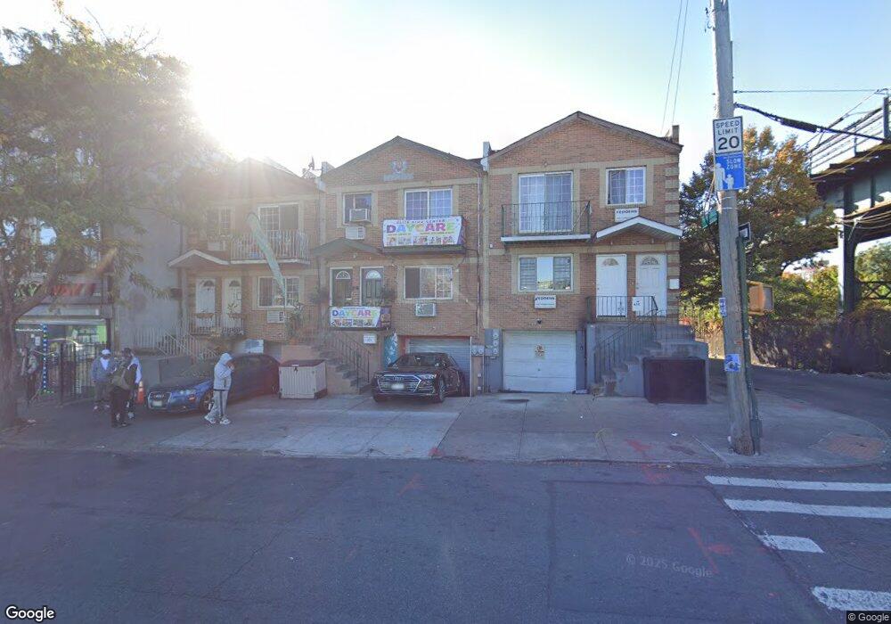
474-476 Sutter Ave Brooklyn, NY 11207
Brownsville NeighborhoodEstimated Value: $894,767 - $1,076,000
Studio
--
Bath
2,280
Sq Ft
$419/Sq Ft
Est. Value
About This Home
This home is located at 474-476 Sutter Ave, Brooklyn, NY 11207 and is currently estimated at $956,192, approximately $419 per square foot. 474-476 Sutter Ave is a home located in Kings County with nearby schools including P.S. 328 - Phyllis Wheatley, J.H.S 292 Margaret S. Douglas, and Brownsville Collegiate Charter School.
Ownership History
Date
Name
Owned For
Owner Type
Purchase Details
Closed on
Nov 22, 2006
Sold by
Isaac Sheryl
Bought by
Harrigain Roderick and Isaac Sheryl
Current Estimated Value
Create a Home Valuation Report for This Property
The Home Valuation Report is an in-depth analysis detailing your home's value as well as a comparison with similar homes in the area
Home Values in the Area
Average Home Value in this Area
Purchase History
| Date | Buyer | Sale Price | Title Company |
|---|---|---|---|
| Harrigain Roderick | -- | -- | |
| Harrigain Roderick | -- | -- |
Source: Public Records
Mortgage History
| Date | Status | Borrower | Loan Amount |
|---|---|---|---|
| Closed | Harrigain Roderick | $0 |
Source: Public Records
Tax History
| Year | Tax Paid | Tax Assessment Tax Assessment Total Assessment is a certain percentage of the fair market value that is determined by local assessors to be the total taxable value of land and additions on the property. | Land | Improvement |
|---|---|---|---|---|
| 2025 | $7,722 | $58,020 | $14,880 | $43,140 |
| 2024 | $7,722 | $54,120 | $14,880 | $39,240 |
| 2023 | $7,366 | $51,120 | $14,880 | $36,240 |
| 2022 | $6,090 | $41,820 | $14,880 | $26,940 |
| 2021 | $6,053 | $32,280 | $14,880 | $17,400 |
| 2020 | $3,622 | $39,780 | $14,880 | $24,900 |
| 2019 | $7,002 | $39,780 | $14,880 | $24,900 |
| 2018 | $7,118 | $34,916 | $14,011 | $20,905 |
| 2017 | $6,715 | $32,940 | $14,880 | $18,060 |
| 2016 | $6,357 | $31,800 | $14,880 | $16,920 |
| 2015 | $4,519 | $35,352 | $15,296 | $20,056 |
| 2014 | $4,519 | $33,644 | $14,892 | $18,752 |
Source: Public Records
Map
Nearby Homes
- 472 Sutter Ave
- 440 Blake Ave
- 406 Hinsdale St
- 105 Belmont Ave
- 1782 Pitkin Ave
- 353 Pennsylvania Ave
- 317 Pennsylvania Ave
- 392 New Jersey Ave Unit 3921
- 444 New Jersey Ave
- 117 Osborn St
- 45 Hinsdale St
- 525 Alabama Ave
- 486 Vermont St
- 502 Powell St
- 504 Vermont St
- 533 Snediker Ave
- 548 Rockaway Ave
- 342 Wyona St
- 195 Chester St
- 560 Riverdale Ave
- 476 Sutter Ave
- 476 Sutter Ave
- 476 Sutter St
- 480 Sutter Ave
- 359 van Sinderen Ave
- 482 Sutter Ave
- 361-371 van Sinderen Ave
- 274 Snediker Ave
- 276 Snediker Ave
- 278 Snediker Ave
- 272 Snediker Ave
- 272 Snediker Ave Unit 2
- 280 Snediker Ave
- 284 Snediker Ave
- 286 Snediker Ave
- 292 Snediker Ave
- 288 Snediker Ave
- 288 Snediker Ave Unit 2
- 288 Snediker Ave Unit 1
- 373-375 van Sinderen Ave
Your Personal Tour Guide
Ask me questions while you tour the home.