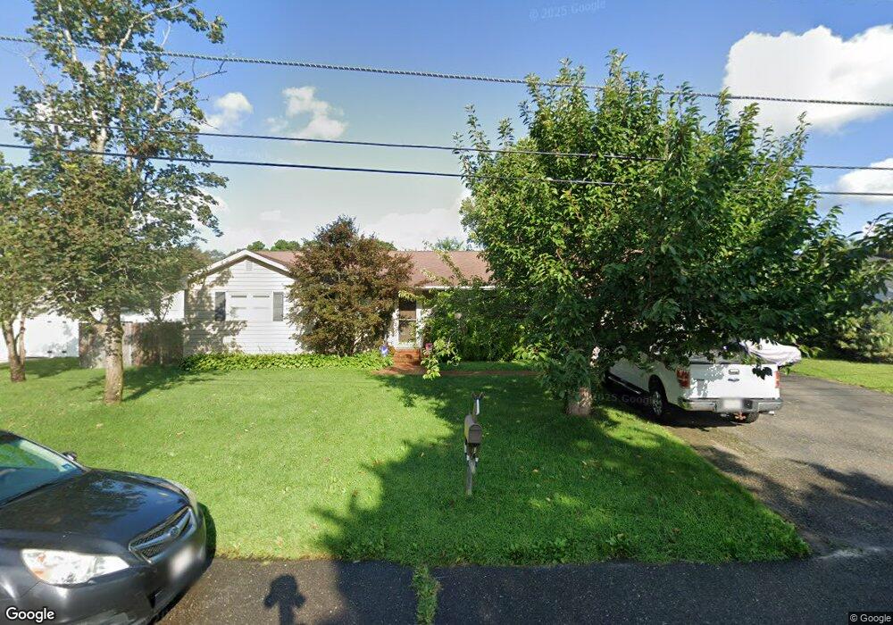
474 Barnacle Rd Forked River, NJ 08731
Estimated Value: $489,895 - $538,000
4
Beds
3
Baths
1,970
Sq Ft
$260/Sq Ft
Est. Value
About This Home
This home is located at 474 Barnacle Rd, Forked River, NJ 08731 and is currently estimated at $511,974, approximately $259 per square foot. 474 Barnacle Rd is a home located in Ocean County with nearby schools including Lacey Township High School.
Ownership History
Date
Name
Owned For
Owner Type
Purchase Details
Closed on
Nov 7, 2011
Sold by
Kiernan Matthew and Kiernan Martha
Bought by
Kiernan Matthew and Kiernan Martha
Current Estimated Value
Home Financials for this Owner
Home Financials are based on the most recent Mortgage that was taken out on this home.
Original Mortgage
$197,200
Outstanding Balance
$134,990
Interest Rate
4.1%
Mortgage Type
New Conventional
Estimated Equity
$376,984
Purchase Details
Closed on
Apr 30, 2004
Sold by
Sharry Robert G and Sharry Mary
Bought by
Kiernan Matthew and Sulkowski Marta
Home Financials for this Owner
Home Financials are based on the most recent Mortgage that was taken out on this home.
Original Mortgage
$216,795
Interest Rate
5.39%
Mortgage Type
Purchase Money Mortgage
Create a Home Valuation Report for This Property
The Home Valuation Report is an in-depth analysis detailing your home's value as well as a comparison with similar homes in the area
Home Values in the Area
Average Home Value in this Area
Purchase History
| Date | Buyer | Sale Price | Title Company |
|---|---|---|---|
| Kiernan Matthew | -- | None Available | |
| Kiernan Matthew | $223,500 | Counsellors Title Agency Inc |
Source: Public Records
Mortgage History
| Date | Status | Borrower | Loan Amount |
|---|---|---|---|
| Open | Kiernan Matthew | $197,200 | |
| Closed | Kiernan Matthew | $216,795 |
Source: Public Records
Tax History
| Year | Tax Paid | Tax Assessment Tax Assessment Total Assessment is a certain percentage of the fair market value that is determined by local assessors to be the total taxable value of land and additions on the property. | Land | Improvement |
|---|---|---|---|---|
| 2025 | $6,677 | $263,500 | $101,500 | $162,000 |
| 2024 | $6,242 | $263,500 | $101,500 | $162,000 |
Source: Public Records
Map
Nearby Homes
- 463 Ensign Rd
- 22 Saltspray Dr
- 123 Oakwood Place
- 9 Hollywood Blvd S
- 69 Saltspray Dr
- 75 Saltspray Dr
- 79 Saltspray Dr
- 102 Maria Loretta Ln
- 404 Beach Blvd
- 10 Dolphin Ct
- 417 Riverview Rd
- 72 Saltspray Dr
- 217 Nantucket Rd
- 1303 Cypress St
- 1216 Taylor Ln
- 615 Beach Blvd
- 126 Bay Ave
- 634 Fairview Ln
- 1223 Sylvania Place
- 635 Oakwood Dr
- 472 Barnacle Rd
- 476 Barnacle Rd
- 475 Admiral Rd
- 477 Admiral Rd
- 473 Admiral Rd
- 475 Barnacle Rd
- 477 Barnacle Rd
- 478 Barnacle Rd
- 470 Barnacle Rd
- 473 Barnacle Rd
- 479 Admiral Rd
- 471 Admiral Rd
- 479 Barnacle Rd
- 471 Barnacle Rd
- 474 Commodore Dr
- 474 Admiral Rd
- 476 Admiral Rd
- 472 Commodore Dr
- 480 Barnacle Rd
- 476 Commodore Dr
Your Personal Tour Guide
Ask me questions while you tour the home.