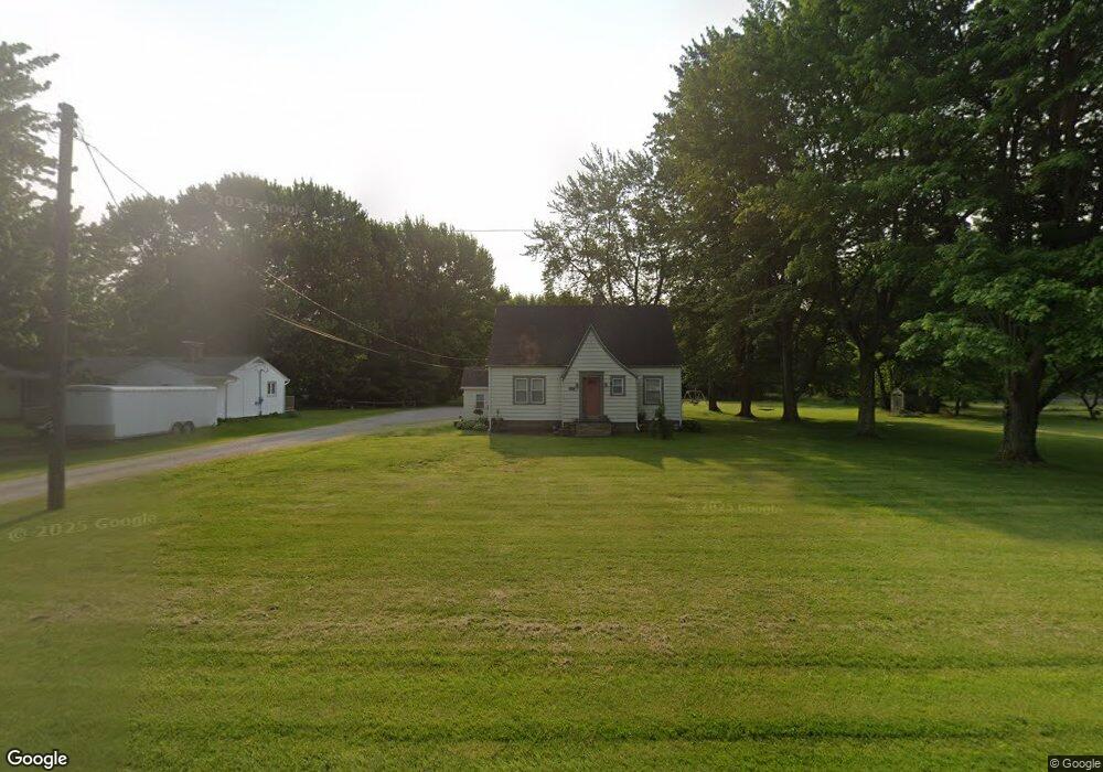
474 Center Rd Conneaut, OH 44030
Estimated Value: $207,000 - $242,000
3
Beds
2
Baths
1,657
Sq Ft
$135/Sq Ft
Est. Value
About This Home
This home is located at 474 Center Rd, Conneaut, OH 44030 and is currently estimated at $223,215, approximately $134 per square foot. 474 Center Rd is a home located in Ashtabula County with nearby schools including Lakeshore Primary Elementary School, Gateway Elementary School, and Conneaut Middle School.
Ownership History
Date
Name
Owned For
Owner Type
Purchase Details
Closed on
Jan 30, 2014
Sold by
Dames Donald J and Dames Alanna J
Bought by
Ensman Lawrence D and Ensman Lana
Current Estimated Value
Home Financials for this Owner
Home Financials are based on the most recent Mortgage that was taken out on this home.
Original Mortgage
$103,920
Outstanding Balance
$79,014
Interest Rate
4.5%
Mortgage Type
New Conventional
Estimated Equity
$144,201
Purchase Details
Closed on
Aug 30, 2010
Sold by
Brown Lisa A
Bought by
Dames Donald J and Farley Alanna J
Home Financials for this Owner
Home Financials are based on the most recent Mortgage that was taken out on this home.
Original Mortgage
$115,440
Interest Rate
5.5%
Mortgage Type
FHA
Purchase Details
Closed on
May 4, 2001
Sold by
Brown Jerry
Bought by
Randolph James O and Randolph Gail L
Create a Home Valuation Report for This Property
The Home Valuation Report is an in-depth analysis detailing your home's value as well as a comparison with similar homes in the area
Home Values in the Area
Average Home Value in this Area
Purchase History
| Date | Buyer | Sale Price | Title Company |
|---|---|---|---|
| Ensman Lawrence D | $129,900 | Franklin Blair Title Agency | |
| Dames Donald J | $117,000 | Chicago Title | |
| Randolph James O | $25,000 | -- |
Source: Public Records
Mortgage History
| Date | Status | Borrower | Loan Amount |
|---|---|---|---|
| Open | Ensman Lawrence D | $103,920 | |
| Previous Owner | Dames Donald J | $115,440 |
Source: Public Records
Tax History
| Year | Tax Paid | Tax Assessment Tax Assessment Total Assessment is a certain percentage of the fair market value that is determined by local assessors to be the total taxable value of land and additions on the property. | Land | Improvement |
|---|---|---|---|---|
| 2024 | $3,879 | $53,030 | $8,540 | $44,490 |
| 2023 | $2,505 | $53,030 | $8,540 | $44,490 |
| 2022 | $2,262 | $42,180 | $6,580 | $35,600 |
| 2021 | $2,301 | $42,180 | $6,580 | $35,600 |
| 2020 | $2,299 | $42,180 | $6,580 | $35,600 |
| 2019 | $1,837 | $33,050 | $4,240 | $28,810 |
| 2018 | $1,753 | $33,050 | $4,240 | $28,810 |
| 2017 | $1,663 | $33,050 | $4,240 | $28,810 |
| 2016 | $1,561 | $32,030 | $4,100 | $27,930 |
| 2015 | $1,577 | $32,030 | $4,100 | $27,930 |
| 2014 | $1,396 | $32,030 | $4,100 | $27,930 |
| 2013 | $1,100 | $25,940 | $5,670 | $20,270 |
Source: Public Records
Map
Nearby Homes
- 18 Hillcrest Ct
- VL Center Rd
- 238 Whitney St
- 745 Maple Ave
- 681 Madison St
- 475 State St
- 536 Madison St
- 0 Dorman Rd
- 210 W Main Rd
- 220 Daniels Ave
- 474 Sherman St
- 202 W Main Rd Unit 132
- 284 Clay St
- 450 Buffalo St
- 375 Bliss Ave
- 146 Nickle Plate Ave
- 386 Washington St
- 716 Chestnut St
- 370 E Underridge Rd
- 1145 Lake Rd
Your Personal Tour Guide
Ask me questions while you tour the home.