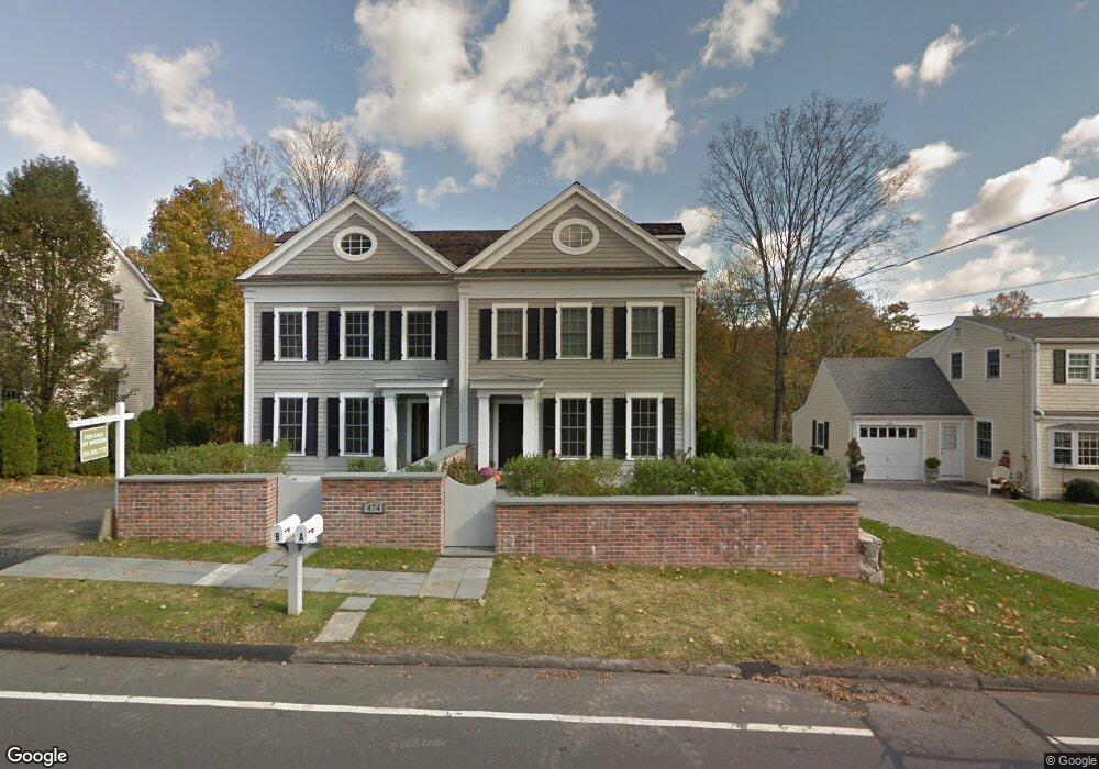
474 Main St Unit South A New Canaan, CT 06840
Estimated Value: $1,616,000 - $2,038,000
4
Beds
4
Baths
3,366
Sq Ft
$560/Sq Ft
Est. Value
About This Home
This home is located at 474 Main St Unit South A, New Canaan, CT 06840 and is currently estimated at $1,885,240, approximately $560 per square foot. 474 Main St Unit South A is a home located in Fairfield County with nearby schools including South Elementary School, Saxe Middle School, and New Canaan High School.
Ownership History
Date
Name
Owned For
Owner Type
Purchase Details
Closed on
Oct 22, 2019
Sold by
General Real Estate Hldg
Bought by
Miningham Barrett and Christiansen Kristina
Current Estimated Value
Home Financials for this Owner
Home Financials are based on the most recent Mortgage that was taken out on this home.
Original Mortgage
$816,000
Outstanding Balance
$714,857
Interest Rate
3.5%
Mortgage Type
Purchase Money Mortgage
Estimated Equity
$1,170,383
Purchase Details
Closed on
Jun 15, 2015
Sold by
Kaeser Development Llc
Bought by
Kaiser Land Holdings L
Home Financials for this Owner
Home Financials are based on the most recent Mortgage that was taken out on this home.
Original Mortgage
$100,000
Interest Rate
4.25%
Mortgage Type
New Conventional
Purchase Details
Closed on
Jan 31, 2014
Sold by
Richardson New Canaan
Bought by
Kaeser Development Llc
Create a Home Valuation Report for This Property
The Home Valuation Report is an in-depth analysis detailing your home's value as well as a comparison with similar homes in the area
Home Values in the Area
Average Home Value in this Area
Purchase History
| Date | Buyer | Sale Price | Title Company |
|---|---|---|---|
| Miningham Barrett | $1,020,000 | -- | |
| Kaiser Land Holdings L | -- | -- | |
| Kaeser Development Llc | $730,000 | -- |
Source: Public Records
Mortgage History
| Date | Status | Borrower | Loan Amount |
|---|---|---|---|
| Open | Miningham Barrett | $816,000 | |
| Previous Owner | Kaeser Development Llc | $100,000 | |
| Previous Owner | Kaeser Development Llc | $1,280,000 |
Source: Public Records
Tax History Compared to Growth
Tax History
| Year | Tax Paid | Tax Assessment Tax Assessment Total Assessment is a certain percentage of the fair market value that is determined by local assessors to be the total taxable value of land and additions on the property. | Land | Improvement |
|---|---|---|---|---|
| 2025 | $16,753 | $1,003,800 | $0 | $1,003,800 |
| 2024 | $16,201 | $1,003,800 | $0 | $1,003,800 |
| 2023 | $14,445 | $762,650 | $0 | $762,650 |
| 2022 | $14,010 | $762,650 | $0 | $762,650 |
| 2021 | $13,850 | $762,650 | $0 | $762,650 |
| 2020 | $13,850 | $762,650 | $0 | $762,650 |
| 2019 | $13,911 | $762,650 | $0 | $762,650 |
| 2018 | $14,099 | $800,730 | $0 | $800,730 |
| 2017 | $13,844 | $800,730 | $0 | $800,730 |
| 2016 | $13,529 | $800,730 | $0 | $800,730 |
| 2015 | $13,722 | $800,730 | $0 | $800,730 |
| 2014 | -- | $385,840 | $0 | $385,840 |
Source: Public Records
Map
Nearby Homes
- 31 Selleck Place
- 12 Lincoln Dr
- 50 Harrison Ave
- 354 South Ave
- 25 Gower Rd
- 44 Putnam Rd
- 180 Summer St
- 52 Putnam Rd
- 216 White Oak Shade Rd
- 317 Park St
- 38 Fitch Ln
- 197 Park St Unit 13
- 63 Middle Ridge Rd
- 15 Burtis Ave Unit Townhome D
- 15 Burtis Ave Unit West Penthouse B
- 15 Burtis Ave Unit East Penthouse C
- 15 Burtis Ave Unit Townhome A
- 15 Burtis Ave Unit East Plaza 203
- 64 East Ave
- 289 New Norwalk Rd Unit 22
- 474 Main St Unit B
- 474 Main St Unit A
- 474 Main St Unit South
- 474 Main St Unit North
- 474 Main St Unit A-B
- 474 Main St Unit South (B)
- 474 Main St Unit North (B)
- 474 Main St Unit A (South)
- 468 Main St
- 482 Main St
- 486 Main St
- 462 Main St
- 140 Elm Place
- 179 Woodland Rd
- 35 Down River Rd
- 492 Main St
- 452 Main St
- 175 Woodland Rd
- 124 Elm Place
- 137 Elm Place