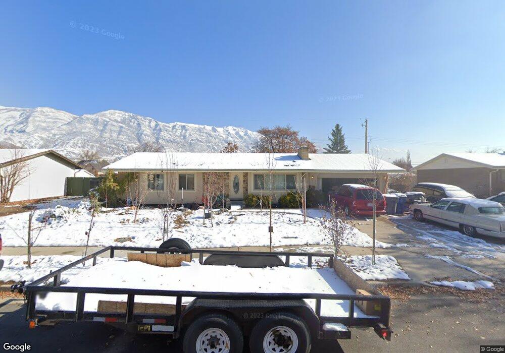
474 N 850 E American Fork, UT 84003
Estimated Value: $504,000 - $569,000
4
Beds
2
Baths
1,271
Sq Ft
$416/Sq Ft
Est. Value
About This Home
This home is located at 474 N 850 E, American Fork, UT 84003 and is currently estimated at $528,501, approximately $415 per square foot. 474 N 850 E is a home located in Utah County with nearby schools including Barratt Elementary School, American Fork Junior High School, and American Fork High School.
Ownership History
Date
Name
Owned For
Owner Type
Purchase Details
Closed on
Jul 11, 2022
Sold by
Perry Denise I
Bought by
Huggins Wesner and Perry Denise I
Current Estimated Value
Purchase Details
Closed on
Feb 27, 2002
Sold by
Wagstaff Ladean M
Bought by
Brady Kathleen
Purchase Details
Closed on
Oct 19, 2000
Sold by
Wagstaff Ladean M
Bought by
Wagstaff Ladean M and The Wagstaff Family Trust
Purchase Details
Closed on
Oct 18, 2000
Sold by
Grant Jay P and Grant Sherri M
Bought by
Wagstaff Ladean M
Create a Home Valuation Report for This Property
The Home Valuation Report is an in-depth analysis detailing your home's value as well as a comparison with similar homes in the area
Home Values in the Area
Average Home Value in this Area
Purchase History
| Date | Buyer | Sale Price | Title Company |
|---|---|---|---|
| Huggins Wesner | -- | Perry Denise I | |
| Brady Kathleen | -- | -- | |
| Wagstaff Ladean M | -- | Equity Title Agency Inc | |
| Wagstaff Ladean M | -- | Equity Title Agency Inc |
Source: Public Records
Tax History Compared to Growth
Tax History
| Year | Tax Paid | Tax Assessment Tax Assessment Total Assessment is a certain percentage of the fair market value that is determined by local assessors to be the total taxable value of land and additions on the property. | Land | Improvement |
|---|---|---|---|---|
| 2025 | $2,127 | $253,000 | -- | -- |
| 2024 | $2,127 | $236,335 | $0 | $0 |
| 2023 | $1,975 | $232,705 | $0 | $0 |
| 2022 | $2,182 | $253,715 | $0 | $0 |
| 2021 | $1,870 | $339,500 | $139,000 | $200,500 |
| 2020 | $1,749 | $308,000 | $124,100 | $183,900 |
| 2019 | $1,656 | $301,700 | $120,600 | $181,100 |
| 2018 | $1,536 | $267,500 | $110,000 | $157,500 |
| 2017 | $1,384 | $130,130 | $0 | $0 |
| 2016 | $1,330 | $116,105 | $0 | $0 |
| 2015 | $1,320 | $109,395 | $0 | $0 |
| 2014 | $1,293 | $105,710 | $0 | $0 |
Source: Public Records
Map
Nearby Homes