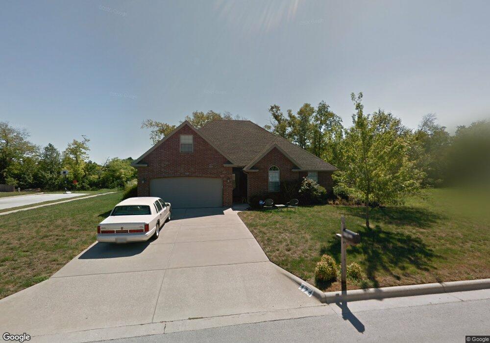
474 S Patterson Republic, MO 65738
Estimated Value: $293,528 - $316,000
3
Beds
2
Baths
1,750
Sq Ft
$175/Sq Ft
Est. Value
About This Home
This home is located at 474 S Patterson, Republic, MO 65738 and is currently estimated at $305,632, approximately $174 per square foot. 474 S Patterson is a home located in Greene County with nearby schools including Lyon Elementary School, Republic Middle School, and Republic High School.
Ownership History
Date
Name
Owned For
Owner Type
Purchase Details
Closed on
Mar 28, 2008
Sold by
David Pittman Homes Llc
Bought by
Rich Dan and Rich Jane
Current Estimated Value
Purchase Details
Closed on
Jul 26, 2006
Sold by
Msc Properties Llc
Bought by
Lyons Daniel and Lyons Shelly
Home Financials for this Owner
Home Financials are based on the most recent Mortgage that was taken out on this home.
Original Mortgage
$145,900
Interest Rate
6.62%
Mortgage Type
New Conventional
Purchase Details
Closed on
Nov 23, 2005
Sold by
Corner Kevin L and Corner Kerri K
Bought by
Msc Properties Llc
Home Financials for this Owner
Home Financials are based on the most recent Mortgage that was taken out on this home.
Original Mortgage
$153,000
Interest Rate
6.12%
Mortgage Type
Construction
Create a Home Valuation Report for This Property
The Home Valuation Report is an in-depth analysis detailing your home's value as well as a comparison with similar homes in the area
Home Values in the Area
Average Home Value in this Area
Purchase History
| Date | Buyer | Sale Price | Title Company |
|---|---|---|---|
| Rich Dan | -- | None Available | |
| David Pittman Llc | -- | None Available | |
| Lyons Daniel | -- | None Available | |
| Msc Properties Llc | -- | Lincoln-Evans Land Title Co |
Source: Public Records
Mortgage History
| Date | Status | Borrower | Loan Amount |
|---|---|---|---|
| Previous Owner | Lyons Daniel | $145,900 | |
| Previous Owner | Msc Properties Llc | $153,000 |
Source: Public Records
Tax History
| Year | Tax Paid | Tax Assessment Tax Assessment Total Assessment is a certain percentage of the fair market value that is determined by local assessors to be the total taxable value of land and additions on the property. | Land | Improvement |
|---|---|---|---|---|
| 2025 | $2,304 | $43,380 | $6,650 | $36,730 |
| 2024 | $2,151 | $38,510 | $5,700 | $32,810 |
| 2023 | $2,110 | $38,510 | $5,700 | $32,810 |
| 2022 | $1,830 | $33,230 | $5,700 | $27,530 |
| 2021 | $1,819 | $33,230 | $5,700 | $27,530 |
| 2020 | $1,746 | $31,410 | $5,700 | $25,710 |
| 2019 | $1,696 | $31,410 | $5,700 | $25,710 |
| 2018 | $1,696 | $29,580 | $5,700 | $23,880 |
| 2017 | $1,682 | $27,990 | $5,700 | $22,290 |
| 2016 | $1,609 | $27,990 | $5,700 | $22,290 |
| 2015 | $1,604 | $27,990 | $5,700 | $22,290 |
| 2014 | $1,565 | $27,080 | $5,700 | $21,380 |
Source: Public Records
Map
Nearby Homes
- 1001 W Broad St
- 473 S Michelle Ave
- 4507 S Farm Road 71
- 566 S Buxton Ln
- 000 W Crestview Ln
- 609 S Mckee Ave
- 548 S Buxton Ln
- 1135 W Broad St
- 2450 Highway 60
- 114 S Eagan St
- 0 Highway 60 Unit 60308100
- 0 Highway 60 Unit 60308095
- 401 S West Ave
- 393 N Ladera Dr
- 421 W Elm St
- 413 W Elm St
- 347 W Elm St
- 511 S Main Ave
- 626 W Melody Ln
- 307 W Granada St
- 498 S Patterson Unit 13
- 498 S Patterson
- 842 W Stanton Dr
- 823 W Stanton Dr
- 809 W Stanton Dr
- 516 S Patterson
- 837 W Stanton Dr
- 839 W Somerset Dr
- 856 W Stanton Dr
- 853 W Stanton Dr
- 857 W Somerset Dr
- 826 W Broad St
- 800 W Broad St
- 838 W Broad St
- 872 W Stanton Dr
- 871 W Stanton Dr
- 832 W Somerset Dr
- 875 W Somerset Dr
- 850 W Broad St
- 844 W Somerset Dr Unit 17
Your Personal Tour Guide
Ask me questions while you tour the home.