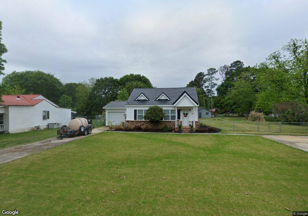
474 Ty Cobb St Royston, GA 30662
Estimated Value: $145,000 - $185,000
2
Beds
1
Bath
988
Sq Ft
$166/Sq Ft
Est. Value
About This Home
This home is located at 474 Ty Cobb St, Royston, GA 30662 and is currently estimated at $163,735, approximately $165 per square foot. 474 Ty Cobb St is a home located in Franklin County with nearby schools including Franklin County High School, Grace Ranch Academy, and Cornerstone Christian Academy.
Ownership History
Date
Name
Owned For
Owner Type
Purchase Details
Closed on
Nov 12, 2008
Sold by
Fowler Bobbie
Bought by
Starcher Bobbie B and Starcher Marshall E
Current Estimated Value
Purchase Details
Closed on
Jul 28, 1999
Sold by
Maxwell Thomas S
Bought by
Fowler Bobbie
Purchase Details
Closed on
Mar 26, 1999
Sold by
Segars Travis
Bought by
Maxwell Thomas S
Purchase Details
Closed on
Sep 30, 1991
Bought by
Segars Travis
Create a Home Valuation Report for This Property
The Home Valuation Report is an in-depth analysis detailing your home's value as well as a comparison with similar homes in the area
Home Values in the Area
Average Home Value in this Area
Purchase History
| Date | Buyer | Sale Price | Title Company |
|---|---|---|---|
| Starcher Bobbie B | -- | -- | |
| Fowler Bobbie | $55,000 | -- | |
| Maxwell Thomas S | $50,000 | -- | |
| Segars Travis | -- | -- |
Source: Public Records
Tax History Compared to Growth
Tax History
| Year | Tax Paid | Tax Assessment Tax Assessment Total Assessment is a certain percentage of the fair market value that is determined by local assessors to be the total taxable value of land and additions on the property. | Land | Improvement |
|---|---|---|---|---|
| 2024 | $1,262 | $38,109 | $5,400 | $32,709 |
| 2023 | $1,243 | $35,180 | $5,400 | $29,780 |
| 2022 | $819 | $32,500 | $5,400 | $27,100 |
| 2021 | $722 | $27,433 | $3,420 | $24,013 |
| 2020 | $649 | $24,406 | $3,420 | $20,986 |
| 2019 | $615 | $23,940 | $3,420 | $20,520 |
| 2018 | $0 | $20,805 | $3,420 | $17,385 |
| 2017 | $547 | $20,805 | $3,420 | $17,385 |
| 2016 | $494 | $18,294 | $3,420 | $14,874 |
| 2015 | -- | $18,293 | $3,420 | $14,874 |
| 2014 | -- | $18,294 | $3,420 | $14,874 |
| 2013 | -- | $18,293 | $3,420 | $14,873 |
Source: Public Records
Map
Nearby Homes
- 121 Cook St
- 0 Wildcat Bridge Rd Unit 23872265
- 0 Wildcat Bridge Rd Unit 10544672
- 464 Church St
- 157 Hartwell St
- 527 Daniel St
- 110 Bermuda St
- 240 Bowers St
- 231 Bowers St
- 134 College St
- 40 Burch St
- 70 Bowers St
- 157 Grizzle St
- 256 Adams Place Rd
- LOT 6 Pine Valley Dr
- 60 Tanglewood N
- 00 Georgia 17
- 5.88 Royston Bypass
- 401 Georgia 17
- 00 S Tanglewood
- 234 Phillips St
- 214 Phillips St
- 68 Johnson St
- 40 Johnson St
- 452 Cobb St
- 486 Ty Cobb St
- 10 Johnson St
- 281 Cook St
- 506 Ty Cobb St
- 233 Phillips St
- 0 Phillips St Unit 8631880
- 0 Phillips St Unit 8714977
- 0 Phillips St Unit 8428587
- 0 Phillips St Unit 3135764
- 0 Phillips St
- 33 Johnson St
- 245 Cook St
- 219 Phillips St
- 57 Johnson St
- 505 Ty Cobb St