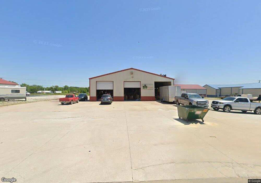
4740 S 131st Rd Bolivar, MO 65613
--
Bed
--
Bath
9,000
Sq Ft
0.6
Acres
About This Home
This home is located at 4740 S 131st Rd, Bolivar, MO 65613. 4740 S 131st Rd is a home located in Polk County with nearby schools including Bolivar Primary School, Bolivar Intermediate School, and Bolivar Middle School.
Ownership History
Date
Name
Owned For
Owner Type
Purchase Details
Closed on
May 15, 2024
Sold by
Lee Grant
Bought by
Acer Cabinet Company Llc
Home Financials for this Owner
Home Financials are based on the most recent Mortgage that was taken out on this home.
Original Mortgage
$508,000
Outstanding Balance
$500,795
Interest Rate
6.82%
Mortgage Type
Credit Line Revolving
Purchase Details
Closed on
Oct 24, 2016
Sold by
Gary Conley and Gary Annette
Bought by
Grant Lee
Home Financials for this Owner
Home Financials are based on the most recent Mortgage that was taken out on this home.
Original Mortgage
$235,000
Interest Rate
5%
Mortgage Type
New Conventional
Create a Home Valuation Report for This Property
The Home Valuation Report is an in-depth analysis detailing your home's value as well as a comparison with similar homes in the area
Home Values in the Area
Average Home Value in this Area
Purchase History
| Date | Buyer | Sale Price | Title Company |
|---|---|---|---|
| Acer Cabinet Company Llc | -- | None Listed On Document | |
| Grant Lee | $293,750 | -- |
Source: Public Records
Mortgage History
| Date | Status | Borrower | Loan Amount |
|---|---|---|---|
| Open | Acer Cabinet Company Llc | $508,000 | |
| Previous Owner | Grant Lee | $235,000 |
Source: Public Records
Tax History Compared to Growth
Tax History
| Year | Tax Paid | Tax Assessment Tax Assessment Total Assessment is a certain percentage of the fair market value that is determined by local assessors to be the total taxable value of land and additions on the property. | Land | Improvement |
|---|---|---|---|---|
| 2024 | $31 | $52,890 | $0 | $0 |
| 2023 | $3,044 | $52,890 | $0 | $0 |
| 2022 | $2,878 | $52,290 | $0 | $0 |
| 2021 | $2,867 | $52,290 | $0 | $0 |
| 2020 | $2,888 | $52,290 | $0 | $0 |
| 2019 | $2,888 | $52,290 | $0 | $0 |
| 2018 | $2,895 | $51,750 | $0 | $0 |
| 2017 | $2,892 | $51,750 | $0 | $0 |
| 2016 | $2,892 | $51,750 | $0 | $0 |
| 2015 | -- | $51,750 | $0 | $0 |
| 2014 | -- | $51,750 | $0 | $0 |
Source: Public Records
Map
Nearby Homes
- 1310 E 476 Rd
- 1322 E 476 Rd
- 4776 S 129th Rd
- 1294 E 478th Rd
- 4814 S 129th Rd
- 4723 S 125th Rd
- 4706 S 125th Rd
- 000 Park Ct
- 1216 Charlene Dr
- 1331 E 490th Rd
- 1222 Kemp Dr
- 1220 Kemp Dr
- 1218 Kemp Dr
- 002 E 490th Rd
- 1209 S Stewart Dr
- Topaz Plan at Prairie Heights
- Amber B Plan at Prairie Heights
- Amber Plan at Prairie Heights
- 1431 Isdell St
- 2790 S Hartford Ave
- 4746 S 131st Rd Unit A
- 4746 S 131st Rd
- 4738 S 131st Rd
- 4744 S 131st Rd
- 4745 S 131st Rd
- 4737 S 131st Rd
- 4742 S 131st Rd
- 4741 S 131st Rd
- Lot 2 S 131st Rd
- Lot 1 S 131st Rd
- 1311 E 475th Rd
- 5850 S Scenic Ave
- 00 S 131st
- 5140 N 13 Hwy
- 1305 E 475th Rd Unit A&B
- 1305 E 475th Rd
- 5650 Scenic Ave
- 4750 S 130th Rd
- 4751 S 130th Rd
- 1315 E 475th Rd