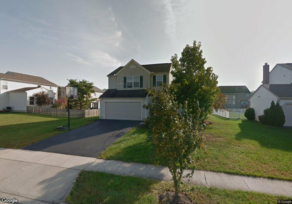
4741 Michael Place Grove City, OH 43123
Estimated Value: $354,000 - $387,000
3
Beds
3
Baths
1,640
Sq Ft
$226/Sq Ft
Est. Value
About This Home
This home is located at 4741 Michael Place, Grove City, OH 43123 and is currently estimated at $370,341, approximately $225 per square foot. 4741 Michael Place is a home located in Franklin County with nearby schools including Hayes Intermediate School, Jc Sommer Elementary School, and Jackson Middle School.
Ownership History
Date
Name
Owned For
Owner Type
Purchase Details
Closed on
Jan 19, 2016
Sold by
Fulk Stan M and Fulk Lesa M
Bought by
Fulk Lesa M
Current Estimated Value
Home Financials for this Owner
Home Financials are based on the most recent Mortgage that was taken out on this home.
Original Mortgage
$138,000
Interest Rate
3.95%
Mortgage Type
New Conventional
Purchase Details
Closed on
Sep 29, 2003
Sold by
M/I Schottenstein Homes Inc
Bought by
Fulk Stan M and Fulk Lesa M
Home Financials for this Owner
Home Financials are based on the most recent Mortgage that was taken out on this home.
Original Mortgage
$168,239
Interest Rate
6.43%
Mortgage Type
FHA
Create a Home Valuation Report for This Property
The Home Valuation Report is an in-depth analysis detailing your home's value as well as a comparison with similar homes in the area
Home Values in the Area
Average Home Value in this Area
Purchase History
| Date | Buyer | Sale Price | Title Company |
|---|---|---|---|
| Fulk Lesa M | -- | First American Title Insuran | |
| Fulk Stan M | $170,900 | Transohio Residential Title |
Source: Public Records
Mortgage History
| Date | Status | Borrower | Loan Amount |
|---|---|---|---|
| Closed | Fulk Lesa M | $138,000 | |
| Closed | Fulk Stan M | $168,239 |
Source: Public Records
Tax History Compared to Growth
Tax History
| Year | Tax Paid | Tax Assessment Tax Assessment Total Assessment is a certain percentage of the fair market value that is determined by local assessors to be the total taxable value of land and additions on the property. | Land | Improvement |
|---|---|---|---|---|
| 2024 | $4,769 | $104,860 | $35,700 | $69,160 |
| 2023 | $4,701 | $104,860 | $35,700 | $69,160 |
| 2022 | $4,566 | $74,870 | $16,490 | $58,380 |
| 2021 | $4,654 | $74,870 | $16,490 | $58,380 |
| 2020 | $4,639 | $74,870 | $16,490 | $58,380 |
| 2019 | $4,161 | $62,310 | $13,760 | $48,550 |
| 2018 | $3,989 | $62,310 | $13,760 | $48,550 |
| 2017 | $4,032 | $62,310 | $13,760 | $48,550 |
| 2016 | $3,934 | $52,850 | $13,510 | $39,340 |
| 2015 | $3,832 | $52,850 | $13,510 | $39,340 |
| 2014 | $3,835 | $52,850 | $13,510 | $39,340 |
| 2013 | $1,723 | $50,330 | $12,880 | $37,450 |
Source: Public Records
Map
Nearby Homes
- 3502 Stephen St
- 3575 Artberry Way Unit 42
- 4793 Woodside Dr Unit 56
- 3540 Whirla Way
- Newport Plan at Holton Run - Woodside at Holton Run
- Cambridge Plan at Holton Run - Woodside at Holton Run
- 4399 Rishel St
- 4314 Robin St
- 4270 Broadway
- 3600 Whirla Way
- 4861 Citation Ct
- Edgewood Plan at Holton Run
- Palmetto Plan at Holton Run
- Galveston Plan at Holton Run
- Manchester Plan at Holton Run
- McKenzie Plan at Holton Run
- Sanibel Plan at Holton Run
- Augustine Plan at Holton Run
- Brookhaven Plan at Holton Run
- Bradenton Plan at Holton Run
- 4731 Michael Place
- 4453 Edgarton Dr
- 4463 Edgarton Dr
- 4601 Michael Place
- 4721 Michael Place
- 4611 Michael Place
- 4473 Edgarton Dr
- 4734 Michael Place
- 4433 Edgarton Dr
- 4621 Michael Place
- 4724 Michael Place
- 4714 Michael Place
- 4671 Michael Place
- 4651 Michael Place
- 0 Edgarton Dr
- 4456 Edgarton Dr
- 4446 Edgarton Dr
- 4704 Michael Place
- 4436 Edgarton Dr
- 4466 Edgarton Dr