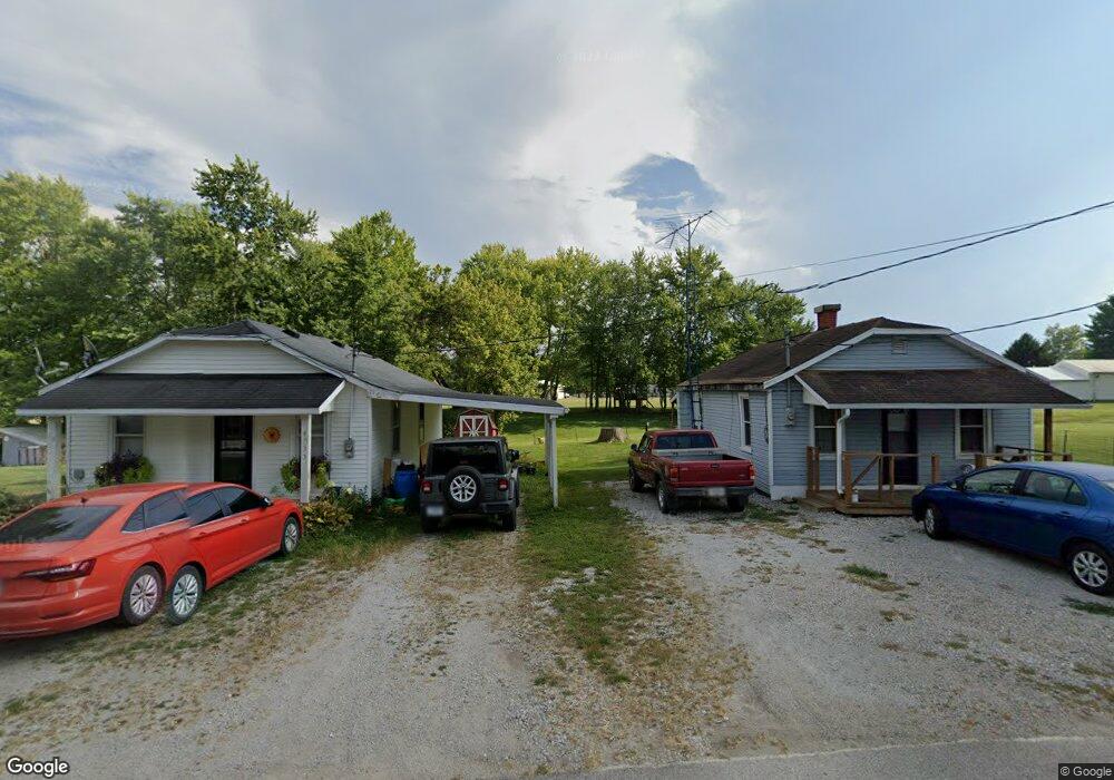
4741 W State Road 58 Freetown, IN 47235
Estimated Value: $65,000 - $167,000
1
Bed
1
Bath
500
Sq Ft
$208/Sq Ft
Est. Value
About This Home
This home is located at 4741 W State Road 58, Freetown, IN 47235 and is currently estimated at $103,936, approximately $207 per square foot. 4741 W State Road 58 is a home located in Jackson County with nearby schools including Brownstown Elementary School, Brownstown Central Middle School, and Brownstown Central High School.
Ownership History
Date
Name
Owned For
Owner Type
Purchase Details
Closed on
Sep 15, 2022
Sold by
Taylor Robert L and Taylor Romona K
Bought by
Bredhold Tonya J and Taylor Robert L
Current Estimated Value
Purchase Details
Closed on
Mar 19, 2009
Sold by
Ziegler Sandy M D
Bought by
Taylor Robert L and Taylor Ramona K
Purchase Details
Closed on
Feb 1, 2005
Sold by
Piel Elmer Clarence and Schmidt Shirley
Bought by
Brown Sandy M D
Purchase Details
Closed on
Dec 12, 2004
Sold by
Piel Elmer Clarence
Bought by
Piel Elmer Clarence and Schmidt Shirley
Create a Home Valuation Report for This Property
The Home Valuation Report is an in-depth analysis detailing your home's value as well as a comparison with similar homes in the area
Home Values in the Area
Average Home Value in this Area
Purchase History
| Date | Buyer | Sale Price | Title Company |
|---|---|---|---|
| Bredhold Tonya J | -- | None Listed On Document | |
| Taylor Robert L | $6,000 | D & E Abstract And Title Co | |
| Taylor Robert L | -- | None Available | |
| Brown Sandy M D | -- | None Available | |
| Piel Elmer Clarence | -- | None Available |
Source: Public Records
Tax History Compared to Growth
Tax History
| Year | Tax Paid | Tax Assessment Tax Assessment Total Assessment is a certain percentage of the fair market value that is determined by local assessors to be the total taxable value of land and additions on the property. | Land | Improvement |
|---|---|---|---|---|
| 2024 | $126 | $36,100 | $4,700 | $31,400 |
| 2023 | $640 | $36,400 | $4,700 | $31,700 |
| 2022 | $149 | $35,400 | $4,300 | $31,100 |
| 2021 | $128 | $32,600 | $4,300 | $28,300 |
| 2020 | $128 | $32,800 | $4,300 | $28,500 |
| 2019 | $122 | $32,800 | $4,300 | $28,500 |
| 2018 | $119 | $32,800 | $4,300 | $28,500 |
| 2017 | $145 | $34,900 | $4,300 | $30,600 |
| 2016 | $115 | $35,000 | $4,300 | $30,700 |
| 2014 | $156 | $34,300 | $4,300 | $30,000 |
| 2013 | $156 | $36,400 | $4,300 | $32,100 |
Source: Public Records
Map
Nearby Homes
- 5000 W County Road 680 N
- 6100 W County Road 700 N
- 5000 W County Road 700 N
- 6000 W County Road 700 N
- 3000 W Block Co Rd 900 N
- 6725 W County Road 700 N
- 2221 Indiana 258
- 9649 N County Road 450 W
- 4325 N County Road 650 W
- 8000 W County Road 625 Tract 4 N
- 8515 N County Road 100 W
- 7594 W County Road 925 N
- 8000 W County Road 625 N Unit LotWP004
- 3780 W County Road 300 N
- 3264 N County Road 250 W
- 2000 Block W 1125 N
- 11000 N County Road 650 W
- 1109 N County Road 600 W Unit Medora
- 9601 Buffalo Pike
- 8650 Mount Nebo Rd
- 4741 E State Road 58
- 4733 W State Road 58
- 4730 W State Road 58
- 4764 W State Road 58
- 4713 W State Road 58
- 4522 W 4th St
- 4770 W State Road 58
- 4767 W State Road 58
- 4704 W State Road 58
- 4768 W State Road 58
- 4774 W State Road 58
- 4499 W 4th St
- 4704 W St Rd 58
- 6852 N Noe St
- 4481 W 4th St
- 6873 N Poplar St
- 6883 N Noe St
- 4775 W State Road 58
- 4752 W State Road 58
- 6859 N Poplar St