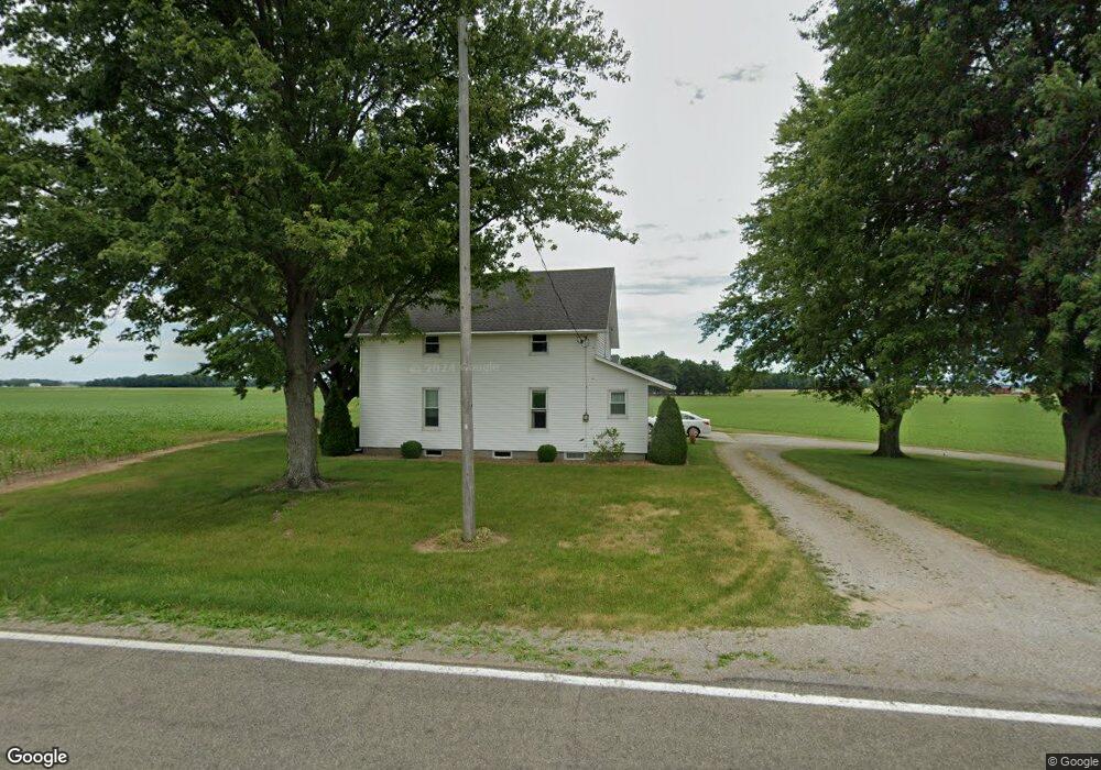
4745 Adams Ridge Rd Defiance, OH 43512
Estimated Value: $197,000 - $244,000
4
Beds
3
Baths
1,575
Sq Ft
$137/Sq Ft
Est. Value
About This Home
This home is located at 4745 Adams Ridge Rd, Defiance, OH 43512 and is currently estimated at $216,336, approximately $137 per square foot. 4745 Adams Ridge Rd is a home located in Defiance County with nearby schools including Tinora Elementary School, Noble Elementary School, and Tinora Middle School.
Ownership History
Date
Name
Owned For
Owner Type
Purchase Details
Closed on
Nov 14, 2023
Sold by
Bostelman Bruce E and Bostelman Deborah
Bought by
Conklin Bryce D and Conklin Anna R
Current Estimated Value
Home Financials for this Owner
Home Financials are based on the most recent Mortgage that was taken out on this home.
Original Mortgage
$155,200
Outstanding Balance
$152,393
Interest Rate
7.31%
Mortgage Type
New Conventional
Estimated Equity
$63,943
Purchase Details
Closed on
Aug 25, 2021
Sold by
Bostelman Betty J and Bostelman Thomas L
Bought by
Bostelman Bradley G and Bostelman Jeremy T
Purchase Details
Closed on
Jul 12, 2021
Sold by
Estate Of Thomas L Bostelman
Bought by
Bostelman Betty J
Purchase Details
Closed on
Dec 11, 1996
Bought by
Bostelman Thomas L
Create a Home Valuation Report for This Property
The Home Valuation Report is an in-depth analysis detailing your home's value as well as a comparison with similar homes in the area
Home Values in the Area
Average Home Value in this Area
Purchase History
| Date | Buyer | Sale Price | Title Company |
|---|---|---|---|
| Conklin Bryce D | $194,000 | None Listed On Document | |
| Bostelman Bradley G | -- | None Available | |
| Bostelman Betty J | -- | None Available | |
| Bostelman Betty J | -- | None Available | |
| Bostelman Thomas L | -- | -- |
Source: Public Records
Mortgage History
| Date | Status | Borrower | Loan Amount |
|---|---|---|---|
| Open | Conklin Bryce D | $155,200 |
Source: Public Records
Tax History Compared to Growth
Tax History
| Year | Tax Paid | Tax Assessment Tax Assessment Total Assessment is a certain percentage of the fair market value that is determined by local assessors to be the total taxable value of land and additions on the property. | Land | Improvement |
|---|---|---|---|---|
| 2024 | $1,736 | $47,530 | $2,820 | $44,710 |
| 2023 | $1,694 | $47,530 | $2,820 | $44,710 |
| 2022 | $1,133 | $36,380 | $2,640 | $33,740 |
| 2021 | $1,133 | $36,380 | $2,640 | $33,740 |
| 2020 | $1,137 | $36,380 | $2,640 | $33,740 |
| 2019 | $992 | $33,370 | $3,610 | $29,760 |
| 2018 | $1,021 | $33,370 | $3,610 | $29,760 |
| 2017 | $905 | $33,369 | $3,605 | $29,764 |
| 2016 | $803 | $30,163 | $3,605 | $26,558 |
| 2015 | $424 | $30,163 | $3,605 | $26,558 |
| 2014 | $424 | $29,936 | $3,605 | $26,331 |
| 2013 | $424 | $29,936 | $3,605 | $26,331 |
| 2012 | $424 | $29,936 | $3,605 | $26,331 |
Source: Public Records
Map
Nearby Homes
- 29232 Coressel Rd
- 26825 Behrens Rd
- 26761 Behrens Rd
- 6767 Independence Rd
- 23648 County Rd S
- 20401 U S 6
- 6909 Ohio 66
- 0 Saint Rt 66
- 23132 Coressel Rd
- 19972 County Road X
- 19950 County Road X
- 19913 County Road X
- 405 W High St
- 8208 N State Route 66 Unit 8219
- 212 E High St
- 1275 Pinehurst Dr
- 850 Deerwood Dr
- 846 Deerwood Dr
- 1459 Deerwood Dr
- 679 Burning Tree Dr
- 4792 Adams Ridge Rd
- 4615 Adams Ridge Rd
- 4585 Adams Ridge Rd
- 28276 Gerken Rd
- 4998 Adams Ridge Rd
- 28478 Gerken Rd
- 5074 Adams Ridge Rd
- 28035 Mekus Rd
- 5035 Independence Rd
- 4307 Adams Ridge Rd
- 4205 Adams Ridge Rd
- 5295 Adams Ridge Rd
- 28242 Coressel Rd
- 28455 Coressel Rd
- 0 Behrens Rd
- 28200 Behrens Rd
- 28524 Behrens Rd
- 27988 Coressel Rd
- 29133 Gerken Rd
- 28865 Behrens Rd