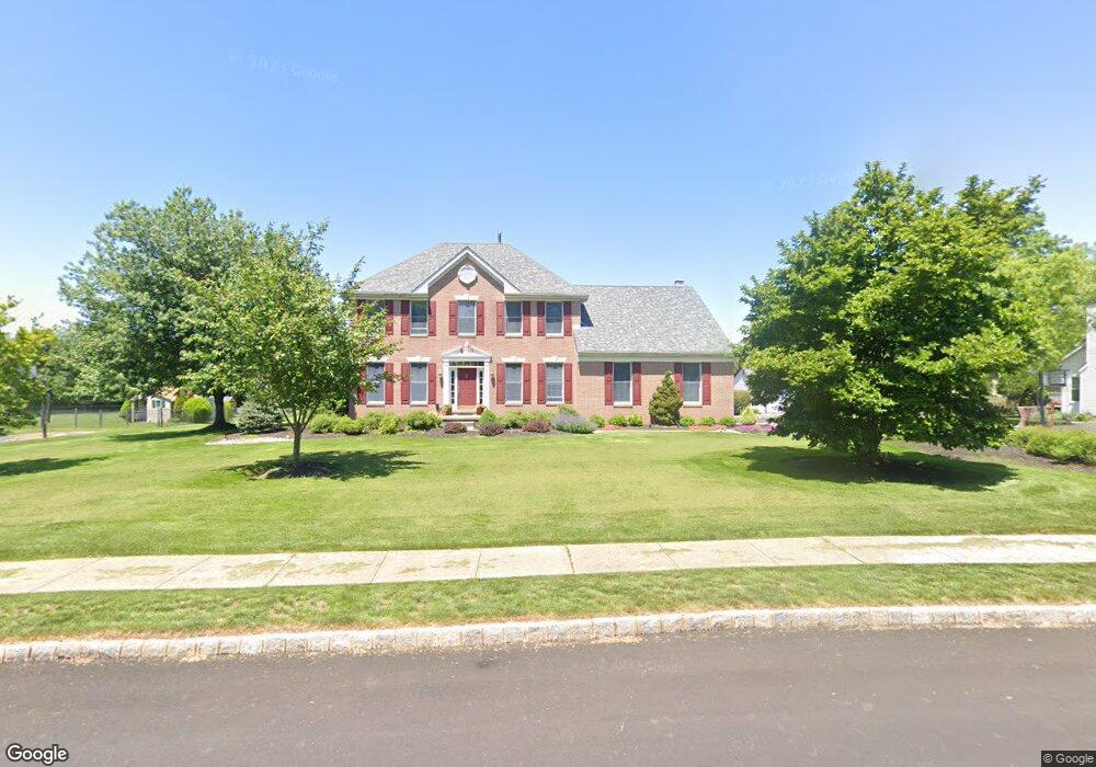
4745 Twinbrook Cir Doylestown, PA 18902
Estimated Value: $843,000 - $974,000
4
Beds
3
Baths
2,710
Sq Ft
$334/Sq Ft
Est. Value
About This Home
This home is located at 4745 Twinbrook Cir, Doylestown, PA 18902 and is currently estimated at $905,197, approximately $334 per square foot. 4745 Twinbrook Cir is a home located in Bucks County with nearby schools including Cold Spring Elementary School, Holicong Middle School, and Central Bucks High School - East.
Ownership History
Date
Name
Owned For
Owner Type
Purchase Details
Closed on
Jun 10, 2005
Sold by
Pomper John L and Pomper Beth Ellen
Bought by
Pomper John L and Pomper Beth Ellen
Current Estimated Value
Purchase Details
Closed on
Aug 21, 1995
Sold by
Calton Homes Inc
Bought by
Pomper John L and Pomper Beth Ellen
Home Financials for this Owner
Home Financials are based on the most recent Mortgage that was taken out on this home.
Original Mortgage
$220,000
Interest Rate
7.8%
Create a Home Valuation Report for This Property
The Home Valuation Report is an in-depth analysis detailing your home's value as well as a comparison with similar homes in the area
Home Values in the Area
Average Home Value in this Area
Purchase History
| Date | Buyer | Sale Price | Title Company |
|---|---|---|---|
| Pomper John L | -- | -- | |
| Pomper John L | $276,435 | -- |
Source: Public Records
Mortgage History
| Date | Status | Borrower | Loan Amount |
|---|---|---|---|
| Closed | Pomper John L | $220,000 |
Source: Public Records
Tax History Compared to Growth
Tax History
| Year | Tax Paid | Tax Assessment Tax Assessment Total Assessment is a certain percentage of the fair market value that is determined by local assessors to be the total taxable value of land and additions on the property. | Land | Improvement |
|---|---|---|---|---|
| 2025 | $9,007 | $55,320 | $17,120 | $38,200 |
| 2024 | $9,007 | $55,320 | $17,120 | $38,200 |
| 2023 | $8,701 | $55,320 | $17,120 | $38,200 |
| 2022 | $8,597 | $55,320 | $17,120 | $38,200 |
| 2021 | $8,494 | $55,320 | $17,120 | $38,200 |
| 2020 | $8,494 | $55,320 | $17,120 | $38,200 |
| 2019 | $8,439 | $55,320 | $17,120 | $38,200 |
| 2018 | $8,439 | $55,320 | $17,120 | $38,200 |
| 2017 | $8,370 | $55,320 | $17,120 | $38,200 |
| 2016 | $8,453 | $55,320 | $17,120 | $38,200 |
| 2015 | -- | $55,320 | $17,120 | $38,200 |
| 2014 | -- | $55,320 | $17,120 | $38,200 |
Source: Public Records
Map
Nearby Homes
- 4605 Twinbrook Cir
- 3865 Burnt House Hill Rd
- 3689 Hancock Ln
- 4542 Deep Creek Way
- 4201 Sir Andrew Cir
- 4936 Davis Dr
- 4190 Milords Ln
- 4925 Redfield Rd
- 3555 Northview Ln
- 5063 Sagewood Ct
- 4221 Enders Way
- 3975 Amberton Ct
- 4250 Aly Dr
- 5115 Sugar Hill Ct
- 4928 Edgewood Rd
- 3479 Durham Rd
- 3455 Durham Rd
- 3468 Holicong Rd
- 5281 Harrington Ct
- 4080 Holly Way
- 4755 Twinbrook Cir
- 4735 Twinbrook Cir
- 4750 Twinbrook Cir
- 4740 Twinbrook Cir
- 4715 Twinbrook Cir
- 4765 Twinbrook Cir
- 4760 Twinbrook Cir
- 4730 Twinbrook Cir
- 4695 Twinbrook Cir
- 4720 Twinbrook Cir
- 4775 Twinbrook Cir
- 4625 Twinbrook Cir
- 4770 Twinbrook Cir
- 4635 Twinbrook Cir
- 4675 Twinbrook Cir
- 4710 Twinbrook Cir
- 4665 Twinbrook Cir
- 4645 Twinbrook Cir
- 3947 S Mallard Ln
- 3713 Hancock Ln