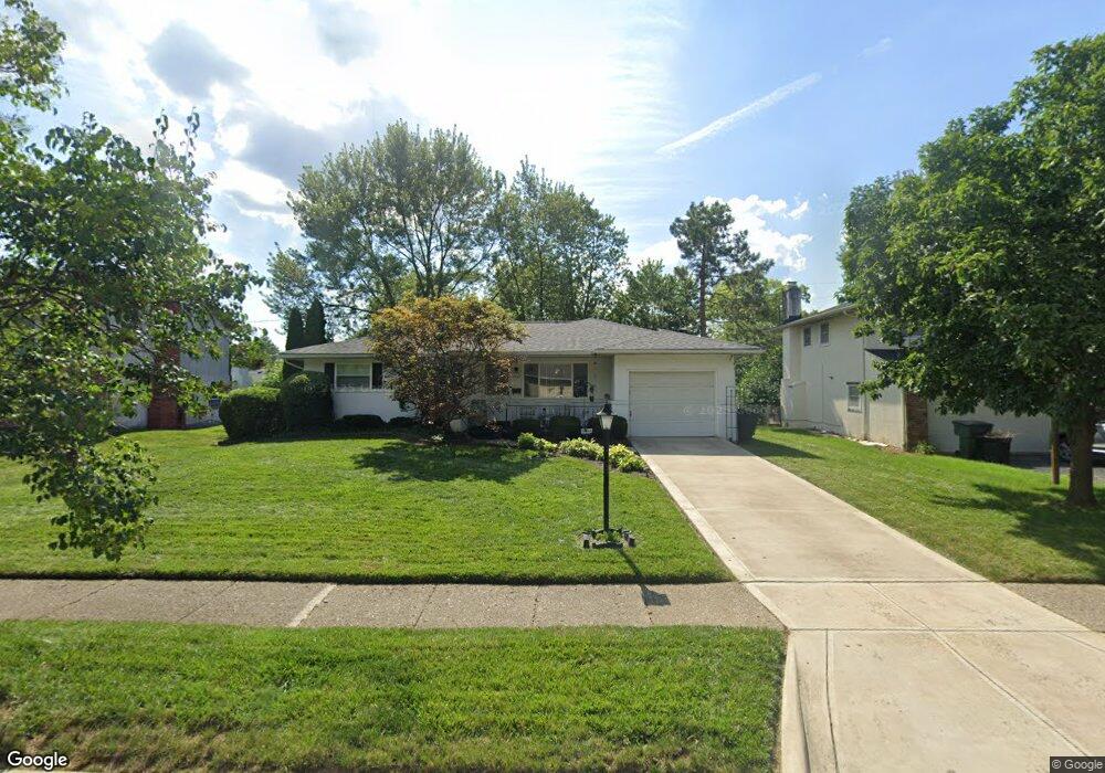
4747 Esterbrook Rd Columbus, OH 43229
Woodward Park NeighborhoodEstimated Value: $251,673 - $287,000
3
Beds
2
Baths
1,358
Sq Ft
$204/Sq Ft
Est. Value
About This Home
This home is located at 4747 Esterbrook Rd, Columbus, OH 43229 and is currently estimated at $276,668, approximately $203 per square foot. 4747 Esterbrook Rd is a home located in Franklin County with nearby schools including Valley Forge Elementary School, Woodward Park Middle School, and Northland High School.
Ownership History
Date
Name
Owned For
Owner Type
Purchase Details
Closed on
Aug 15, 2000
Sold by
Bradford Investment Company
Bought by
Carter Robert and Carter Rosalyn M
Current Estimated Value
Home Financials for this Owner
Home Financials are based on the most recent Mortgage that was taken out on this home.
Original Mortgage
$110,378
Outstanding Balance
$37,897
Interest Rate
8.26%
Mortgage Type
FHA
Estimated Equity
$238,771
Purchase Details
Closed on
May 5, 2000
Sold by
Knorn Gloria G and Knorn Patricia L
Bought by
Bradford Investment Company
Home Financials for this Owner
Home Financials are based on the most recent Mortgage that was taken out on this home.
Original Mortgage
$66,000
Interest Rate
8.26%
Purchase Details
Closed on
Oct 29, 1990
Bought by
Knorn Gloria G
Create a Home Valuation Report for This Property
The Home Valuation Report is an in-depth analysis detailing your home's value as well as a comparison with similar homes in the area
Home Values in the Area
Average Home Value in this Area
Purchase History
| Date | Buyer | Sale Price | Title Company |
|---|---|---|---|
| Carter Robert | $116,600 | Chicago Title West | |
| Bradford Investment Company | $90,000 | Chicago Title West | |
| Knorn Gloria G | $76,000 | -- |
Source: Public Records
Mortgage History
| Date | Status | Borrower | Loan Amount |
|---|---|---|---|
| Open | Carter Robert | $110,378 | |
| Previous Owner | Bradford Investment Company | $66,000 |
Source: Public Records
Tax History
| Year | Tax Paid | Tax Assessment Tax Assessment Total Assessment is a certain percentage of the fair market value that is determined by local assessors to be the total taxable value of land and additions on the property. | Land | Improvement |
|---|---|---|---|---|
| 2025 | $3,013 | $76,930 | $20,370 | $56,560 |
| 2024 | $3,013 | $76,930 | $20,370 | $56,560 |
| 2023 | $3,002 | $76,930 | $20,370 | $56,560 |
| 2022 | $1,875 | $44,910 | $11,380 | $33,530 |
| 2021 | $1,879 | $44,910 | $11,380 | $33,530 |
| 2020 | $1,872 | $44,740 | $11,380 | $33,360 |
| 2019 | $1,603 | $35,180 | $9,100 | $26,080 |
| 2018 | $2,117 | $35,180 | $9,100 | $26,080 |
| 2017 | $2,133 | $35,180 | $9,100 | $26,080 |
| 2016 | $2,319 | $35,010 | $8,440 | $26,570 |
| 2015 | $2,105 | $35,010 | $8,440 | $26,570 |
| 2014 | $2,110 | $35,010 | $8,440 | $26,570 |
| 2013 | $1,096 | $36,855 | $8,890 | $27,965 |
Source: Public Records
Map
Nearby Homes
- 1116 Tulsa Dr
- 1144 Reed Circle Dr
- 4800 Bourke Rd
- 4795 Colonel Perry Dr
- 1485 Norma Rd
- 4605 Glenmawr Ave
- 4923 Karl Rd Unit 4925
- 4450 N 4th St
- 5004 Julie Place
- 5010 Julie Place
- 4320 Sandy Lane Rd
- 1130 Carbone Dr
- 952 Minerva Ave
- 1685 Norma Rd
- 940 Minerva Ave
- 4143 Karl Rd Unit 215
- 4143 Karl Rd Unit 314
- 4145 Karl Rd Unit 223
- 5318 Eisenhower Rd
- 827 Inwood Place
- 4755 Esterbrook Rd
- 4739 Esterbrook Rd
- 4754-4756 Dechant Rd
- 4754 Dechant Rd Unit 756
- 4742-4744 Dechant Rd
- 4742 Dechant Rd Unit 744
- 4763 Esterbrook Rd
- 4731 Esterbrook Rd
- 4764 Dechant Rd
- 4734 Dechant Rd Unit 736
- 4748 Esterbrook Rd
- 4736 Esterbrook Rd
- 4756 Esterbrook Rd
- 4775 Esterbrook Rd
- 4772 Dechant Rd
- 4728 Esterbrook Rd
- 4722 Dechant Rd Unit 724
- 4719 Esterbrook Rd
- 4724 Dechant Rd
- 4722-4724 Dechant Rd
Your Personal Tour Guide
Ask me questions while you tour the home.