Estimated Value: $1,379,000 - $2,012,783
3
Beds
3
Baths
1,184
Sq Ft
$1,499/Sq Ft
Est. Value
About This Home
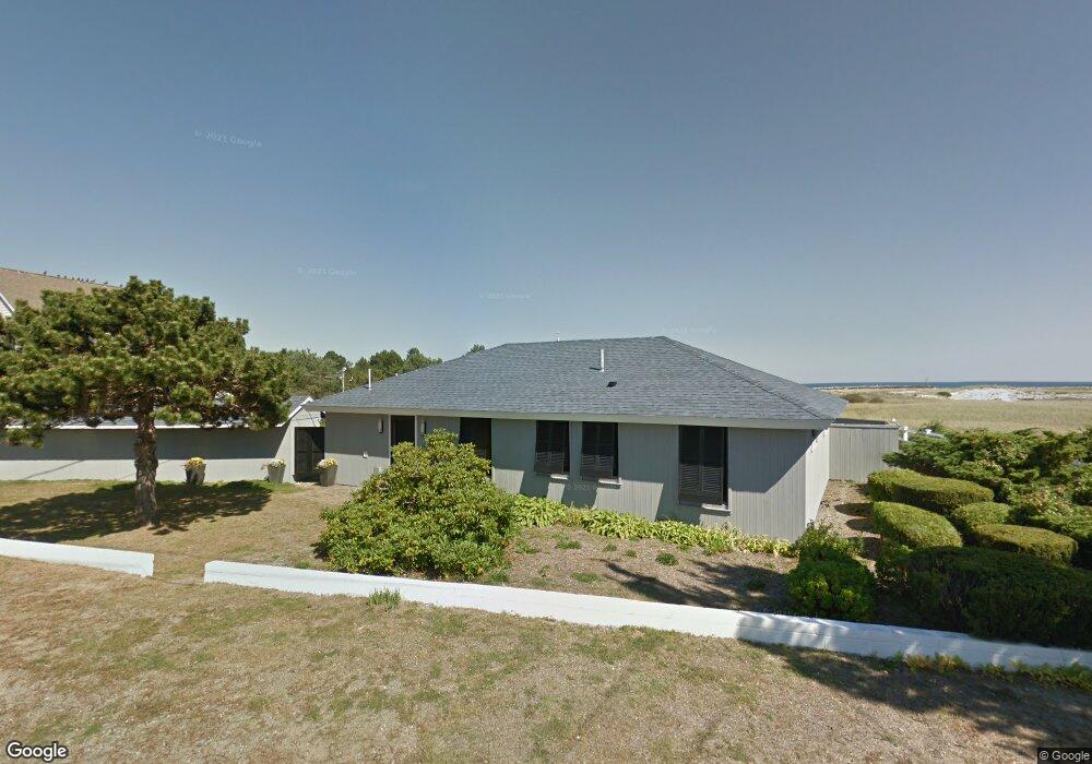
This home is located at 475 Atlantic Ave, Wells, ME 04090 and is currently estimated at $1,774,446, approximately $1,498 per square foot. 475 Atlantic Ave is a home located in York County with nearby schools including Wells Junior High School, Wells Elementary School, and Wells High School.
Ownership History
Date
Name
Owned For
Owner Type
Purchase Details
Closed on
Dec 30, 2013
Sold by
Macdonald Jeffrey and Macdonald Elizabeth
Bought by
Macdonald Jeffrey
Current Estimated Value
Home Financials for this Owner
Home Financials are based on the most recent Mortgage that was taken out on this home.
Original Mortgage
$322,000
Interest Rate
5%
Mortgage Type
Adjustable Rate Mortgage/ARM
Create a Home Valuation Report for This Property
The Home Valuation Report is an in-depth analysis detailing your home's value as well as a comparison with similar homes in the area
Home Values in the Area
Average Home Value in this Area
Purchase History
| Date | Buyer | Sale Price | Title Company |
|---|---|---|---|
| Macdonald Jeffrey | -- | -- | |
| Macdonald Jeffrey | -- | -- |
Source: Public Records
Mortgage History
| Date | Status | Borrower | Loan Amount |
|---|---|---|---|
| Closed | Macdonald Jeffrey | $322,000 |
Source: Public Records
Tax History Compared to Growth
Tax History
| Year | Tax Paid | Tax Assessment Tax Assessment Total Assessment is a certain percentage of the fair market value that is determined by local assessors to be the total taxable value of land and additions on the property. | Land | Improvement |
|---|---|---|---|---|
| 2024 | $12,844 | $2,112,570 | $1,862,340 | $250,230 |
| 2023 | $12,591 | $2,112,570 | $1,862,340 | $250,230 |
| 2022 | $13,148 | $1,257,010 | $1,130,570 | $126,440 |
| 2021 | $13,201 | $1,254,850 | $1,130,570 | $124,280 |
| 2020 | $13,151 | $1,254,850 | $1,130,570 | $124,280 |
| 2019 | $13,005 | $1,248,040 | $1,130,570 | $117,470 |
| 2018 | $12,880 | $1,248,040 | $1,130,570 | $117,470 |
| 2017 | $12,680 | $1,248,040 | $1,130,570 | $117,470 |
| 2016 | $12,555 | $1,248,040 | $1,130,570 | $117,470 |
| 2015 | $12,121 | $1,218,240 | $1,130,570 | $87,670 |
| 2013 | $11,110 | $1,218,240 | $1,130,570 | $87,670 |
Source: Public Records
Map
Nearby Homes
- 446 Atlantic Ave
- 500 Atlantic Ave Unit 2
- 9 Robert Ln
- 229 Atlantic Ave
- 225 Atlantic Ave
- 163 Island Beach Rd
- 75 Ox Cart Ln Unit 2
- 61 Atlantic Ave Unit 3
- 1801 Post Rd Unit 190
- 1801 Post Rd Unit 180
- 1801 Post Rd Unit 143
- 46 Ox Cart Ln
- 1830 Post Rd
- 1733 Post Rd
- 1516 Post Rd
- 43 Sylvan Way Unit 10
- 35 Burnt Mill Rd Unit B
- 1762 Post Rd Unit 209
- 1373 Post Rd Unit 1F
- 1373 Post Rd Unit 6B
- 481 Atlantic Ave
- 478 Atlantic Ave
- 469 Atlantic Ave
- 465 Atlantic Ave
- 88 Riverside Dr
- 482 Atlantic Ave
- 82 Riverside Dr
- 485 Atlantic Ave
- 486 Atlantic Ave Unit 2
- 486 Atlantic Ave Unit 1
- 80&82 Riverside Dr
- 489 Atlantic Ave
- 456 Atlantic Ave
- 490 Atlantic Ave
- 490 Atlantic Ave Unit ID1248573P
- 496 Atlantic Ave
- 76 Riverside Dr
- 461 Atlantic Ave
- 80 Riverside Dr
- 457 Atlantic Ave