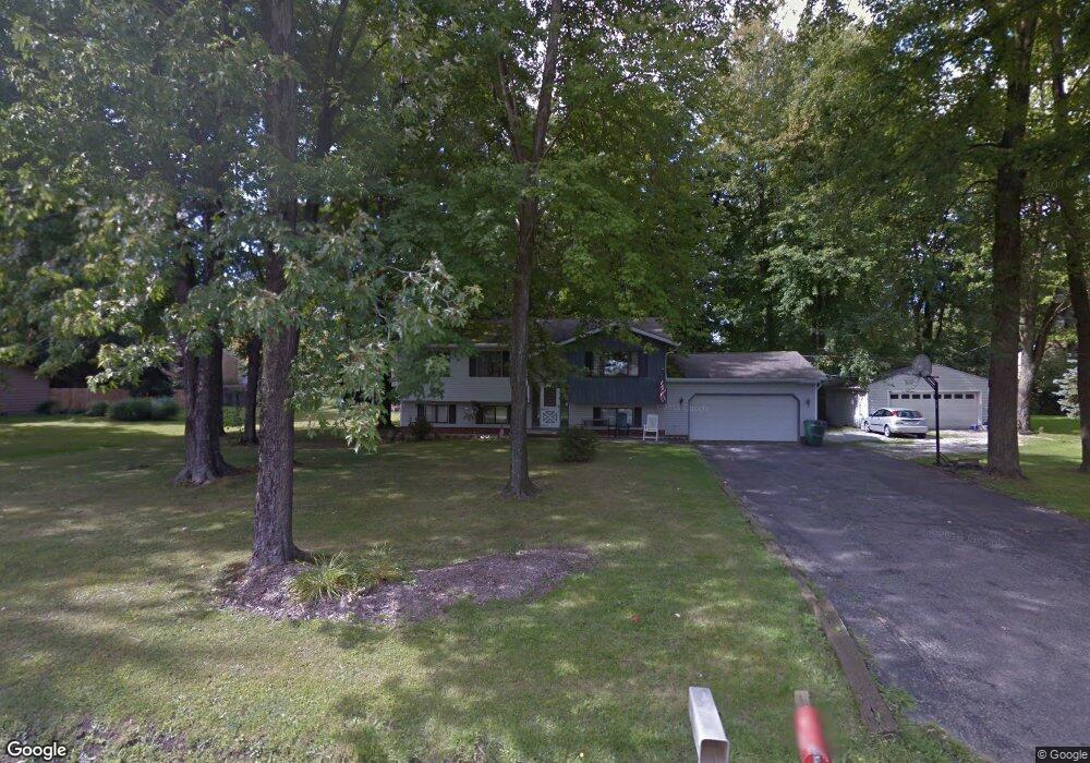
475 Morgan Dr Painesville, OH 44077
Estimated Value: $210,000 - $234,097
3
Beds
2
Baths
1,164
Sq Ft
$192/Sq Ft
Est. Value
About This Home
This home is located at 475 Morgan Dr, Painesville, OH 44077 and is currently estimated at $223,274, approximately $191 per square foot. 475 Morgan Dr is a home located in Lake County with nearby schools including Henry F. Lamuth Middle School, Riverside Junior/Senior High School, and Summit Academy Community School - Painesville.
Ownership History
Date
Name
Owned For
Owner Type
Purchase Details
Closed on
Sep 25, 2002
Sold by
Aiken Norman D
Bought by
Dewit Paulus A and Dewit Sandra
Current Estimated Value
Home Financials for this Owner
Home Financials are based on the most recent Mortgage that was taken out on this home.
Original Mortgage
$100,000
Outstanding Balance
$42,414
Interest Rate
6.32%
Estimated Equity
$180,860
Purchase Details
Closed on
Jun 30, 1984
Bought by
Aiken Norman D
Create a Home Valuation Report for This Property
The Home Valuation Report is an in-depth analysis detailing your home's value as well as a comparison with similar homes in the area
Home Values in the Area
Average Home Value in this Area
Purchase History
| Date | Buyer | Sale Price | Title Company |
|---|---|---|---|
| Dewit Paulus A | $125,000 | Midland Title Security Inc | |
| Aiken Norman D | -- | -- |
Source: Public Records
Mortgage History
| Date | Status | Borrower | Loan Amount |
|---|---|---|---|
| Open | Dewit Paulus A | $100,000 |
Source: Public Records
Tax History Compared to Growth
Tax History
| Year | Tax Paid | Tax Assessment Tax Assessment Total Assessment is a certain percentage of the fair market value that is determined by local assessors to be the total taxable value of land and additions on the property. | Land | Improvement |
|---|---|---|---|---|
| 2024 | -- | $69,400 | $22,850 | $46,550 |
| 2023 | $5,902 | $54,160 | $18,420 | $35,740 |
| 2022 | $3,179 | $54,160 | $18,420 | $35,740 |
| 2021 | $3,190 | $54,160 | $18,420 | $35,740 |
| 2020 | $3,142 | $47,090 | $16,020 | $31,070 |
| 2019 | $3,166 | $47,090 | $16,020 | $31,070 |
| 2018 | $3,210 | $46,710 | $18,520 | $28,190 |
| 2017 | $3,243 | $46,710 | $18,520 | $28,190 |
| 2016 | $2,856 | $46,710 | $18,520 | $28,190 |
| 2015 | $2,675 | $46,710 | $18,520 | $28,190 |
| 2014 | $2,719 | $46,710 | $18,520 | $28,190 |
| 2013 | $2,657 | $46,710 | $18,520 | $28,190 |
Source: Public Records
Map
Nearby Homes
- 525 Morgan Dr
- V/L Morgan Dr
- 500 Park Rd
- 396 Park Rd
- 43 Bristol Ave
- 269 Hale Rd
- 67 Tanners Farm Dr
- 108 Birch Dr
- 65 Tanners Farm Dr
- 4505 Lane Rd
- 1182 Dalton Dr
- 1172 Dalton Dr
- 1787 Muirfield Ln
- 5406 Pebble Creek Ln
- 0 N Ridge Rd Unit 5110949
- 44 Grove Ave
- 30 Orton Rd
- 808 N Creek Dr
- 634 N Creek Dr
- 3147 Maine Ave
- 459 Morgan Dr
- 493 Morgan Dr
- 1596 Hampton Ct
- 1586 Hampton Ct
- 1589 Greenwich Ct
- 476 Morgan Dr
- 486 Morgan Dr
- 456 Morgan Dr
- 1595 Hampton Ct
- 1595 Greenwich Ct
- 496 Morgan Dr
- 388 Manhattan Pkwy
- 509 Morgan Dr
- 380 Manhattan Pkwy
- 396 Manhattan Pkwy
- 1596 Greenwich Ct
- 1589 Hampton Ct
- 440 Morgan Dr
- 370 Manhattan Pkwy
- 500 Morgan Dr