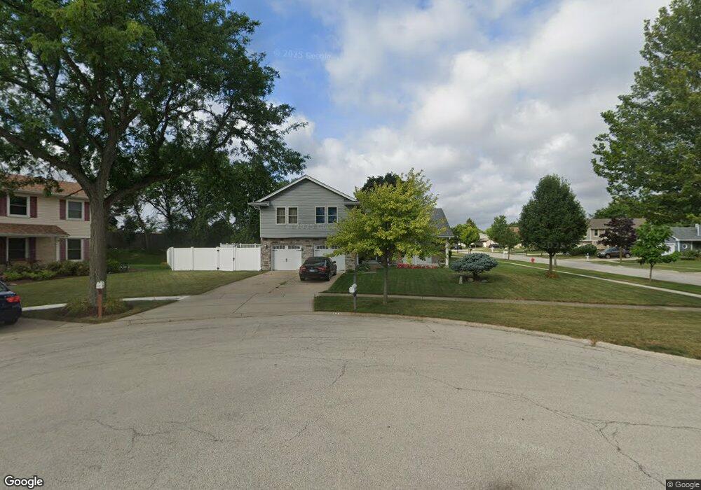
475 Union Cir Elk Grove Village, IL 60007
Elk Grove Village West NeighborhoodEstimated Value: $626,000 - $661,000
4
Beds
3
Baths
2,374
Sq Ft
$268/Sq Ft
Est. Value
About This Home
This home is located at 475 Union Cir, Elk Grove Village, IL 60007 and is currently estimated at $636,895, approximately $268 per square foot. 475 Union Cir is a home located in Cook County with nearby schools including Frederick Nerge Elementary School, Margaret Mead Junior High School, and J B Conant High School.
Ownership History
Date
Name
Owned For
Owner Type
Purchase Details
Closed on
Mar 25, 2001
Sold by
Waters Joseph R and Waters Mary L
Bought by
Roeske Charles R and Roeske Doris
Current Estimated Value
Home Financials for this Owner
Home Financials are based on the most recent Mortgage that was taken out on this home.
Original Mortgage
$225,000
Outstanding Balance
$82,113
Interest Rate
7.05%
Estimated Equity
$554,782
Create a Home Valuation Report for This Property
The Home Valuation Report is an in-depth analysis detailing your home's value as well as a comparison with similar homes in the area
Home Values in the Area
Average Home Value in this Area
Purchase History
| Date | Buyer | Sale Price | Title Company |
|---|---|---|---|
| Roeske Charles R | $292,000 | -- |
Source: Public Records
Mortgage History
| Date | Status | Borrower | Loan Amount |
|---|---|---|---|
| Open | Roeske Charles R | $225,000 |
Source: Public Records
Tax History Compared to Growth
Tax History
| Year | Tax Paid | Tax Assessment Tax Assessment Total Assessment is a certain percentage of the fair market value that is determined by local assessors to be the total taxable value of land and additions on the property. | Land | Improvement |
|---|---|---|---|---|
| 2024 | $11,819 | $44,000 | $14,820 | $29,180 |
| 2023 | $11,461 | $44,000 | $14,820 | $29,180 |
| 2022 | $11,461 | $44,000 | $14,820 | $29,180 |
| 2021 | $11,084 | $38,160 | $9,690 | $28,470 |
| 2020 | $10,871 | $38,160 | $9,690 | $28,470 |
| 2019 | $10,881 | $42,401 | $9,690 | $32,711 |
| 2018 | $11,706 | $40,910 | $8,265 | $32,645 |
| 2017 | $11,597 | $40,910 | $8,265 | $32,645 |
| 2016 | $11,072 | $40,910 | $8,265 | $32,645 |
| 2015 | $9,562 | $33,476 | $6,840 | $26,636 |
| 2014 | $9,453 | $33,476 | $6,840 | $26,636 |
| 2013 | $10,256 | $37,047 | $6,840 | $30,207 |
Source: Public Records
Map
Nearby Homes
- 665 Arizona Pass
- 1771 Vermont Dr
- 713 Oklahoma Way
- 1910 Baltimore Dr
- 263 Doral Ct Unit 1
- 307 University Ln Unit A
- 797 Geneva Cir
- 1385 Scarboro Rd Unit 204
- 833 Thornton Ct Unit 2B
- 1386 Scarboro Rd Unit 1102
- 826 Thornton Ct Unit 2AL
- 870 Debra Ln
- 1517 White Trail
- 373 Southbury Ct Unit D-1
- 391 Thornhill Ct Unit B1
- 718 N Point Dr
- 1124 Lovell Ct
- 1810 Hawk Ln
- 402 Sandalwood Ln Unit C1
- 1224 Knottingham Ct Unit 1A
- 477 Franklin Ln
- 471 Union Cir
- 479 Franklin Ln
- 474 Franklin Ln
- 469 Union Cir
- 476 Franklin Ln
- 467 Union Cir
- 466 Franklin Ln
- 481 Franklin Ln
- 463 Franklin Ln
- 478 Franklin Ln
- 1671 Salem Ct
- 480 Franklin Ln
- 452 Franklin Ln
- 457 Franklin Ln
- 483 Franklin Ln
- 1669 Salem Ct
- 482 Franklin Ln
- 1673 Salem Ct
- 451 Franklin Ln