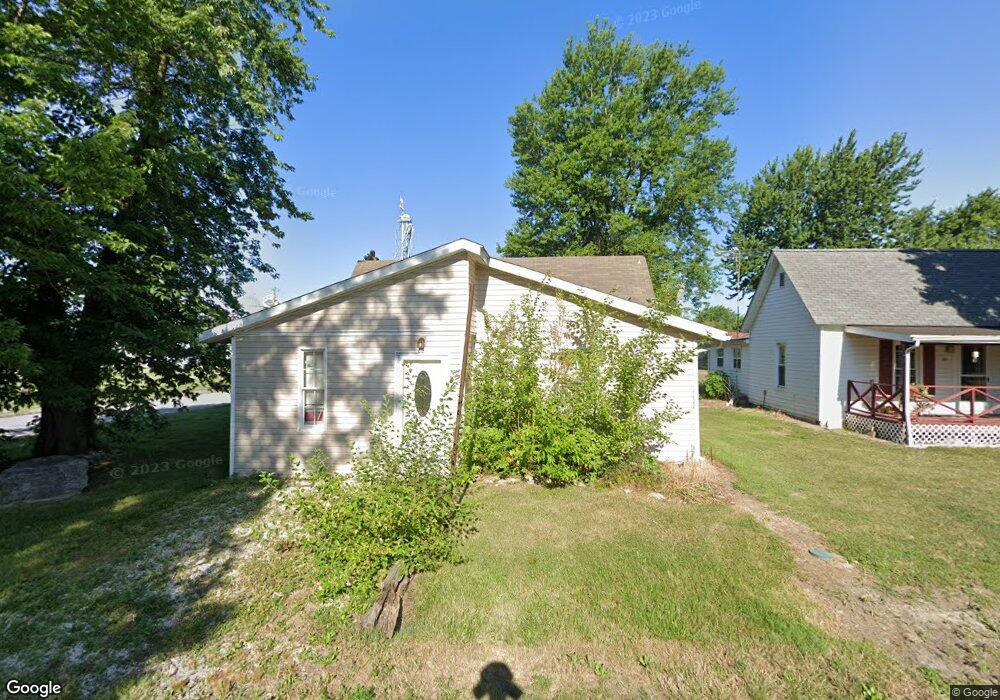
475 Walnut St Hawk Point, MO 63349
Estimated Value: $131,665 - $181,000
1
Bed
1
Bath
1,080
Sq Ft
$145/Sq Ft
Est. Value
About This Home
This home is located at 475 Walnut St, Hawk Point, MO 63349 and is currently estimated at $156,916, approximately $145 per square foot. 475 Walnut St is a home located in Lincoln County with nearby schools including Hawk Point Elementary School, Troy Middle School, and Troy Buchanan High School.
Ownership History
Date
Name
Owned For
Owner Type
Purchase Details
Closed on
Dec 10, 2019
Sold by
Leblanc Roy D
Bought by
Leblanc Roy D and Roy D Leblanc Revocable Trust
Current Estimated Value
Home Financials for this Owner
Home Financials are based on the most recent Mortgage that was taken out on this home.
Original Mortgage
$50,000
Outstanding Balance
$44,168
Interest Rate
3.7%
Mortgage Type
New Conventional
Estimated Equity
$112,748
Purchase Details
Closed on
Jun 18, 2013
Sold by
Rohde Joshua J and Komindo Lisa D
Bought by
Komindo Lisa D
Purchase Details
Closed on
Jul 26, 2011
Sold by
First Bank
Bought by
Secretary Of Hud
Purchase Details
Closed on
Jul 31, 2009
Sold by
Smoot Jason Wesley
Bought by
Matteston Kelly A
Purchase Details
Closed on
Nov 30, 2006
Sold by
Francis John Adam and Francis Meghan R
Bought by
Dennis Mark
Home Financials for this Owner
Home Financials are based on the most recent Mortgage that was taken out on this home.
Original Mortgage
$99,500
Interest Rate
11.74%
Mortgage Type
Adjustable Rate Mortgage/ARM
Create a Home Valuation Report for This Property
The Home Valuation Report is an in-depth analysis detailing your home's value as well as a comparison with similar homes in the area
Purchase History
| Date | Buyer | Sale Price | Title Company |
|---|---|---|---|
| Leblanc Roy D | -- | None Available | |
| Komindo Lisa D | -- | None Available | |
| Secretary Of Hud | -- | None Available | |
| First Bank | $85,303 | None Available | |
| Matteston Kelly A | -- | None Available | |
| Dennis Mark | -- | None Available |
Source: Public Records
Mortgage History
| Date | Status | Borrower | Loan Amount |
|---|---|---|---|
| Open | Leblanc Roy D | $50,000 | |
| Previous Owner | Dennis Mark | $99,500 |
Source: Public Records
Tax History
| Year | Tax Paid | Tax Assessment Tax Assessment Total Assessment is a certain percentage of the fair market value that is determined by local assessors to be the total taxable value of land and additions on the property. | Land | Improvement |
|---|---|---|---|---|
| 2025 | $694 | $10,900 | $699 | $10,201 |
| 2024 | $655 | $10,097 | $437 | $9,660 |
| 2023 | $651 | $10,097 | $437 | $9,660 |
| 2022 | $610 | $9,519 | $437 | $9,082 |
| 2021 | $612 | $50,100 | $0 | $0 |
| 2020 | $523 | $43,190 | $0 | $0 |
| 2019 | $523 | $43,190 | $0 | $0 |
| 2018 | $530 | $8,206 | $0 | $0 |
| 2017 | $531 | $8,206 | $0 | $0 |
| 2016 | $393 | $5,919 | $0 | $0 |
| 2015 | $395 | $5,919 | $0 | $0 |
| 2014 | $384 | $5,740 | $0 | $0 |
| 2013 | -- | $5,740 | $0 | $0 |
Source: Public Records
Map
Nearby Homes
- 415 Walnut St
- 4 Ashley Ln
- 140 Turkey Creek Crossing Dr
- 339 White Rd
- 8 Summers Breeze Ct
- 2 Country Ridge Trail
- 346 Bethel Rd
- 300 Shumard Oak Dr
- 804 Timber Creek Ct
- 401 Deep Forest Dr
- 113 Bridlespur Ct
- 64 Mocking Bird Ln
- 0 Cedar Circle Ln Unit MIS25071955
- 456 Westridge Dr
- 459 Westridge Dr
- 45 Blue Line Ln
- 157 Denise Ct
- 762 Cave Farm Rd
- 0 Westridge Dr
- 62 Copper Hills Cove
- 465 Walnut St
- 479 Washington St
- 440 Cedar St
- 38 + - N Tunnel Rd
- 474 Walnut St
- 440 W Lincoln St
- 416 Cedar St
- 461 Cedar St
- 348 W Lincoln St
- 771 Washington St
- 517 Chestnut St
- 514 W Lincoln St
- 346 W Lincoln St
- 447 W Lincoln St
- 419 Chestnut St
- 381 Walnut St
- 42 Lot 42
- 377 W Lincoln St
- 544 W Lincoln St
- 573 Washington St
Your Personal Tour Guide
Ask me questions while you tour the home.