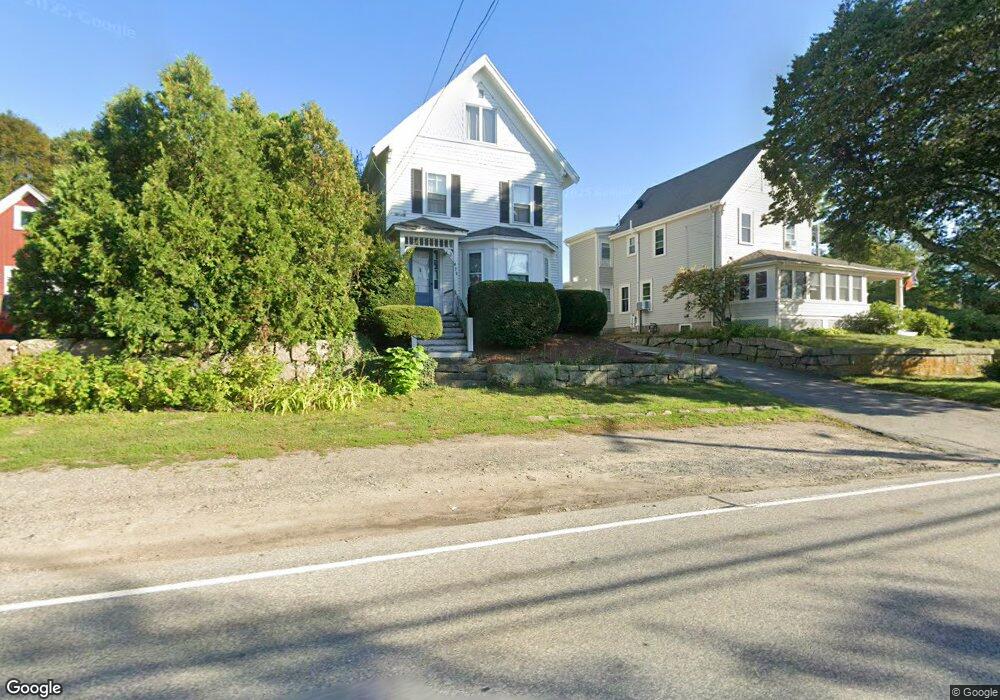
475 Washington St Gloucester, MA 01930
Estimated Value: $590,684 - $736,000
3
Beds
1
Bath
1,495
Sq Ft
$436/Sq Ft
Est. Value
About This Home
This home is located at 475 Washington St, Gloucester, MA 01930 and is currently estimated at $652,171, approximately $436 per square foot. 475 Washington St is a home located in Essex County with nearby schools including Beeman Memorial, Ralph B O'maley Middle School, and Faith Christian School.
Ownership History
Date
Name
Owned For
Owner Type
Purchase Details
Closed on
Feb 3, 2006
Sold by
Brown Donna R and Brown Ronald W
Bought by
Brown Randall W
Current Estimated Value
Create a Home Valuation Report for This Property
The Home Valuation Report is an in-depth analysis detailing your home's value as well as a comparison with similar homes in the area
Home Values in the Area
Average Home Value in this Area
Purchase History
| Date | Buyer | Sale Price | Title Company |
|---|---|---|---|
| Brown Randall W | $350,000 | -- |
Source: Public Records
Mortgage History
| Date | Status | Borrower | Loan Amount |
|---|---|---|---|
| Open | Brown Randall W | $75,000 | |
| Open | Brown Randall W | $283,000 | |
| Closed | Brown Randall W | $280,000 | |
| Closed | Brown Randall W | $280,000 |
Source: Public Records
Tax History Compared to Growth
Tax History
| Year | Tax Paid | Tax Assessment Tax Assessment Total Assessment is a certain percentage of the fair market value that is determined by local assessors to be the total taxable value of land and additions on the property. | Land | Improvement |
|---|---|---|---|---|
| 2025 | $4,844 | $498,400 | $148,900 | $349,500 |
| 2024 | $4,780 | $491,300 | $141,800 | $349,500 |
| 2023 | $4,570 | $431,500 | $126,700 | $304,800 |
| 2022 | $4,418 | $376,600 | $110,200 | $266,400 |
| 2021 | $4,296 | $345,300 | $102,800 | $242,500 |
| 2020 | $4,225 | $342,700 | $102,800 | $239,900 |
| 2019 | $4,001 | $315,300 | $102,800 | $212,500 |
| 2018 | $3,826 | $295,900 | $102,800 | $193,100 |
| 2017 | $3,704 | $280,800 | $97,900 | $182,900 |
| 2016 | $3,601 | $264,600 | $102,200 | $162,400 |
| 2015 | $3,438 | $251,900 | $102,200 | $149,700 |
Source: Public Records
Map
Nearby Homes
- 49 Thurston Point Rd
- 18 Cherry St
- 109 Riverview Rd
- 65 Poplar St
- 19 Mystic Ave
- 672 Washington St
- 78 Grove St
- 6 Beauport Ave
- 196 Washington St
- 40 Sargent St
- 6 River Rd
- 3 Stone Ct
- 119 Pleasant St
- 188 Atlantic St
- 15 Harvard St
- 33 Maplewood Ave Unit 21
- 226 Atlantic St
- 8 Summer St Unit 103
- 4 Mount Vernon St
- 145 Essex Ave Unit 610
- 477 Washington St
- 473 Washington St
- 462 Washington St
- 458 Washington St
- 468 Washington St
- 456 Washington St
- 464 Washington St
- 1 Deacon Farm Ln
- 465 Washington St
- 483 Washington St
- 470 Washington St
- 6 Deacon Farm Ln
- 3 Piraino Ln
- 3 Piraino Ln Unit 3
- 485 Washington St
- 461 Washington St
- 5 Piraino Ln
- 5 Piraino Ln Unit 5
- 4 Reef Knot Way
- 3 Reef Knot Way