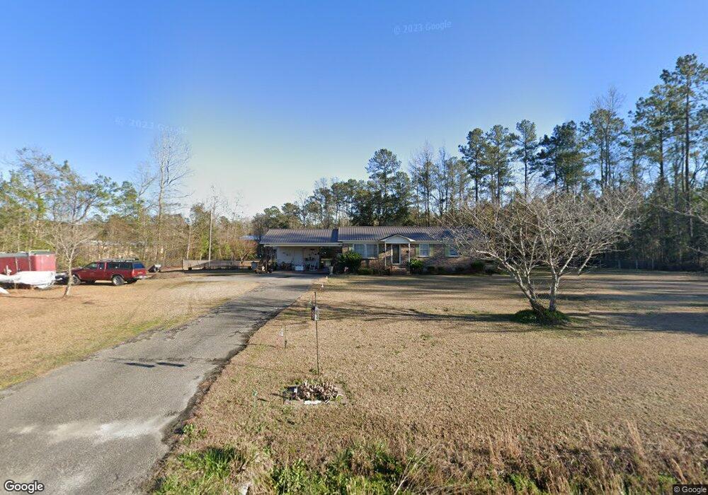
4750 Highway 472 Conway, SC 29526
Estimated Value: $182,000 - $248,000
3
Beds
1
Bath
1,269
Sq Ft
$164/Sq Ft
Est. Value
About This Home
This home is located at 4750 Highway 472, Conway, SC 29526 and is currently estimated at $208,300, approximately $164 per square foot. 4750 Highway 472 is a home located in Horry County with nearby schools including Kingston Elementary School, Conway Middle School, and Conway High School.
Ownership History
Date
Name
Owned For
Owner Type
Purchase Details
Closed on
Oct 23, 2003
Sold by
Burruss Edna Carol and Burruss Carol
Bought by
Hughes Jarrett Randall
Current Estimated Value
Home Financials for this Owner
Home Financials are based on the most recent Mortgage that was taken out on this home.
Original Mortgage
$81,000
Outstanding Balance
$37,254
Interest Rate
6%
Mortgage Type
Purchase Money Mortgage
Estimated Equity
$171,046
Purchase Details
Closed on
Jun 20, 2002
Sold by
Burruss Edna Carol and Estate Of Robert Ray Burruss
Bought by
Burruss Edna Carol
Create a Home Valuation Report for This Property
The Home Valuation Report is an in-depth analysis detailing your home's value as well as a comparison with similar homes in the area
Home Values in the Area
Average Home Value in this Area
Purchase History
| Date | Buyer | Sale Price | Title Company |
|---|---|---|---|
| Hughes Jarrett Randall | $90,000 | -- | |
| Burruss Edna Carol | -- | -- |
Source: Public Records
Mortgage History
| Date | Status | Borrower | Loan Amount |
|---|---|---|---|
| Open | Hughes Jarrett Randall | $81,000 |
Source: Public Records
Tax History Compared to Growth
Tax History
| Year | Tax Paid | Tax Assessment Tax Assessment Total Assessment is a certain percentage of the fair market value that is determined by local assessors to be the total taxable value of land and additions on the property. | Land | Improvement |
|---|---|---|---|---|
| 2024 | $1,514 | $8,661 | $4,740 | $3,921 |
| 2023 | $1,514 | $6,162 | $1,626 | $4,536 |
| 2021 | $1,400 | $6,648 | $2,112 | $4,536 |
| 2020 | $1,308 | $6,648 | $2,112 | $4,536 |
| 2019 | $1,308 | $6,648 | $2,112 | $4,536 |
| 2018 | $1,184 | $5,359 | $1,405 | $3,954 |
| 2017 | $1,169 | $5,359 | $1,405 | $3,954 |
| 2016 | -- | $5,359 | $1,405 | $3,954 |
| 2015 | $349 | $5,359 | $1,405 | $3,954 |
| 2014 | $324 | $5,359 | $1,405 | $3,954 |
Source: Public Records
Map
Nearby Homes
- TBD Dukes Rd
- 926 Eula Dr
- 4423 S Carolina 905
- 115 Missouria Ln
- TBD Bluebird Loop
- 222 Highway 471
- 4037 Highway 905
- 183 S Carolina 66 Unit 20 SFR Lots Hwy 905
- 194 Foxford Dr
- 990 Cherrystone Loop
- 133 Alpharetta Ct
- 1106 Cherrystone Loop
- 367 Dunbarton Ln
- Vision Plan at Shaftesbury Meadows
- Vantage Plan at Shaftesbury Meadows
- Wayfare Plan at Shaftesbury Meadows
- Venture Plan at Shaftesbury Meadows
- Prelude Plan at Shaftesbury Meadows
- Engage Plan at Shaftesbury Meadows
- Embark Plan at Shaftesbury Meadows
- 4742 Highway 472
- 4780 Highway 472
- 4820 Highway 472
- 4656 Highway 472
- 860 Eula Dr
- 895 Hudnall Rd
- 0 Hudnall Rd
- 929 Hudnall Rd
- 783 Strickland Rd
- 1585 Dukes Rd
- 4651 Highway 472
- 836 Strickland Rd
- 4865 Highway 472
- 842 Strickland Rd
- 4626 Highway 472
- Lot 4 Strickland Rd Unit 1.66 Acres corner of
- Lot 3 Strickland Rd Unit 1.97 Acres Dukes Rd
- 329 Moon Bridge Ct
- 4900 Highway 472
- 4627 Highway 472