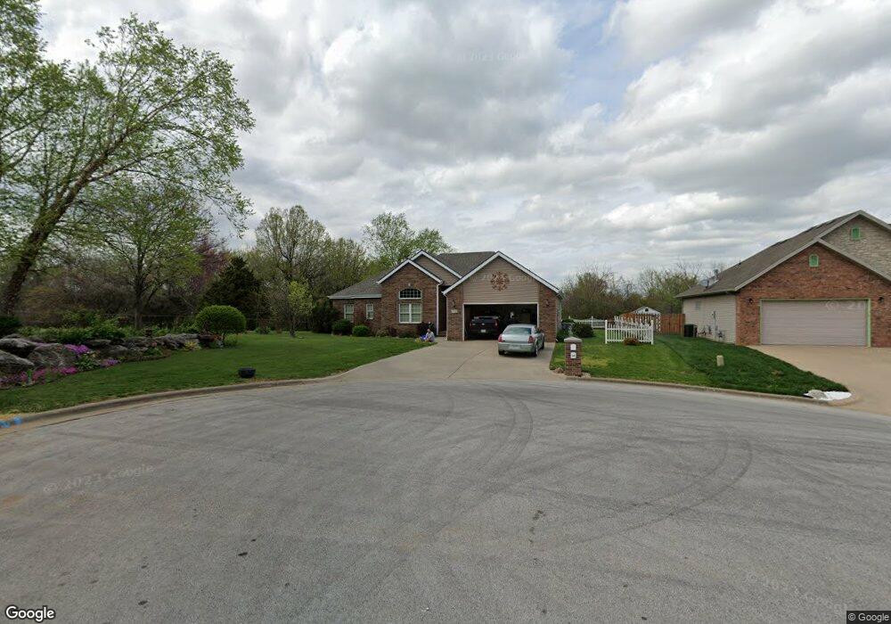
4753 W Minota St Springfield, MO 65802
Southwest Springfield NeighborhoodEstimated Value: $299,000 - $316,000
3
Beds
3
Baths
1,851
Sq Ft
$166/Sq Ft
Est. Value
About This Home
This home is located at 4753 W Minota St, Springfield, MO 65802 and is currently estimated at $308,180, approximately $166 per square foot. 4753 W Minota St is a home located in Greene County with nearby schools including Price Elementary School, Republic Middle School, and Republic High School.
Ownership History
Date
Name
Owned For
Owner Type
Purchase Details
Closed on
Jun 1, 2007
Sold by
T And B Develpment Co Llc
Bought by
Robert David A and Roberts Patricia A
Current Estimated Value
Home Financials for this Owner
Home Financials are based on the most recent Mortgage that was taken out on this home.
Original Mortgage
$188,000
Outstanding Balance
$114,849
Interest Rate
6.16%
Mortgage Type
New Conventional
Estimated Equity
$193,331
Purchase Details
Closed on
Apr 19, 2006
Sold by
Jiyhn Ross Development Llc
Bought by
Flavin Tim
Create a Home Valuation Report for This Property
The Home Valuation Report is an in-depth analysis detailing your home's value as well as a comparison with similar homes in the area
Home Values in the Area
Average Home Value in this Area
Purchase History
| Date | Buyer | Sale Price | Title Company |
|---|---|---|---|
| Robert David A | -- | Southwest Missouri Title Co | |
| Flavin Tim | -- | Lincoln-Evens Land Title Co |
Source: Public Records
Mortgage History
| Date | Status | Borrower | Loan Amount |
|---|---|---|---|
| Open | Robert David A | $188,000 |
Source: Public Records
Tax History Compared to Growth
Tax History
| Year | Tax Paid | Tax Assessment Tax Assessment Total Assessment is a certain percentage of the fair market value that is determined by local assessors to be the total taxable value of land and additions on the property. | Land | Improvement |
|---|---|---|---|---|
| 2025 | $2,327 | $45,830 | $6,650 | $39,180 |
| 2024 | $2,327 | $40,890 | $5,700 | $35,190 |
| 2023 | $2,281 | $40,890 | $5,700 | $35,190 |
| 2022 | $1,578 | $28,030 | $5,700 | $22,330 |
| 2021 | $1,578 | $28,030 | $5,700 | $22,330 |
| 2020 | $1,461 | $28,030 | $5,700 | $22,330 |
| 2019 | $1,456 | $28,030 | $5,700 | $22,330 |
| 2018 | $1,467 | $27,400 | $5,700 | $21,700 |
| 2017 | $1,456 | $27,400 | $5,700 | $21,700 |
| 2016 | $1,470 | $27,400 | $5,700 | $21,700 |
| 2015 | $1,469 | $27,400 | $5,700 | $21,700 |
| 2014 | $1,484 | $27,400 | $5,700 | $21,700 |
Source: Public Records
Map
Nearby Homes
- 4723 W Portland St
- 4574 Hummer Dr
- 4641 Blackfoot Dr
- 4652 Blackfoot Dr
- 1161 S Broadview Ave
- 4845 W Washita St
- 5033 W Skyler Dr
- 4487 W University St
- 1169 S Miller Ave
- 1898 S Lullwood Ave
- 1895 S Lullwood Ave
- 000 W Farm Road 148
- 4357 W Riley St
- 1282 S Canton Ave
- 5145 W Sunstruck St
- 5170 W Sunstruck St
- 5182 W Sunstruck St
- 2031 S Pebble Ridge Rd
- 4409 W Nicholas St
- 4515 W Greenridge St
- 4741 W Minota St
- 4752 W Minota St
- 4729 W Minota St
- 4740 W Minota St
- 4728 W Minota St
- 1386 S Waco Ave
- 4751 W Waco Ct
- 4739 W Waco Ct
- 1398 S Waco Ave
- 1424 S Waco Ave
- 4727 W Waco Ct
- 1436 S Waco Ave
- 1448 S Waco Ave
- 1393 S Miller Ave Unit L7
- 1393 S Miller Ave
- 1381 S Miller Ave
- 1381 S Miller Ave Unit L8
- 1369 S Miller Ave
- 1460 S Waco Ave
- 1423 S Miller Ave