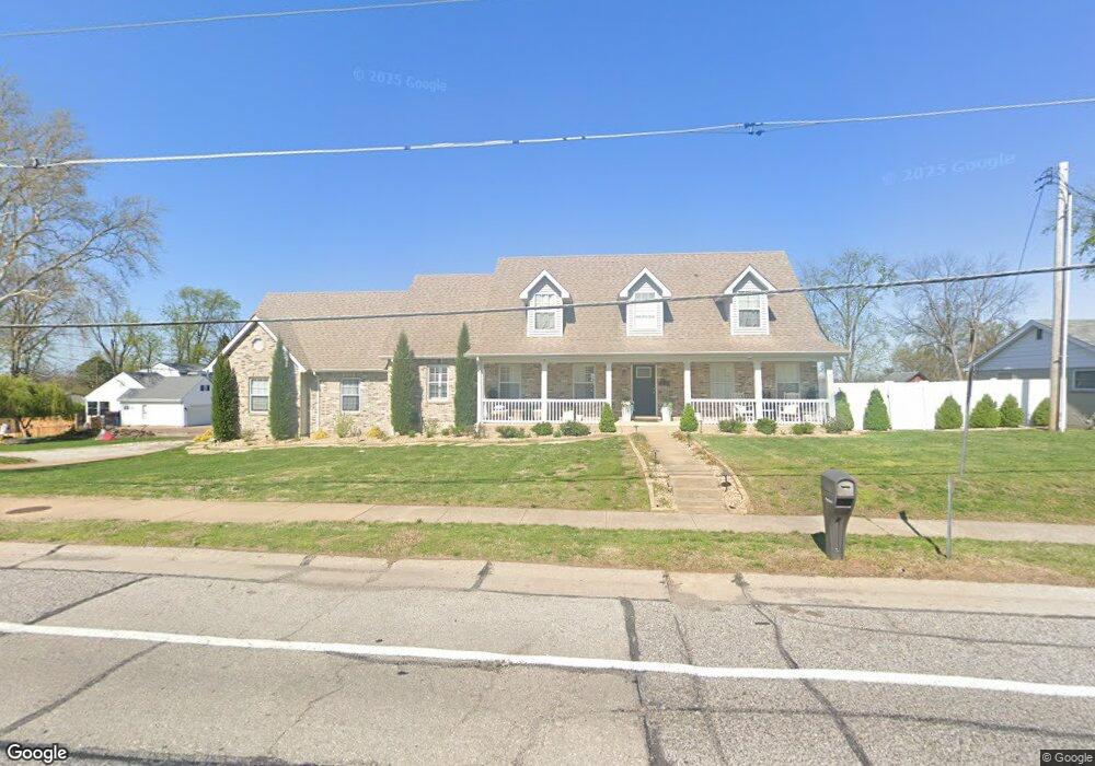
4757 Mattis Rd Saint Louis, MO 63128
Estimated Value: $502,000 - $718,628
4
Beds
5
Baths
3,072
Sq Ft
$198/Sq Ft
Est. Value
About This Home
This home is located at 4757 Mattis Rd, Saint Louis, MO 63128 and is currently estimated at $606,907, approximately $197 per square foot. 4757 Mattis Rd is a home located in St. Louis County with nearby schools including Kennerly Elementary School, Sperreng Middle School, and Lindbergh High School.
Ownership History
Date
Name
Owned For
Owner Type
Purchase Details
Closed on
Sep 28, 2007
Sold by
Merry Mattis Llc
Bought by
Masson Jeffrey A and Masson Monica L
Current Estimated Value
Home Financials for this Owner
Home Financials are based on the most recent Mortgage that was taken out on this home.
Original Mortgage
$269,500
Outstanding Balance
$170,454
Interest Rate
6.55%
Mortgage Type
Unknown
Estimated Equity
$436,453
Purchase Details
Closed on
Nov 15, 2005
Sold by
Geci Llc
Bought by
Merry Mattis Llc
Home Financials for this Owner
Home Financials are based on the most recent Mortgage that was taken out on this home.
Original Mortgage
$2,000,000
Interest Rate
5.92%
Mortgage Type
Construction
Purchase Details
Closed on
Apr 26, 2003
Sold by
Scherrer Sylvester A
Bought by
Scherrer Donald J and Scherrer Dennis J
Create a Home Valuation Report for This Property
The Home Valuation Report is an in-depth analysis detailing your home's value as well as a comparison with similar homes in the area
Home Values in the Area
Average Home Value in this Area
Purchase History
| Date | Buyer | Sale Price | Title Company |
|---|---|---|---|
| Masson Jeffrey A | $302,500 | Ort | |
| Merry Mattis Llc | -- | Ort | |
| Scherrer Donald J | -- | -- |
Source: Public Records
Mortgage History
| Date | Status | Borrower | Loan Amount |
|---|---|---|---|
| Open | Masson Jeffrey A | $269,500 | |
| Previous Owner | Merry Mattis Llc | $2,000,000 |
Source: Public Records
Tax History Compared to Growth
Tax History
| Year | Tax Paid | Tax Assessment Tax Assessment Total Assessment is a certain percentage of the fair market value that is determined by local assessors to be the total taxable value of land and additions on the property. | Land | Improvement |
|---|---|---|---|---|
| 2025 | $7,080 | $125,420 | $18,700 | $106,720 |
| 2024 | $7,080 | $109,180 | $20,770 | $88,410 |
| 2023 | $7,063 | $109,180 | $20,770 | $88,410 |
| 2022 | $6,263 | $92,880 | $20,770 | $72,110 |
| 2021 | $6,040 | $92,880 | $20,770 | $72,110 |
| 2020 | $5,779 | $85,730 | $17,160 | $68,570 |
| 2019 | $5,246 | $77,980 | $17,160 | $60,820 |
| 2018 | $5,266 | $71,210 | $10,810 | $60,400 |
Source: Public Records
Map
Nearby Homes
- 4643 Littlebury Dr
- 4818 Chapel Hill Dr
- 4833 Hursley Dr
- 4839 Hursley Dr
- 4645 Tauneybrook Dr
- 4829 Vermilion Dr
- 4449 Pinyon Jay Ct
- 4942 Caribee Dr
- 4801 Langtree Dr
- 5057 Peyton Place Ct
- 4931 Theiss Rd
- 5135 Towne Centre Dr
- 4700 Theiss Rd
- 4642 Theiss Rd
- 4921 Kerth Rd
- 5100 Melitta Dr
- 4838 Dorsie Dr
- 4525 Eli Dr Unit D
- 12055 Charwick Dr
- 4501 Eli Dr Unit I
- 4751 Mattis Rd
- 4805 Mattis Rd
- 4766 Mattis Rd
- 4800 Mattis Rd
- 15 Cedar Ln
- 4750 Mattis Rd
- 4810 Mattis Rd
- 4669 Littlebury Dr
- 4663 Littlebury Dr
- 4655 Littlebury Dr
- 8 Cedar Ln
- 4811 Mattis Rd
- 11 Cedar Ln
- 4814 Mattis Rd
- 4649 Littlebury Dr
- 4742 Mattis Rd
- 4740 Mattis Rd
- 4819 Mattis Rd
- 4670 Littlebury Dr
- 7 Cedar Ln