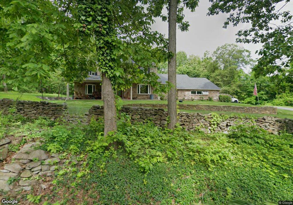
4758 MacUngie Mountain Rd Macungie, PA 18062
Lower Macungie Township West NeighborhoodEstimated Value: $488,000 - $771,000
4
Beds
3
Baths
3,295
Sq Ft
$189/Sq Ft
Est. Value
About This Home
This home is located at 4758 MacUngie Mountain Rd, Macungie, PA 18062 and is currently estimated at $624,200, approximately $189 per square foot. 4758 MacUngie Mountain Rd is a home located in Lehigh County with nearby schools including Shoemaker Elementary School, Eyer Middle School, and Emmaus High School.
Ownership History
Date
Name
Owned For
Owner Type
Purchase Details
Closed on
Oct 31, 2006
Sold by
Walker Leigh E and Walker Mary M
Bought by
Defanti Brad M and Defanti Andrea L
Current Estimated Value
Home Financials for this Owner
Home Financials are based on the most recent Mortgage that was taken out on this home.
Original Mortgage
$220,000
Outstanding Balance
$132,025
Interest Rate
6.47%
Mortgage Type
Purchase Money Mortgage
Estimated Equity
$492,175
Purchase Details
Closed on
Jul 8, 1985
Sold by
Sweeney James M and Sweeney Jean E
Bought by
Walker Leigh E and Walker Mary M
Purchase Details
Closed on
Mar 28, 1983
Sold by
Hieter David and Mary Elizabeth
Bought by
Sweeney James M and Sweeney Jean E
Purchase Details
Closed on
May 26, 1978
Bought by
Hieter David and Mary Elizabeth
Create a Home Valuation Report for This Property
The Home Valuation Report is an in-depth analysis detailing your home's value as well as a comparison with similar homes in the area
Home Values in the Area
Average Home Value in this Area
Purchase History
| Date | Buyer | Sale Price | Title Company |
|---|---|---|---|
| Defanti Brad M | $275,000 | None Available | |
| Walker Leigh E | $131,000 | -- | |
| Sweeney James M | $142,000 | -- | |
| Hieter David | -- | -- |
Source: Public Records
Mortgage History
| Date | Status | Borrower | Loan Amount |
|---|---|---|---|
| Open | Defanti Brad M | $220,000 |
Source: Public Records
Tax History Compared to Growth
Tax History
| Year | Tax Paid | Tax Assessment Tax Assessment Total Assessment is a certain percentage of the fair market value that is determined by local assessors to be the total taxable value of land and additions on the property. | Land | Improvement |
|---|---|---|---|---|
| 2025 | $8,884 | $348,000 | $72,100 | $275,900 |
| 2024 | $8,491 | $348,000 | $72,100 | $275,900 |
| 2023 | $7,777 | $325,300 | $72,100 | $253,200 |
| 2022 | $7,590 | $325,300 | $253,200 | $72,100 |
| 2021 | $7,427 | $325,300 | $72,100 | $253,200 |
| 2020 | $7,355 | $325,300 | $72,100 | $253,200 |
| 2019 | $7,310 | $325,300 | $72,100 | $253,200 |
| 2018 | $7,123 | $325,300 | $72,100 | $253,200 |
| 2017 | $6,001 | $279,000 | $72,100 | $206,900 |
| 2016 | -- | $279,000 | $72,100 | $206,900 |
| 2015 | -- | $279,000 | $72,100 | $206,900 |
| 2014 | -- | $270,000 | $72,100 | $197,900 |
Source: Public Records
Map
Nearby Homes
- Lot 1 Mountain Rd
- 98 Maple St
- 0 Mountain Lot 1
- 975 Hillcrest Dr S
- 6709 Mountain Rd
- 830 E Main St
- 725 E Main St
- 167 Aspen Ln
- 38 Cedar St
- 6405 Robin Rd
- 3814 Clay Dr
- 6832 Scenic View Dr
- 3610 Sweet Meadow Ct
- 6903 Lincoln Dr
- 0 Clauss Hunt Knight Dr Unit 10 Units 763578
- 7077 Hunt Dr
- 5722 Kings Hwy S
- 5761 Chestnut St
- 4245 Tank Farm Rd
- 4835 Shimerville Rd
- 6444 Sweetwood Dr
- 6502 Sweetwood Dr
- 4801 MacUngie Mountain Rd
- 4763 MacUngie Mountain Rd
- 6372 Sweetwood Dr
- 6447 Sweetwood Dr
- 6524 Sweetwood Dr
- 6423 Sweetwood Dr
- 6365 Sweetwood Dr
- 4837 MacUngie Mountain Rd
- 6391 Sweetwood Dr
- 6546 Sweetwood Dr
- 6338 Sweetwood Dr
- 7501 Chestnut St
- 6541 Sweetwood Dr
- 6560 Sweetwood Dr
- 4863 MacUngie Mountain Rd
- 6554 Sweetwood Dr
- 6302 Sweetwood Dr