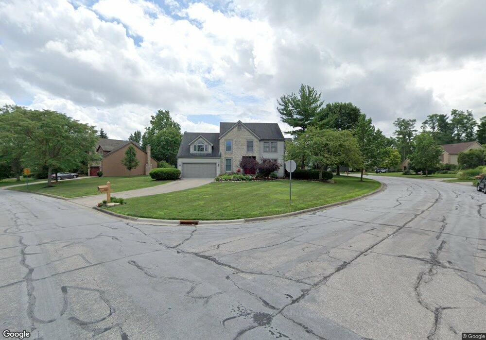
4759 Saint Andrews Cir Westerville, OH 43082
Genoa NeighborhoodEstimated Value: $541,000 - $560,000
4
Beds
4
Baths
2,983
Sq Ft
$185/Sq Ft
Est. Value
About This Home
This home is located at 4759 Saint Andrews Cir, Westerville, OH 43082 and is currently estimated at $550,579, approximately $184 per square foot. 4759 Saint Andrews Cir is a home located in Delaware County with nearby schools including Fouse Elementary School, Genoa Middle School, and Westerville Central High School.
Ownership History
Date
Name
Owned For
Owner Type
Purchase Details
Closed on
Oct 21, 2021
Sold by
Edwards Nicole C
Bought by
Fkh Sfr Propco Ii Lp
Current Estimated Value
Purchase Details
Closed on
Oct 8, 2021
Sold by
Edwards Nicole C
Bought by
Fkh Sfr Propco H Lp
Purchase Details
Closed on
Jan 20, 2005
Sold by
Fillmore Traci Rusk and Fillmore Christopher R
Bought by
Cicero Joseph J and Edwards Nicole C
Home Financials for this Owner
Home Financials are based on the most recent Mortgage that was taken out on this home.
Original Mortgage
$232,000
Interest Rate
5.25%
Mortgage Type
Purchase Money Mortgage
Purchase Details
Closed on
Nov 2, 2001
Sold by
Ganobsik Dale N
Bought by
Rusk Traci J
Create a Home Valuation Report for This Property
The Home Valuation Report is an in-depth analysis detailing your home's value as well as a comparison with similar homes in the area
Home Values in the Area
Average Home Value in this Area
Purchase History
| Date | Buyer | Sale Price | Title Company |
|---|---|---|---|
| Fkh Sfr Propco Ii Lp | $375,000 | None Available | |
| Fkh Sfr Propco H Lp | $375,000 | New Title Company Name | |
| Cicero Joseph J | $290,000 | Title First Agency Inc | |
| Rusk Traci J | $269,500 | -- |
Source: Public Records
Mortgage History
| Date | Status | Borrower | Loan Amount |
|---|---|---|---|
| Previous Owner | Cicero Joseph J | $232,000 | |
| Closed | Cicero Joseph J | $58,000 |
Source: Public Records
Tax History Compared to Growth
Tax History
| Year | Tax Paid | Tax Assessment Tax Assessment Total Assessment is a certain percentage of the fair market value that is determined by local assessors to be the total taxable value of land and additions on the property. | Land | Improvement |
|---|---|---|---|---|
| 2024 | $8,437 | $159,430 | $33,950 | $125,480 |
| 2023 | $8,274 | $159,430 | $33,950 | $125,480 |
| 2022 | $8,850 | $131,250 | $21,000 | $110,250 |
| 2021 | $7,499 | $112,700 | $21,000 | $91,700 |
| 2020 | $8,005 | $112,700 | $21,000 | $91,700 |
| 2019 | $7,278 | $104,370 | $21,000 | $83,370 |
| 2018 | $7,161 | $104,370 | $21,000 | $83,370 |
| 2017 | $7,310 | $101,570 | $18,480 | $83,090 |
| 2016 | $7,384 | $101,570 | $18,480 | $83,090 |
| 2015 | $7,710 | $101,570 | $18,480 | $83,090 |
| 2014 | $7,325 | $101,570 | $18,480 | $83,090 |
| 2013 | $7,151 | $98,390 | $18,480 | $79,910 |
Source: Public Records
Map
Nearby Homes
- 7513 Africa Rd
- 377 Westgreen Ln Unit 377
- 7373 Frasier Rd
- 5515 Stillwater Ave
- 5552 Quail Hollow Way
- 7697 Bale Kenyon Rd
- 5259 Sorrento Ct
- 5633 Travis Pointe Ct
- 6954 Lakeside Ct
- 4960 Hawthorne Valley Dr
- 6573 Kenwood Place
- 705 N State St Unit 211
- 5532 Meadowood Ln
- 49 Village Green Dr
- 543 N State St
- 3737 Birkland Cir
- 449 Buckstone Place
- 160 Moss Rd
- 6394 Mission Hills Place
- 3679 Birkland Cir
- 4759 St Andrews Dr
- 4759 Saint Andrews Dr
- 4739 Saint Andrews Dr
- 4797 Saint Andrews Dr
- 4760 Parkmoor Dr
- 4721 Saint Andrews Dr
- 4760 Saint Andrews Dr
- 4782 Saint Andrews Cir
- 4736 Saint Andrews Dr
- 4705 Saint Andrews Dr
- 4805 Saint Andrews Dr
- 4714 Saint Andrews Dr
- 4800 Saint Andrews Dr
- 4695 Saint Andrews Dr
- 4821 Saint Andrews Dr
- 4860 Patricia Ln
- 4682 Saint Andrews Dr
- 4779 Parkmoor Dr
- 4681 Saint Andrews Cir
- 4850 Patricia Ln