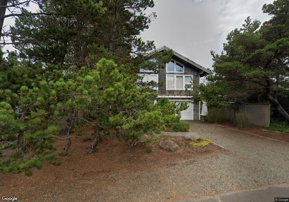
476 A St Seaside, OR 97138
Estimated Value: $640,000 - $1,037,000
4
Beds
3
Baths
676
Sq Ft
$1,197/Sq Ft
Est. Value
About This Home
This home is located at 476 A St, Seaside, OR 97138 and is currently estimated at $809,255, approximately $1,197 per square foot. 476 A St is a home located in Clatsop County with nearby schools including Seaside High School.
Ownership History
Date
Name
Owned For
Owner Type
Purchase Details
Closed on
Jan 16, 2025
Sold by
Victor Kisch Trust and Pamela Frasch Trust
Bought by
Pamela Frasch Trust and Frasch
Current Estimated Value
Purchase Details
Closed on
Dec 30, 2020
Sold by
Kisch Victor J and Frasch Pamela D
Bought by
Kisch Victor and The Victor Kisch Trust
Create a Home Valuation Report for This Property
The Home Valuation Report is an in-depth analysis detailing your home's value as well as a comparison with similar homes in the area
Purchase History
| Date | Buyer | Sale Price | Title Company |
|---|---|---|---|
| Pamela Frasch Trust | -- | None Listed On Document | |
| Pamela Frasch Trust | -- | None Listed On Document | |
| Kisch Victor | -- | None Available |
Source: Public Records
Tax History
| Year | Tax Paid | Tax Assessment Tax Assessment Total Assessment is a certain percentage of the fair market value that is determined by local assessors to be the total taxable value of land and additions on the property. | Land | Improvement |
|---|---|---|---|---|
| 2025 | $3,708 | $339,496 | -- | -- |
| 2024 | $3,770 | $329,608 | -- | -- |
| 2023 | $3,664 | $320,009 | $0 | $0 |
| 2022 | $3,554 | $310,690 | $0 | $0 |
| 2021 | $3,628 | $301,642 | $0 | $0 |
| 2020 | $3,500 | $292,858 | $0 | $0 |
| 2019 | $3,410 | $284,329 | $0 | $0 |
| 2018 | $3,286 | $276,049 | $0 | $0 |
| 2017 | $3,199 | $268,010 | $0 | $0 |
| 2016 | $2,764 | $260,205 | $99,631 | $160,574 |
| 2015 | $2,673 | $252,628 | $96,730 | $155,898 |
| 2014 | $2,541 | $245,271 | $0 | $0 |
| 2013 | -- | $238,128 | $0 | $0 |
Source: Public Records
Map
Nearby Homes
- 735 3rd St
- 1396 N Ocean Ave
- 1255 A St
- 641 6th St
- 750 5th St
- 934 H St
- 1065 Picture Place
- 101 13th St Unit 209
- 856 Neacoxie Blvd
- 856 Neacoxie Blvd Unit 311
- 782 Woodland Ct
- 3387-3389 U S 101
- 3389 U S 101
- 1146 N Marion Ave Unit 1-606
- 1238 N Marion Ave Unit 467
- 1238 N Marion Pacific View Condo Ave Unit 467
- 645 Meadow Ln
- 1398 N Ocean Ave
- 1400 N Ocean Ave
- 4043 Highway 101 N
- 402 A St
- 498 A St
- 491 Pacific Way
- 469 Pacific View Condo
- 401 Pacific Way
- 400 A St
- 400 Avenue A
- 483 Pacific View Unit 208
- 516 A St
- 475 Pacific Way Unit 109
- 483 Pacific Way Unit 208
- 499 A St
- 468 Pacific Way Unit V468
- 492 Pacific Way
- 486 Pacific Way Unit 486
- 488 Pacific Way Unit CONDO
- 488 Pacific Way Unit 488
- 365 Pacific Way
- 94 S Cottage Ave
- 567 Pacific Way
Your Personal Tour Guide
Ask me questions while you tour the home.