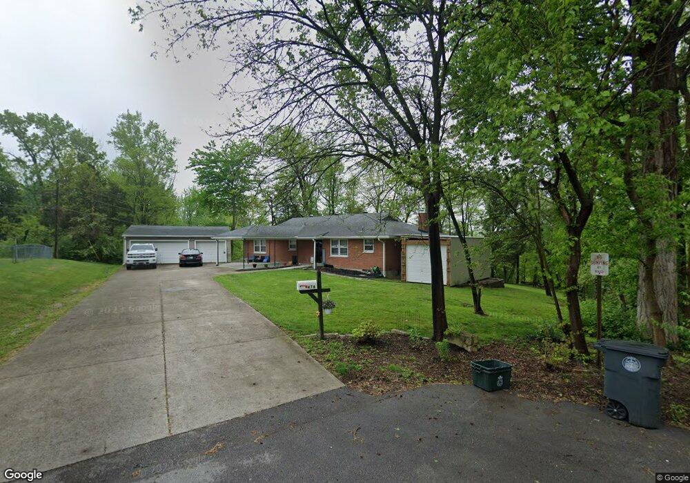
476 Alan Dr New Albany, IN 47150
Estimated Value: $248,000 - $264,639
3
Beds
2
Baths
1,740
Sq Ft
$147/Sq Ft
Est. Value
About This Home
This home is located at 476 Alan Dr, New Albany, IN 47150 and is currently estimated at $255,910, approximately $147 per square foot. 476 Alan Dr is a home located in Floyd County with nearby schools including Hazelwood Middle School, New Albany Senior High School, and Holy Family School.
Ownership History
Date
Name
Owned For
Owner Type
Purchase Details
Closed on
Aug 14, 2020
Sold by
Noble Beauford F
Bought by
Clay Dalton K
Current Estimated Value
Purchase Details
Closed on
Jul 9, 2020
Sold by
Clay Aron L
Bought by
Noble Beauford F
Purchase Details
Closed on
Aug 15, 2007
Sold by
Noble Maudine and Noble Beauford F
Bought by
Noble Besauford F
Create a Home Valuation Report for This Property
The Home Valuation Report is an in-depth analysis detailing your home's value as well as a comparison with similar homes in the area
Home Values in the Area
Average Home Value in this Area
Purchase History
| Date | Buyer | Sale Price | Title Company |
|---|---|---|---|
| Clay Dalton K | -- | None Available | |
| Noble Beauford F | -- | None Available | |
| Noble Besauford F | -- | None Available |
Source: Public Records
Tax History Compared to Growth
Tax History
| Year | Tax Paid | Tax Assessment Tax Assessment Total Assessment is a certain percentage of the fair market value that is determined by local assessors to be the total taxable value of land and additions on the property. | Land | Improvement |
|---|---|---|---|---|
| 2024 | $2,004 | $189,500 | $16,100 | $173,400 |
| 2023 | $2,550 | $198,700 | $16,100 | $182,600 |
| 2022 | $2,561 | $196,900 | $16,100 | $180,800 |
| 2021 | $2,420 | $186,000 | $16,100 | $169,900 |
| 2020 | $993 | $175,600 | $16,100 | $159,500 |
| 2019 | $765 | $162,000 | $16,100 | $145,900 |
| 2018 | $211 | $128,800 | $16,100 | $112,700 |
| 2017 | $206 | $129,800 | $16,100 | $113,700 |
| 2016 | $173 | $128,600 | $16,100 | $112,500 |
| 2014 | $194 | $129,100 | $16,100 | $113,000 |
| 2013 | -- | $167,000 | $32,100 | $134,900 |
Source: Public Records
Map
Nearby Homes
- 2424 Stover Dr
- 205 Robin Lynne Dr
- 528 Drawbrook Cir
- 511 E Daisy Ln
- 6369 Indiana 111
- 805 Elmwood Ave
- 627 Roseview Terrace
- 2928 Green Valley Rd
- 102 Crown Ct
- 823 Elmwood Ave
- 61 Wolfe Trace Ct
- 2318 Coyle Dr
- 301 Country Club Dr
- 8 Robin Ct
- 1464 South St
- 2548 Broadway St
- 2550 Broadway St
- 10 Valley View Ct
- 2703 Clearstream Ct
- 1455 South St