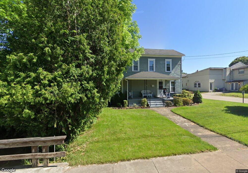
476 W Martin St East Palestine, OH 44413
Estimated Value: $73,194 - $125,000
2
Beds
1
Bath
1,296
Sq Ft
$71/Sq Ft
Est. Value
About This Home
This home is located at 476 W Martin St, East Palestine, OH 44413 and is currently estimated at $92,299, approximately $71 per square foot. 476 W Martin St is a home located in Columbiana County with nearby schools including East Palestine Elementary School, East Palestine Middle School, and East Palestine High School.
Ownership History
Date
Name
Owned For
Owner Type
Purchase Details
Closed on
Aug 31, 2016
Sold by
Gotthardt David S and Gotthardt Dena R
Bought by
Dsg Rentals Llc
Current Estimated Value
Purchase Details
Closed on
May 6, 2004
Sold by
Guy George Patrick
Bought by
Schmidt Clifford O and Schmidt Eileen M
Home Financials for this Owner
Home Financials are based on the most recent Mortgage that was taken out on this home.
Original Mortgage
$54,150
Interest Rate
5.5%
Mortgage Type
FHA
Purchase Details
Closed on
Mar 12, 2002
Sold by
Guy Anna L
Bought by
Guy George Patrick
Create a Home Valuation Report for This Property
The Home Valuation Report is an in-depth analysis detailing your home's value as well as a comparison with similar homes in the area
Home Values in the Area
Average Home Value in this Area
Purchase History
| Date | Buyer | Sale Price | Title Company |
|---|---|---|---|
| Dsg Rentals Llc | -- | None Available | |
| Schmidt Clifford O | $52,375 | -- | |
| Guy George Patrick | -- | -- |
Source: Public Records
Mortgage History
| Date | Status | Borrower | Loan Amount |
|---|---|---|---|
| Previous Owner | Schmidt Clifford O | $54,150 |
Source: Public Records
Tax History Compared to Growth
Tax History
| Year | Tax Paid | Tax Assessment Tax Assessment Total Assessment is a certain percentage of the fair market value that is determined by local assessors to be the total taxable value of land and additions on the property. | Land | Improvement |
|---|---|---|---|---|
| 2024 | $832 | $21,430 | $3,820 | $17,610 |
| 2023 | $832 | $21,430 | $3,820 | $17,610 |
| 2022 | $832 | $21,430 | $3,820 | $17,610 |
| 2021 | $803 | $19,530 | $5,040 | $14,490 |
| 2020 | $803 | $19,530 | $5,040 | $14,490 |
| 2019 | $802 | $19,530 | $5,040 | $14,490 |
| 2018 | $762 | $17,750 | $4,590 | $13,160 |
| 2017 | $762 | $17,750 | $4,590 | $13,160 |
| 2016 | $761 | $14,980 | $4,760 | $10,220 |
| 2015 | $647 | $14,980 | $4,760 | $10,220 |
| 2014 | $637 | $14,980 | $4,760 | $10,220 |
Source: Public Records
Map
Nearby Homes
- 395 W Clark St
- 581 W North Ave Unit 2
- 288 W North Ave
- 601 W North Ave
- 385 Park Ave
- 201-203 W Clark St
- 344 W Main St
- 115 W Taggart St
- 377 N Market St
- 681 Grandview Ave
- 167 S Market St
- 295 E Martin St
- 1075 Bacon Ave
- 737 Moore Ln
- 199 Garfield Ave
- 1141 Howell Ave
- 5136 State Route 170
- 1367 N Market St
- 0 N Pleasant Dr
- 745 E Martin St
- 492 W Martin St
- 475 W Martin St
- 456 W Martin St
- 493 W Martin St
- 446 W Martin St
- 501 W Martin St
- 512 W Martin St Unit 514
- 453 W Martin St
- 436 W Martin St
- 445 W Martin St
- 435 W Martin St
- 521 W Martin St
- 445 W North Ave
- 524 W Martin St
- 278 Valley St
- 515 W North Ave
- 455 W North Ave
- 525 W North Ave
- 425 W Martin St
- 425 W North Ave