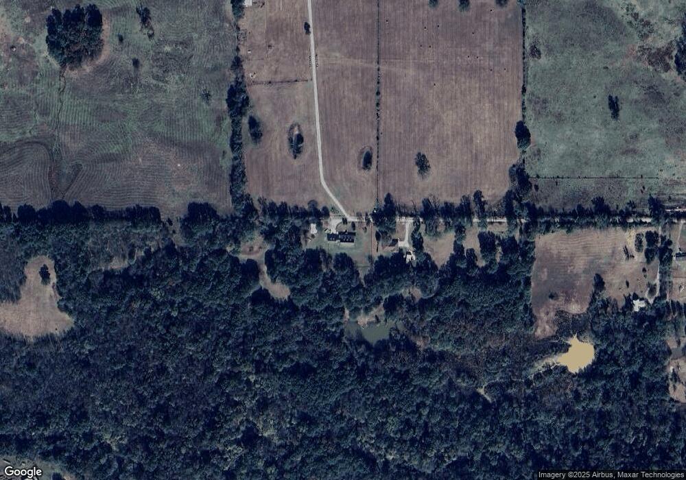
476038 E 1130 Rd Muldrow, OK 74948
Estimated Value: $197,000 - $356,389
3
Beds
2
Baths
2,087
Sq Ft
$139/Sq Ft
Est. Value
About This Home
This home is located at 476038 E 1130 Rd, Muldrow, OK 74948 and is currently estimated at $290,597, approximately $139 per square foot. 476038 E 1130 Rd is a home located in Sequoyah County with nearby schools including Roland Middle School and Roland High School.
Ownership History
Date
Name
Owned For
Owner Type
Purchase Details
Closed on
Mar 15, 2022
Sold by
Bourdon Woods Martha
Bought by
Martha Bourdon Woods Revocable Trust
Current Estimated Value
Purchase Details
Closed on
Sep 5, 2017
Sold by
Kidd Gary
Bought by
Floyd Family Trust
Purchase Details
Closed on
Dec 28, 2012
Sold by
Floyd Howard Butch and Floyd Nancy
Bought by
Floyd Family Trust
Purchase Details
Closed on
Dec 13, 2011
Sold by
Walker Daniel W and Walker Alia
Bought by
Floyd Howard and Floyd Nancy
Purchase Details
Closed on
Aug 8, 2011
Sold by
Barber Mark and Keech Ruby Louise
Bought by
Floyd Howard and Floyd Nancy
Purchase Details
Closed on
Oct 22, 1996
Sold by
Watts Chloe
Bought by
Floyd Howard and Floyd Nancy
Purchase Details
Closed on
Jan 6, 1993
Sold by
Keech Billy R and Keech Billy Ray
Bought by
Tabor Sammy and Tabor Monica
Create a Home Valuation Report for This Property
The Home Valuation Report is an in-depth analysis detailing your home's value as well as a comparison with similar homes in the area
Purchase History
| Date | Buyer | Sale Price | Title Company |
|---|---|---|---|
| Martha Bourdon Woods Revocable Trust | -- | None Listed On Document | |
| Floyd Family Trust | -- | None Available | |
| Floyd Family Trust | -- | None Available | |
| Floyd Howard | $7,500 | None Available | |
| Floyd Howard | -- | None Available | |
| Floyd Howard | $15,000 | -- | |
| Tabor Sammy | -- | None Available |
Source: Public Records
Tax History
| Year | Tax Paid | Tax Assessment Tax Assessment Total Assessment is a certain percentage of the fair market value that is determined by local assessors to be the total taxable value of land and additions on the property. | Land | Improvement |
|---|---|---|---|---|
| 2025 | -- | $8,315 | $1,405 | $6,910 |
| 2024 | -- | $8,315 | $813 | $7,502 |
| 2023 | $0 | $8,315 | $883 | $7,432 |
| 2022 | $0 | $8,316 | $932 | $7,384 |
| 2021 | $546 | $8,316 | $1,090 | $7,226 |
| 2020 | $546 | $8,316 | $1,090 | $7,226 |
| 2019 | $546 | $8,679 | $3,762 | $4,917 |
| 2018 | $0 | $8,679 | $3,762 | $4,917 |
| 2017 | $0 | $23,626 | $3,762 | $19,864 |
| 2016 | $1,512 | $22,275 | $2,411 | $19,864 |
| 2015 | $1,512 | $22,275 | $2,411 | $19,864 |
| 2014 | $1,466 | $21,626 | $2,319 | $19,307 |
Source: Public Records
Map
Nearby Homes
- 112368 S 4770 Rd
- 400 W Ray Fine Blvd
- 407 W Ray Fine Blvd
- 404 W Ray Fine Blvd
- 111324 S 4780 Rd
- 113 Cherokee Blvd
- 474377 E 1130 Rd
- TBD U S Highway 64
- 110907 S 4760 Rd
- 116 Roland Estate Ln
- 121 Shady Ln
- 103 Mondier St
- 108 Center Dr
- 102 Mondier St
- 109 W Howard St
- 109 Claretta Dr
- 101 Hollow Dr
- 110662 S 4750 Rd
- Lot 1 N 4780 Rd
- 102 Gamma Cir
- 476156 E 1130 Rd
- 476690 E 1130 Rd
- 112952 S 4770 Rd
- 112714 S 4770 Rd
- 476628 E 1125 Rd
- 476618 E 1125 Rd
- 113241 S 4760 Rd
- 112867 S 4770 Rd
- 113322 S 4770 Rd
- 112653 S 4770 Rd
- 112721 S 4770 Rd
- 112566 S 4770 Rd
- 476868 E 1125 Rd
- 112749 S 4760 Rd
- 476808 E 1125 Rd
- 113151 S 4760 Rd
- 112365 S 4770 Rd
- 113183 S 4760 Rd
- 112789 S 4770 Rd
- 476463 E 1125 Rd
Your Personal Tour Guide
Ask me questions while you tour the home.
