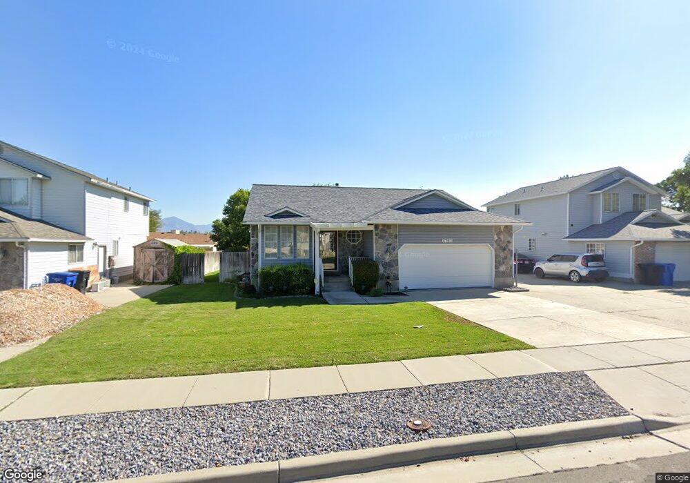
4763 S 2980 W Salt Lake City, UT 84129
Estimated Value: $511,000 - $547,000
2
Beds
2
Baths
1,350
Sq Ft
$390/Sq Ft
Est. Value
About This Home
This home is located at 4763 S 2980 W, Salt Lake City, UT 84129 and is currently estimated at $526,555, approximately $390 per square foot. 4763 S 2980 W is a home located in Salt Lake County with nearby schools including Harry S Truman Elementary School, Eisenhower Jr High School, and Taylorsville High School.
Ownership History
Date
Name
Owned For
Owner Type
Purchase Details
Closed on
Oct 23, 2014
Sold by
Kaufman Shelly L
Bought by
Kaufman Mike J
Current Estimated Value
Purchase Details
Closed on
Oct 14, 2002
Sold by
Kaufman Michael J and Kaufman Shelly L
Bought by
Kaufman Mike J and Kaufman Shelly L
Home Financials for this Owner
Home Financials are based on the most recent Mortgage that was taken out on this home.
Original Mortgage
$120,700
Interest Rate
5.46%
Create a Home Valuation Report for This Property
The Home Valuation Report is an in-depth analysis detailing your home's value as well as a comparison with similar homes in the area
Home Values in the Area
Average Home Value in this Area
Purchase History
| Date | Buyer | Sale Price | Title Company |
|---|---|---|---|
| Kaufman Mike J | -- | None Available | |
| Kaufman Mike J | -- | United Title Services |
Source: Public Records
Mortgage History
| Date | Status | Borrower | Loan Amount |
|---|---|---|---|
| Closed | Kaufman Mike J | $120,700 |
Source: Public Records
Tax History Compared to Growth
Tax History
| Year | Tax Paid | Tax Assessment Tax Assessment Total Assessment is a certain percentage of the fair market value that is determined by local assessors to be the total taxable value of land and additions on the property. | Land | Improvement |
|---|---|---|---|---|
| 2025 | $2,939 | $549,100 | $141,800 | $407,300 |
| 2024 | $2,939 | $482,000 | $132,500 | $349,500 |
| 2023 | $2,725 | $438,400 | $127,500 | $310,900 |
| 2022 | $2,799 | $454,200 | $125,000 | $329,200 |
| 2021 | $2,431 | $343,500 | $96,100 | $247,400 |
| 2020 | $2,354 | $314,900 | $96,100 | $218,800 |
| 2019 | $2,357 | $307,800 | $90,700 | $217,100 |
| 2018 | $2,398 | $301,900 | $90,700 | $211,200 |
| 2017 | $2,048 | $271,000 | $90,700 | $180,300 |
| 2016 | $1,981 | $262,000 | $90,700 | $171,300 |
| 2015 | $1,812 | $224,000 | $89,800 | $134,200 |
| 2014 | $1,773 | $215,200 | $87,100 | $128,100 |
Source: Public Records
Map
Nearby Homes
- 4717 Spicewood Way
- 2752 Santex Cir
- 3055 Westcove Dr
- 4571 S Stonewood Dr
- 3238 W 4630 S
- 3288 W 4700 S
- 4892 S Snarr Haven Ct
- 2767 W Lacewood Dr Unit T-149
- 4483 S Parkbury Way
- 4482 S Stonington Way
- 2892 Roxborough Ct
- 2658 W Scarsdale Ct Unit 49
- 2717 W Redwick Ct
- 2604 W West Central Park Way
- 4831 S 3475 W
- 4414 S 3200 W
- 2306 Bonniebrook Cir
- 3507 W 4700 S
- 3546 W Franco Ct Unit 3
- 4497 S Edgeware Ln
- 4755 S 2980 W
- 4771 S 2980 W
- 4766 Shakestone Dr
- 4758 Shakestone Dr
- 4774 Shakestone Dr
- 4779 S 2980 W
- 4774 S Shakestone Dr
- 4749 S 2980 W
- 4764 S 2980 W
- 2987 W 4745 S
- 4748 Shakestone Dr
- 4784 Shakestone Dr
- 4784 S Shakestone Dr
- 4785 S 2980 W
- 2978 W 4745 S
- 4772 S 2980 W
- 4784 S 2980 W
- 2982 W 4745 S
- 3005 W 4745 S
- 4740 Shakestone Dr