Estimated Value: $162,000 - $198,000
3
Beds
1
Bath
1,440
Sq Ft
$128/Sq Ft
Est. Value
About This Home
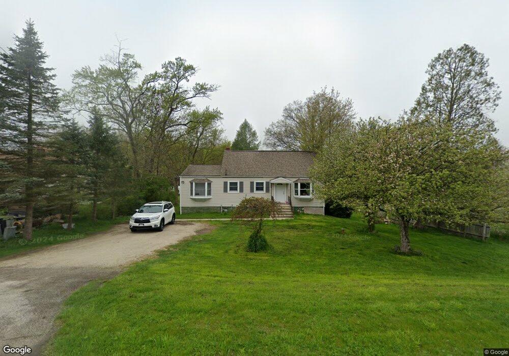
This home is located at 4765 State Route 43, Kent, OH 44240 and is currently estimated at $184,316, approximately $127 per square foot. 4765 State Route 43 is a home located in Portage County with nearby schools including Brimfield Elementary School, Field Middle School, and Field High School.
Ownership History
Date
Name
Owned For
Owner Type
Purchase Details
Closed on
Nov 3, 2003
Sold by
Carter Lumber Co
Bought by
State Of Ohio
Current Estimated Value
Purchase Details
Closed on
Mar 1, 2002
Sold by
Carter Lumber Company
Bought by
Carter Lumber Company
Purchase Details
Closed on
Feb 4, 2002
Sold by
Mcelwee David N and Mcelwee Ruth E
Bought by
Carter Lumber Company
Purchase Details
Closed on
Jan 1, 1990
Bought by
Mcelwee David N
Create a Home Valuation Report for This Property
The Home Valuation Report is an in-depth analysis detailing your home's value as well as a comparison with similar homes in the area
Home Values in the Area
Average Home Value in this Area
Purchase History
| Date | Buyer | Sale Price | Title Company |
|---|---|---|---|
| State Of Ohio | $2,725 | -- | |
| Carter Lumber Company | -- | Midland Commerce Group | |
| Carter Lumber Company | $115,000 | Midland Commerce Group | |
| Mcelwee David N | -- | -- |
Source: Public Records
Tax History Compared to Growth
Tax History
| Year | Tax Paid | Tax Assessment Tax Assessment Total Assessment is a certain percentage of the fair market value that is determined by local assessors to be the total taxable value of land and additions on the property. | Land | Improvement |
|---|---|---|---|---|
| 2024 | $2,632 | $53,800 | $23,590 | $30,210 |
| 2023 | $2,736 | $45,120 | $24,540 | $20,580 |
| 2022 | $2,744 | $45,120 | $24,540 | $20,580 |
| 2021 | $2,672 | $45,120 | $24,540 | $20,580 |
| 2020 | $2,919 | $39,910 | $24,540 | $15,370 |
| 2019 | $2,888 | $39,910 | $24,540 | $15,370 |
| 2018 | $2,421 | $38,540 | $24,540 | $14,000 |
| 2017 | $2,421 | $38,540 | $24,540 | $14,000 |
| 2016 | $2,416 | $38,540 | $24,540 | $14,000 |
| 2015 | $2,350 | $38,540 | $24,540 | $14,000 |
| 2014 | $2,273 | $38,540 | $24,540 | $14,000 |
| 2013 | $2,228 | $38,540 | $24,540 | $14,000 |
Source: Public Records
Map
Nearby Homes
- 4682 State Route 43
- 1354 Brimfield Dr
- V/L Sherman Rd
- Poplar Plan at Woodland Reserve
- Nassau Cove Plan at Woodland Reserve
- 847 Lakeview Ct
- 0 Meloy Rd Unit 5162435
- 1224 Cedar Ridge Rd
- 1236 Cedar Ridge Rd
- 4649 Creekside Dr Unit 4649
- 1755 Honeychuck Ln
- 1625 S Lincoln St
- 4891 Edson Rd
- 720 Ivan Dr
- 1587 Chadwick Rd
- 703 Avondale St
- 1024E Cedar Ridge Dr
- 1024A Cedar Ridge Dr
- 1426 Loop Rd Unit 1426
- 5123 Troyer Dr
- 4757 State Route 43
- 4749 State Route 43
- 4727 State Route 43
- 0 State Route 43 Unit 3915479
- 0 State Route 43 Unit 4043247
- 0 State Route 43 Unit 3689740
- 1295 1297 Howe Rd
- 1206 Howe Rd
- 1177 Howe Rd
- 1295 Howe Rd
- 1200 Howe Rd
- 4674 State Route 43
- 1309 Howe Rd
- 4858 State Route 43
- 1319 Howe Rd
- 4666 State Route 43
- 1159 Howe Rd
- 1329 Howe Rd
- 1145 Howe Rd
- 1147 Howe Rd