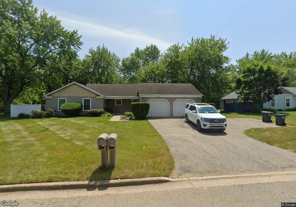
4768 Norfolk Cir Portage, MI 49024
Estimated Value: $327,043 - $384,000
--
Bed
1
Bath
2,112
Sq Ft
$165/Sq Ft
Est. Value
About This Home
This home is located at 4768 Norfolk Cir, Portage, MI 49024 and is currently estimated at $347,511, approximately $164 per square foot. 4768 Norfolk Cir is a home located in Kalamazoo County with nearby schools including 12th Street Elementary School, Portage West Middle School, and Portage Central High School.
Ownership History
Date
Name
Owned For
Owner Type
Purchase Details
Closed on
Aug 8, 2005
Sold by
Footprints In The Sand Llc
Bought by
Pressley Christopher E
Current Estimated Value
Home Financials for this Owner
Home Financials are based on the most recent Mortgage that was taken out on this home.
Original Mortgage
$210,000
Outstanding Balance
$123,006
Interest Rate
7.5%
Mortgage Type
Stand Alone First
Estimated Equity
$224,505
Purchase Details
Closed on
Apr 23, 2004
Sold by
Schram Marcia D
Bought by
Footprints In The Sand Llc
Purchase Details
Closed on
Aug 15, 2003
Sold by
Schram Marcia D
Bought by
Schram Marcia D and Marcia D Schram Trust
Purchase Details
Closed on
Oct 15, 2002
Sold by
Grinstein Alberto and Grinstein Judy Ann
Bought by
Schram Marcia
Home Financials for this Owner
Home Financials are based on the most recent Mortgage that was taken out on this home.
Original Mortgage
$129,500
Interest Rate
6.29%
Create a Home Valuation Report for This Property
The Home Valuation Report is an in-depth analysis detailing your home's value as well as a comparison with similar homes in the area
Home Values in the Area
Average Home Value in this Area
Purchase History
| Date | Buyer | Sale Price | Title Company |
|---|---|---|---|
| Pressley Christopher E | $210,000 | Chicago Title | |
| Footprints In The Sand Llc | -- | -- | |
| Schram Marcia D | -- | -- | |
| Schram Marcia | $161,900 | Chicago Title |
Source: Public Records
Mortgage History
| Date | Status | Borrower | Loan Amount |
|---|---|---|---|
| Open | Pressley Christopher E | $210,000 | |
| Previous Owner | Schram Marcia | $129,500 |
Source: Public Records
Tax History Compared to Growth
Tax History
| Year | Tax Paid | Tax Assessment Tax Assessment Total Assessment is a certain percentage of the fair market value that is determined by local assessors to be the total taxable value of land and additions on the property. | Land | Improvement |
|---|---|---|---|---|
| 2025 | $5,182 | $156,200 | $0 | $0 |
| 2024 | $4,663 | $152,600 | $0 | $0 |
| 2023 | $4,444 | $123,100 | $0 | $0 |
| 2022 | $4,699 | $105,800 | $0 | $0 |
| 2021 | $4,543 | $100,700 | $0 | $0 |
| 2020 | $4,450 | $92,200 | $0 | $0 |
| 2019 | $335 | $91,200 | $0 | $0 |
| 2018 | $0 | $90,500 | $0 | $0 |
| 2017 | $0 | $87,700 | $0 | $0 |
| 2016 | -- | $85,300 | $0 | $0 |
| 2015 | -- | $76,700 | $0 | $0 |
| 2014 | -- | $77,700 | $0 | $0 |
Source: Public Records
Map
Nearby Homes
- 4788 Norfolk Cir
- 7873 Shepherds Glen Ct
- 7951 S 12th St
- 7566 Cobblewood Dr
- 7895 Deerpath Rd
- 3653 Tartan Cir
- 5420 Whippoorwill Dr
- 7296 Annandale Dr
- 5660 Saddle Club Dr
- 5464 Cypress Bay Dr
- 7175 Hopkinton Dr
- 7337 Roslindale Trail
- 6794 Brickleton Ct
- 5353 Chickadee Dr
- 7236 Hampstead Ln Unit 18
- 6971 Annandale Dr
- 3737 Bellflower Dr
- 5825 Saddle Club Dr
- 5850 Dunwoody Ct
- 7922 Kilmory Cir
- 4762 Norfolk Cir
- 4762 Norfolk Cir
- 7699 S 12th St
- 4776 Norfolk Cir
- 4783 Norfolk Cir
- 4745 Norfolk Cir
- 4778 Norfolk Cir
- 4758 Norfolk Cir
- 4793 Norfolk Cir
- 4735 Norfolk Cir
- 4790 Norfolk Cir
- 4735 Norfolk Cir
- 7691 S 12th St
- 4748 Norfolk Cir
- 4803 Norfolk Cir
- 4740 Norfolk Cir
- 4725 Norfolk Cir
- 4738 Norfolk Cir
- 7695 S 12th St
- 4798 Norfolk Cir