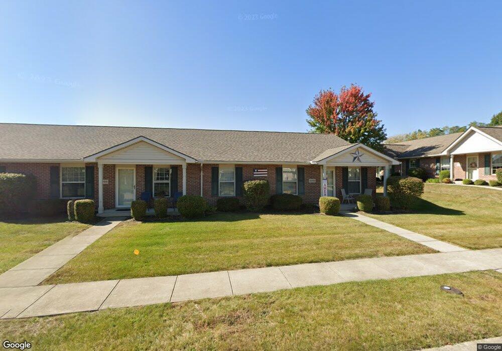
4769 Cornell St Springfield, OH 45503
Estimated Value: $164,000 - $173,000
2
Beds
2
Baths
1,124
Sq Ft
$149/Sq Ft
Est. Value
About This Home
This home is located at 4769 Cornell St, Springfield, OH 45503 and is currently estimated at $167,413, approximately $148 per square foot. 4769 Cornell St is a home located in Clark County with nearby schools including Northridge Elementary School, Kenton Ridge Middle & High School, and Emmanuel Christian Academy.
Ownership History
Date
Name
Owned For
Owner Type
Purchase Details
Closed on
Mar 28, 2023
Sold by
Blevins Julie M
Bought by
Daniel A Massie And Julie M Blevins Trust
Current Estimated Value
Purchase Details
Closed on
Jan 8, 2015
Sold by
Blevins Julie M and The Daniel O Massie And Julie
Bought by
Blevins Julie M
Purchase Details
Closed on
Apr 22, 2008
Sold by
Black Sylvia L and Estate Of Scott A Black
Bought by
Massie Daniel O and Blevins Julie M
Home Financials for this Owner
Home Financials are based on the most recent Mortgage that was taken out on this home.
Original Mortgage
$72,000
Interest Rate
5.88%
Mortgage Type
Purchase Money Mortgage
Purchase Details
Closed on
Dec 19, 2003
Sold by
Hoppes Builders & Development Co
Bought by
Black Scott A
Home Financials for this Owner
Home Financials are based on the most recent Mortgage that was taken out on this home.
Original Mortgage
$78,430
Interest Rate
6.04%
Mortgage Type
Purchase Money Mortgage
Create a Home Valuation Report for This Property
The Home Valuation Report is an in-depth analysis detailing your home's value as well as a comparison with similar homes in the area
Home Values in the Area
Average Home Value in this Area
Purchase History
| Date | Buyer | Sale Price | Title Company |
|---|---|---|---|
| Daniel A Massie And Julie M Blevins Trust | -- | None Listed On Document | |
| Daniel A Massie And Julie M Blevins Trust | -- | None Listed On Document | |
| Blevins Julie M | -- | Attorney | |
| Massie Daniel O | $96,000 | None Available | |
| Black Scott A | $98,100 | -- |
Source: Public Records
Mortgage History
| Date | Status | Borrower | Loan Amount |
|---|---|---|---|
| Previous Owner | Massie Daniel O | $72,000 | |
| Previous Owner | Black Scott A | $78,430 | |
| Closed | Black Scott A | $9,806 |
Source: Public Records
Tax History
| Year | Tax Paid | Tax Assessment Tax Assessment Total Assessment is a certain percentage of the fair market value that is determined by local assessors to be the total taxable value of land and additions on the property. | Land | Improvement |
|---|---|---|---|---|
| 2025 | $1,504 | $56,570 | $9,630 | $46,940 |
| 2024 | $1,481 | $44,190 | $6,830 | $37,360 |
| 2023 | $1,481 | $44,190 | $6,830 | $37,360 |
| 2022 | $1,504 | $44,190 | $6,830 | $37,360 |
| 2021 | $1,059 | $29,900 | $5,250 | $24,650 |
| 2020 | $1,060 | $29,900 | $5,250 | $24,650 |
| 2019 | $1,080 | $29,900 | $5,250 | $24,650 |
| 2018 | $1,041 | $28,310 | $6,090 | $22,220 |
| 2017 | $892 | $34,423 | $6,090 | $28,333 |
| 2016 | $886 | $34,423 | $6,090 | $28,333 |
| 2015 | $1,106 | $35,333 | $7,000 | $28,333 |
| 2014 | $1,106 | $35,333 | $7,000 | $28,333 |
| 2013 | $1,080 | $35,333 | $7,000 | $28,333 |
Source: Public Records
Map
Nearby Homes
- 4802 Willowbrook Dr
- 4741 Cullen Ave
- 1709 Thomas Dr
- 4577 Reno Ln Unit 2
- 4652 Reno Ln Unit 15
- 4446 Ridgewood Rd E Unit 3
- 5033 Ridgewood Rd E
- 1341 Student Ave
- 1521 Erika Dr
- 4256 Midfield St Unit 9
- 4343 Burchill St
- 862 Brendle Trace Unit 20
- 5564 Ridgewood Rd E Unit 7
- 1495 Victorian Way
- 5564 Ridgewood Rd W
- 1707 Berwick Dr
- 593 Hiser Ave
- 5722 Victorian Way Unit 31
- 1836 Dunseth Ln
- 1162 Kingsgate Rd
- 4769 Cornell St Unit 4769
- 4765 Cornell St
- 4761 Cornell St Unit 4761
- 4781 Cornell St
- 4779 Cornell St Unit 4779
- 4779 Cornell St
- 4777 Cornell St Unit 4777
- 4777 Cornell St
- 4777 Cornell St
- 4775 Cornell St Unit 4775
- 4764 Cornell St Unit 4764
- 4772 Cornell St Unit 4772
- 4772 Cornell St
- 1466 Westmont Dr Unit 1466
- 4760 Cornell St
- 4773 Cornell St
- 4773 Cornell St
- 4773 Cornell St Unit 4773
- 4773 Cornell St
- 1464 Westmont Dr Unit 1464
Your Personal Tour Guide
Ask me questions while you tour the home.