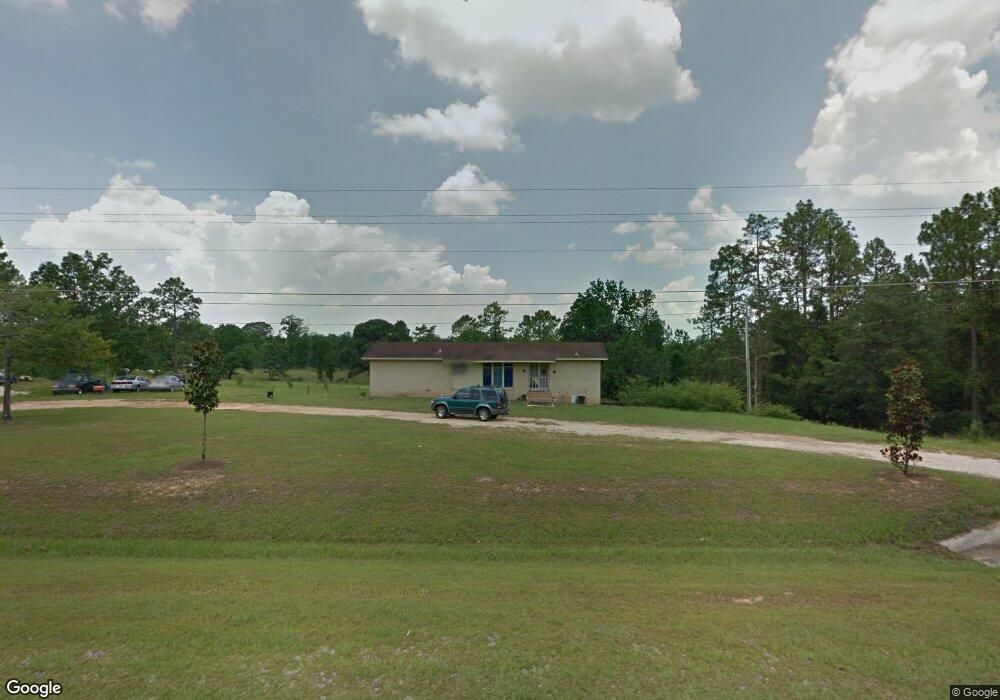
47693 Rabun Rd Bay Minette, AL 36507
Estimated Value: $271,625 - $371,000
3
Beds
2
Baths
2,449
Sq Ft
$134/Sq Ft
Est. Value
About This Home
This home is located at 47693 Rabun Rd, Bay Minette, AL 36507 and is currently estimated at $327,542, approximately $133 per square foot. 47693 Rabun Rd is a home located in Baldwin County with nearby schools including Bay Minette Elementary School, Bay Minette Middle School, and Baldwin County High School.
Ownership History
Date
Name
Owned For
Owner Type
Purchase Details
Closed on
Jun 20, 2016
Sold by
Citizens Bank Inc
Bought by
Long Richard Dewayne
Current Estimated Value
Home Financials for this Owner
Home Financials are based on the most recent Mortgage that was taken out on this home.
Original Mortgage
$52,000
Interest Rate
3.57%
Mortgage Type
Seller Take Back
Purchase Details
Closed on
Sep 11, 2015
Sold by
Graham Denny
Bought by
Citizens Bank Inc
Purchase Details
Closed on
Jul 14, 2006
Sold by
Paslay Lyman W and Gleason Marla J
Bought by
Graham Denny
Home Financials for this Owner
Home Financials are based on the most recent Mortgage that was taken out on this home.
Original Mortgage
$101,896
Interest Rate
6.6%
Mortgage Type
Purchase Money Mortgage
Create a Home Valuation Report for This Property
The Home Valuation Report is an in-depth analysis detailing your home's value as well as a comparison with similar homes in the area
Home Values in the Area
Average Home Value in this Area
Purchase History
| Date | Buyer | Sale Price | Title Company |
|---|---|---|---|
| Long Richard Dewayne | $65,000 | None Available | |
| Citizens Bank Inc | $65,000 | None Available | |
| Graham Denny | -- | Slt |
Source: Public Records
Mortgage History
| Date | Status | Borrower | Loan Amount |
|---|---|---|---|
| Closed | Long Richard Dewayne | $52,000 | |
| Previous Owner | Graham Denny | $101,896 |
Source: Public Records
Tax History Compared to Growth
Tax History
| Year | Tax Paid | Tax Assessment Tax Assessment Total Assessment is a certain percentage of the fair market value that is determined by local assessors to be the total taxable value of land and additions on the property. | Land | Improvement |
|---|---|---|---|---|
| 2024 | $663 | $22,100 | $6,060 | $16,040 |
| 2023 | $571 | $19,020 | $6,160 | $12,860 |
| 2022 | $495 | $16,500 | $0 | $0 |
| 2021 | $443 | $15,080 | $0 | $0 |
| 2020 | $422 | $14,060 | $0 | $0 |
| 2019 | $417 | $13,900 | $0 | $0 |
| 2018 | $397 | $13,240 | $0 | $0 |
| 2017 | $397 | $13,240 | $0 | $0 |
| 2016 | $737 | $24,560 | $0 | $0 |
| 2015 | -- | $14,940 | $0 | $0 |
| 2014 | -- | $14,460 | $0 | $0 |
| 2013 | -- | $14,460 | $0 | $0 |
Source: Public Records
Map
Nearby Homes
- 48980 Rabun Rd
- 2603 Scarlet Dr
- 47580 Lea Baird Ln Unit 3
- 2104 Cate Ct
- 515 Cate Ct Unit Lot 515, Ph V
- 708 Rachel Dr Unit 404
- 1100 Northshore Dr
- 603 Northshore Dr
- 48055 Old Stockton Rd
- 000 Rabun Rd Unit 1 & 2
- 1819 Mary Jane Dr
- 1800 Elaine Ave
- 15373 Calvin Richerson Rd
- 300 Northshore Dr
- 1701 Auburn Ave
- 48818 Living Way
- 1700 Hand Ave
- 0 Norwood Dr Unit 2 365989
- 1204 Forest Park Ave
- 15799 Fawns Run Rd
- 1 Rabun Rd
- 47775 Rabun Rd
- 47720 Rabun Rd
- 47660 Rabun Rd
- 47660 Rabun Rd
- 47740 Rabun Rd
- 47800 Rabun Rd
- 47520 Rabun Rd
- 47656 Rabun Rd
- 14450 Peterson Ln
- 47820 Rabun Rd
- 47860 Rabun Rd
- 14401 Peterson Ln
- 47401 Rabun Rd
- 14377 Peterson Ln
- 47896 Rabun Rd
- 14760 Morris Rd
- 47335 Rabun Rd
- 47980 Rabun Rd
- 14299 Peterson Ln