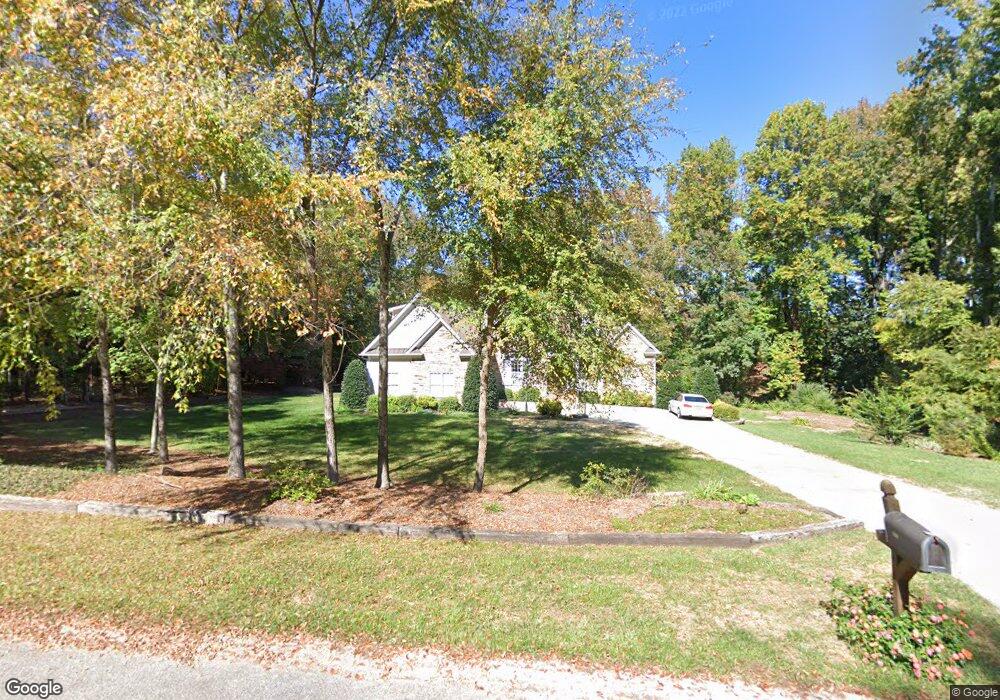
477 Laurel Crest Dr Kannapolis, NC 28081
Estimated Value: $478,241 - $664,000
Studio
4
Baths
2,453
Sq Ft
$218/Sq Ft
Est. Value
About This Home
This home is located at 477 Laurel Crest Dr, Kannapolis, NC 28081 and is currently estimated at $535,810, approximately $218 per square foot. 477 Laurel Crest Dr is a home located in Rowan County with nearby schools including Landis Elementary School, Corriher Lipe Middle School, and South Rowan High School.
Ownership History
Date
Name
Owned For
Owner Type
Purchase Details
Closed on
Jul 30, 2007
Sold by
Finger David A and Finger Maxine B
Bought by
Black Brad C and Black Diane G
Current Estimated Value
Home Financials for this Owner
Home Financials are based on the most recent Mortgage that was taken out on this home.
Original Mortgage
$320,000
Outstanding Balance
$202,504
Interest Rate
6.65%
Mortgage Type
Construction
Estimated Equity
$333,306
Create a Home Valuation Report for This Property
The Home Valuation Report is an in-depth analysis detailing your home's value as well as a comparison with similar homes in the area
Home Values in the Area
Average Home Value in this Area
Purchase History
| Date | Buyer | Sale Price | Title Company |
|---|---|---|---|
| Black Brad C | $53,000 | None Available |
Source: Public Records
Mortgage History
| Date | Status | Borrower | Loan Amount |
|---|---|---|---|
| Open | Black Brad C | $320,000 |
Source: Public Records
Tax History
| Year | Tax Paid | Tax Assessment Tax Assessment Total Assessment is a certain percentage of the fair market value that is determined by local assessors to be the total taxable value of land and additions on the property. | Land | Improvement |
|---|---|---|---|---|
| 2025 | $2,770 | $419,673 | $43,000 | $376,673 |
| 2024 | $2,770 | $419,673 | $43,000 | $376,673 |
| 2023 | $2,770 | $419,673 | $43,000 | $376,673 |
| 2022 | $2,452 | $332,429 | $39,000 | $293,429 |
| 2021 | $2,452 | $332,429 | $39,000 | $293,429 |
| 2020 | $2,452 | $332,429 | $39,000 | $293,429 |
| 2019 | $2,452 | $332,429 | $39,000 | $293,429 |
| 2018 | $2,214 | $302,704 | $39,000 | $263,704 |
| 2017 | $2,214 | $302,704 | $39,000 | $263,704 |
| 2016 | $2,052 | $284,448 | $39,000 | $245,448 |
| 2015 | $2,085 | $284,448 | $39,000 | $245,448 |
| 2014 | $2,018 | $280,288 | $39,000 | $241,288 |
Source: Public Records
Map
Nearby Homes
- 433 Laurel Crest Dr
- 2280 Cannon Farm Rd
- 268 Laurel Crest Dr
- 2640 Cannon Farm Rd
- 255 Wilson St
- 2218 Woodcrest Dr
- 919 Tamary Way
- 1061 Fairway Dr
- 2319 Tully More Dr Unit Lot 39
- 2319 Tullymore Dr Unit 39
- 991 Fairway Dr
- 2274 Tullymore Dr Unit 14
- 113 Hilton Ave
- 959 Tamary Way Unit 29
- 959 Tamary Way Unit 29/30
- 2400 Callaghan Ct Unit Lot 70
- 1224 Pump Station Rd
- 1814 W C St
- 215 Rankin Rd
- 737 Jack St
- 499 Laurel Crest Dr
- 455 Laurel Crest Dr Unit 12
- 455 Laurel Crest Dr
- 2190 Cannon Farm Rd
- 433 Laurel Crest Dr Unit 11
- 434 Laurel Crest Dr
- 476 Laurel Crest Dr
- 2220 Cannon Farm Rd
- 388 Laurel Crest Dr
- 399 Laurel Crest Dr
- 525 Laurel Crest Dr
- 203 Vanderbilt Ave
- 2240 Cannon Farm Rd
- 538 Laurel Crest Dr
- 364 Laurel Crest Dr
- 514 Laurel Crest Dr
- 117 Rutledge St
- 2260 Cannon Farm Rd
- 2260 Cannon Farm Rd Unit 9
- 205 Vanderbilt Ave
Your Personal Tour Guide
Ask me questions while you tour the home.