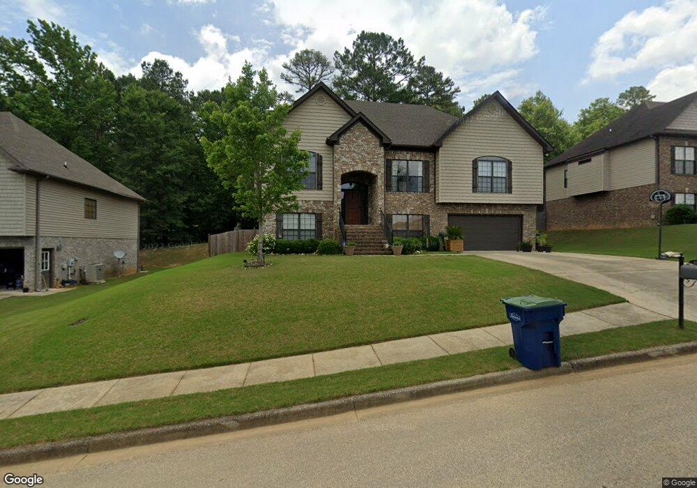
477 Ramsgate Dr Unit 391 Maylene, AL 35114
Estimated Value: $390,000 - $418,000
5
Beds
4
Baths
2,455
Sq Ft
$164/Sq Ft
Est. Value
About This Home
This home is located at 477 Ramsgate Dr Unit 391, Maylene, AL 35114 and is currently estimated at $401,911, approximately $163 per square foot. 477 Ramsgate Dr Unit 391 is a home located in Shelby County with nearby schools including Thompson Intermediate School, Thompson Middle School, and Thompson High School.
Ownership History
Date
Name
Owned For
Owner Type
Purchase Details
Closed on
Feb 26, 2018
Sold by
Aaron Adrian A and Aaron Mary E
Bought by
Guin Anthony W and Guin Leslie S
Current Estimated Value
Home Financials for this Owner
Home Financials are based on the most recent Mortgage that was taken out on this home.
Original Mortgage
$223,920
Outstanding Balance
$190,311
Interest Rate
4.04%
Mortgage Type
New Conventional
Estimated Equity
$211,600
Purchase Details
Closed on
Jun 30, 2009
Sold by
Professional Homebuilders Inc
Bought by
Aaron Adrian A and Aaron Mary E
Home Financials for this Owner
Home Financials are based on the most recent Mortgage that was taken out on this home.
Original Mortgage
$238,696
Interest Rate
4.79%
Mortgage Type
FHA
Create a Home Valuation Report for This Property
The Home Valuation Report is an in-depth analysis detailing your home's value as well as a comparison with similar homes in the area
Home Values in the Area
Average Home Value in this Area
Purchase History
| Date | Buyer | Sale Price | Title Company |
|---|---|---|---|
| Guin Anthony W | $279,900 | None Available | |
| Aaron Adrian A | $243,100 | None Available |
Source: Public Records
Mortgage History
| Date | Status | Borrower | Loan Amount |
|---|---|---|---|
| Open | Guin Anthony W | $223,920 | |
| Previous Owner | Aaron Adrian A | $238,696 |
Source: Public Records
Tax History
| Year | Tax Paid | Tax Assessment Tax Assessment Total Assessment is a certain percentage of the fair market value that is determined by local assessors to be the total taxable value of land and additions on the property. | Land | Improvement |
|---|---|---|---|---|
| 2024 | $1,962 | $36,340 | $0 | $0 |
| 2023 | $1,777 | $33,660 | $0 | $0 |
| 2022 | $1,638 | $31,100 | $0 | $0 |
| 2021 | $1,487 | $28,300 | $0 | $0 |
| 2020 | $1,428 | $27,200 | $0 | $0 |
| 2019 | $1,414 | $26,940 | $0 | $0 |
| 2017 | $1,278 | $24,420 | $0 | $0 |
| 2015 | $1,228 | $23,500 | $0 | $0 |
| 2014 | $1,198 | $22,940 | $0 | $0 |
Source: Public Records
Map
Nearby Homes
- 109 Kingsley Cir
- 306 Mayfair Cir
- 537 Ramsgate Dr
- 124 Kingsley Rd
- 120 Mayfair Park
- 544 Ramsgate Dr
- 309 Cedar Grove Ct
- 305 Cedar Grove Ct
- 236 Queens Gate
- 545 Ramsgate Dr
- 549 Ramsgate Dr
- 208 Queens Gate
- 413 Cornwall Dr
- 280 Cedar Grove Pkwy
- 501 Ramsgate Dr
- 174 Cedar Grove Pkwy
- 132 Victoria Station
- 2001 1st Ave W
- 316 Sterling Manor Cir
- 120 Sterling Gate Dr
- 477 Ramsgate Dr
- 481 Ramsgate Dr Unit 392
- 473 Ramsgate Dr
- 473 Ramsgate Dr Unit 390
- 201 Parliament Pkwy
- 201 Parliament Pkwy Unit 431
- 485 Ramsgate Dr
- 200 Mayfair Park
- 204 Mayfair Park
- 205 Parliament Pkwy
- 205 Parliament Pkwy Unit 432
- 204 Parliament Pkwy Unit 350
- 208 Parliament Pkwy
- 208 Parliament Pkwy Unit 349
- 489 Ramsgate Dr
- 209 Parliament Pkwy
- 209 Parliament Pkwy Unit 433
- 410 Norwick Cir
- 201 Mayfair Park
Your Personal Tour Guide
Ask me questions while you tour the home.