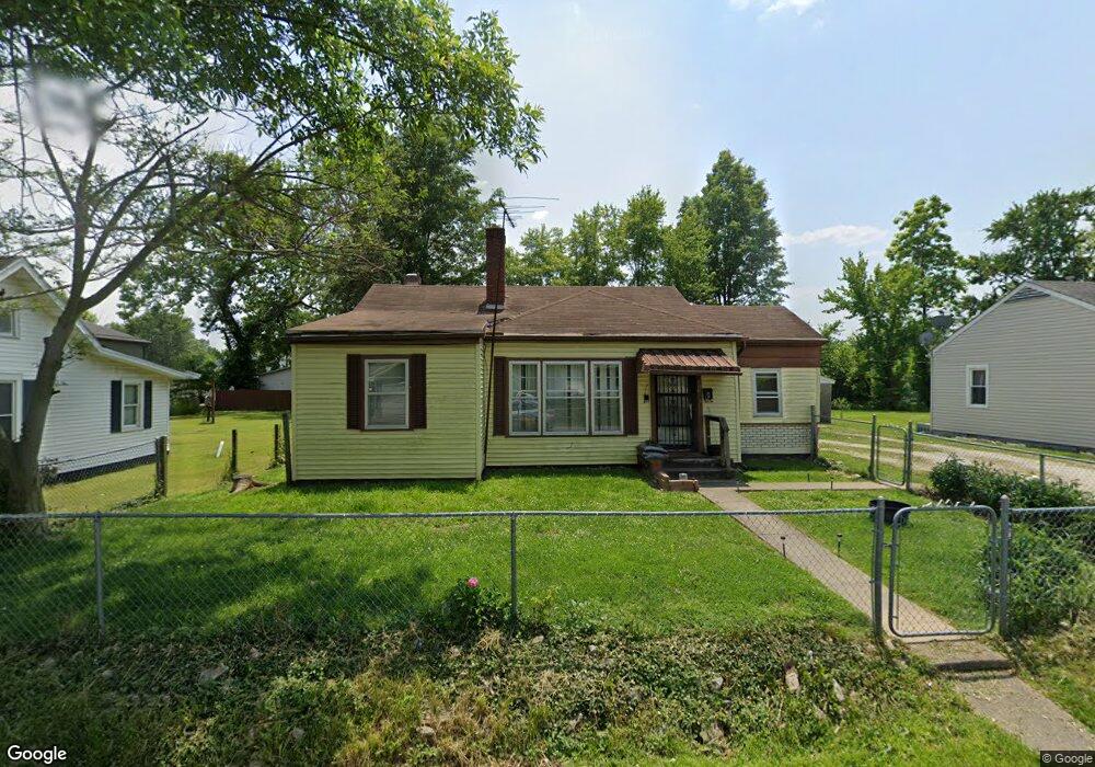
477 W Maple St Austin, IN 47102
Estimated Value: $94,000 - $119,000
2
Beds
1
Bath
956
Sq Ft
$111/Sq Ft
Est. Value
About This Home
This home is located at 477 W Maple St, Austin, IN 47102 and is currently estimated at $106,413, approximately $111 per square foot. 477 W Maple St is a home located in Scott County with nearby schools including Austin Elementary School, Austin Middle School, and Austin High School.
Ownership History
Date
Name
Owned For
Owner Type
Purchase Details
Closed on
Aug 18, 2017
Sold by
Watkins James Arthur
Bought by
Briner Ryan
Current Estimated Value
Home Financials for this Owner
Home Financials are based on the most recent Mortgage that was taken out on this home.
Original Mortgage
$16,000
Outstanding Balance
$8,578
Interest Rate
4.03%
Mortgage Type
Commercial
Estimated Equity
$97,835
Purchase Details
Closed on
Sep 12, 2016
Sold by
Watkins George
Bought by
Watkins James Arthur
Create a Home Valuation Report for This Property
The Home Valuation Report is an in-depth analysis detailing your home's value as well as a comparison with similar homes in the area
Home Values in the Area
Average Home Value in this Area
Purchase History
| Date | Buyer | Sale Price | Title Company |
|---|---|---|---|
| Briner Ryan | -- | Kemp Title Agency Llc | |
| Watkins James Arthur | -- | None Available |
Source: Public Records
Mortgage History
| Date | Status | Borrower | Loan Amount |
|---|---|---|---|
| Open | Briner Ryan | $16,000 |
Source: Public Records
Tax History Compared to Growth
Tax History
| Year | Tax Paid | Tax Assessment Tax Assessment Total Assessment is a certain percentage of the fair market value that is determined by local assessors to be the total taxable value of land and additions on the property. | Land | Improvement |
|---|---|---|---|---|
| 2024 | $413 | $37,400 | $6,500 | $30,900 |
| 2023 | $412 | $37,900 | $6,500 | $31,400 |
| 2022 | $277 | $36,900 | $6,500 | $30,400 |
| 2021 | $250 | $35,000 | $6,500 | $28,500 |
| 2020 | $203 | $28,600 | $6,500 | $22,100 |
| 2019 | $185 | $27,400 | $6,500 | $20,900 |
| 2018 | $208 | $30,700 | $6,500 | $24,200 |
| 2017 | $374 | $48,300 | $6,500 | $41,800 |
| 2016 | $476 | $49,700 | $6,500 | $43,200 |
| 2014 | $465 | $48,200 | $6,200 | $42,000 |
| 2013 | $465 | $47,600 | $6,200 | $41,400 |
Source: Public Records
Map
Nearby Homes