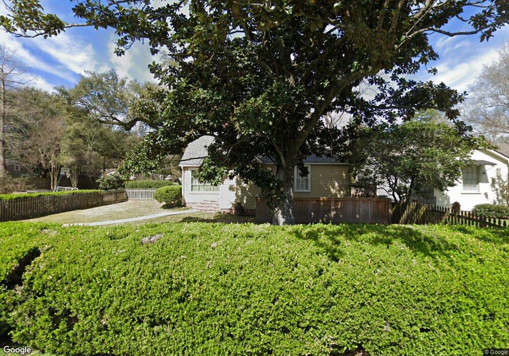
4775 Co Ed Place Baton Rouge, LA 70808
Highlands/Perkins NeighborhoodEstimated Value: $580,000 - $648,000
--
Bed
--
Bath
3,501
Sq Ft
$173/Sq Ft
Est. Value
About This Home
This home is located at 4775 Co Ed Place, Baton Rouge, LA 70808 and is currently estimated at $604,993, approximately $172 per square foot. 4775 Co Ed Place is a home located in East Baton Rouge Parish with nearby schools including University Terrace Elementary School, Glasgow Middle School, and Mckinley Senior High School.
Ownership History
Date
Name
Owned For
Owner Type
Purchase Details
Closed on
Jul 18, 2016
Sold by
Graham Brent Raymond and Graham Vanessa Page Ogden
Bought by
Brockhaus Jonathan David and Brockhaus Lauren Caballero
Current Estimated Value
Home Financials for this Owner
Home Financials are based on the most recent Mortgage that was taken out on this home.
Original Mortgage
$417,000
Outstanding Balance
$333,748
Interest Rate
3.66%
Mortgage Type
New Conventional
Estimated Equity
$271,245
Purchase Details
Closed on
Dec 15, 1998
Sold by
Kouns Sinclair Bert and Kouns Joan
Bought by
Morgan James Dale and Johnson Melissa Jane
Home Financials for this Owner
Home Financials are based on the most recent Mortgage that was taken out on this home.
Original Mortgage
$141,600
Interest Rate
6.87%
Create a Home Valuation Report for This Property
The Home Valuation Report is an in-depth analysis detailing your home's value as well as a comparison with similar homes in the area
Home Values in the Area
Average Home Value in this Area
Purchase History
| Date | Buyer | Sale Price | Title Company |
|---|---|---|---|
| Brockhaus Jonathan David | $445,000 | Stewart Title Guaranty Co | |
| Morgan James Dale | $146,000 | -- |
Source: Public Records
Mortgage History
| Date | Status | Borrower | Loan Amount |
|---|---|---|---|
| Open | Brockhaus Jonathan David | $417,000 | |
| Previous Owner | Morgan James Dale | $141,600 |
Source: Public Records
Tax History Compared to Growth
Tax History
| Year | Tax Paid | Tax Assessment Tax Assessment Total Assessment is a certain percentage of the fair market value that is determined by local assessors to be the total taxable value of land and additions on the property. | Land | Improvement |
|---|---|---|---|---|
| 2024 | $5,653 | $55,000 | $4,150 | $50,850 |
| 2023 | $5,653 | $49,000 | $4,150 | $44,850 |
| 2022 | $5,851 | $49,000 | $4,150 | $44,850 |
| 2021 | $5,716 | $49,000 | $4,150 | $44,850 |
| 2020 | $5,679 | $49,000 | $4,150 | $44,850 |
| 2019 | $5,390 | $44,500 | $4,150 | $40,350 |
| 2018 | $5,323 | $44,500 | $4,150 | $40,350 |
| 2017 | $5,323 | $44,500 | $4,150 | $40,350 |
| 2016 | $2,698 | $29,800 | $4,150 | $25,650 |
| 2015 | $2,293 | $26,300 | $4,150 | $22,150 |
| 2014 | $2,285 | $26,300 | $4,150 | $22,150 |
| 2013 | -- | $24,800 | $4,150 | $20,650 |
Source: Public Records
Map
Nearby Homes
- 544 Polytech Dr
- 442 Centenary Dr
- 424 Centenary Dr
- 617 Carriage Way
- 405 Delgado Dr
- 437 Delgado Dr
- 921 Carriage Way
- 4945 Highland Rd
- 505 Lsu Ave
- 4852 Highland Rd
- 452 Cornell Ave
- 335 Cornell Ave
- 4637 Burbank Dr Unit 206
- 4411 Highland Rd
- 5293 Chenango Dr
- 990 Stanford Ave Unit 504
- 990 Stanford Ave Unit 415
- 990 Stanford Ave Unit 316
- 990 Stanford Ave Unit 307
- 990 Stanford Ave Unit 207
- 505 Polytech Dr
- 517 Polytech Dr
- 545 Polytech Dr
- 506 Centenary Dr
- 522 Centenary Dr
- 514 Polytech Dr
- 479 Polytech Dr
- 532 Polytech Dr
- 508 Polytech Dr
- 583 Polytech Dr
- 544 Centenary Dr
- 439 Polytech Dr
- 548 Polytech Dr
- 476 Polytech Dr
- 456 Centenary Dr
- 611 Polytech Dr
- 584 Polytech Dr
- 521 Centenary Dr
- 444 Polytech Dr
- 429 Polytech Dr