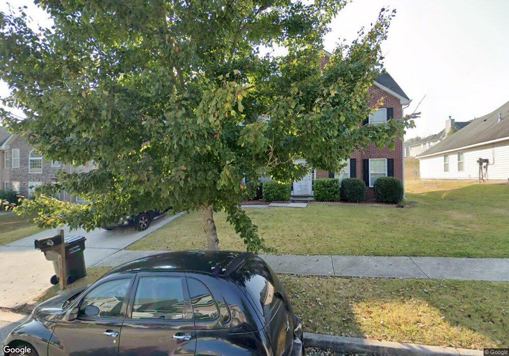
4775 Michael Jay St Unit 3 Snellville, GA 30039
Estimated Value: $412,617 - $443,000
6
Beds
3
Baths
3,392
Sq Ft
$125/Sq Ft
Est. Value
About This Home
This home is located at 4775 Michael Jay St Unit 3, Snellville, GA 30039 and is currently estimated at $423,654, approximately $124 per square foot. 4775 Michael Jay St Unit 3 is a home located in Gwinnett County with nearby schools including Rosebud Elementary School, Grace Snell Middle School, and South Gwinnett High School.
Ownership History
Date
Name
Owned For
Owner Type
Purchase Details
Closed on
Apr 24, 2023
Sold by
Persaud Ronald
Bought by
Hudson Gwendolyn and Graham Azaria
Current Estimated Value
Home Financials for this Owner
Home Financials are based on the most recent Mortgage that was taken out on this home.
Original Mortgage
$391,773
Outstanding Balance
$381,509
Interest Rate
7.12%
Mortgage Type
FHA
Estimated Equity
$42,145
Purchase Details
Closed on
Mar 29, 2006
Sold by
Homelife Communities Of Gwinne
Bought by
Persaud Ronald and Persaud Shehnila
Home Financials for this Owner
Home Financials are based on the most recent Mortgage that was taken out on this home.
Original Mortgage
$45,300
Interest Rate
6.2%
Mortgage Type
New Conventional
Create a Home Valuation Report for This Property
The Home Valuation Report is an in-depth analysis detailing your home's value as well as a comparison with similar homes in the area
Home Values in the Area
Average Home Value in this Area
Purchase History
| Date | Buyer | Sale Price | Title Company |
|---|---|---|---|
| Hudson Gwendolyn | $399,000 | -- | |
| Persaud Ronald | $226,600 | -- |
Source: Public Records
Mortgage History
| Date | Status | Borrower | Loan Amount |
|---|---|---|---|
| Open | Hudson Gwendolyn | $391,773 | |
| Previous Owner | Persaud Ronald | $45,300 | |
| Previous Owner | Persaud Ronald | $181,200 |
Source: Public Records
Tax History Compared to Growth
Tax History
| Year | Tax Paid | Tax Assessment Tax Assessment Total Assessment is a certain percentage of the fair market value that is determined by local assessors to be the total taxable value of land and additions on the property. | Land | Improvement |
|---|---|---|---|---|
| 2025 | $2,542 | $212,200 | $30,000 | $182,200 |
| 2024 | $2,541 | $159,600 | $30,000 | $129,600 |
| 2023 | $2,541 | $177,520 | $29,680 | $147,840 |
| 2022 | $4,741 | $149,520 | $22,000 | $127,520 |
| 2021 | $4,170 | $118,960 | $14,000 | $104,960 |
| 2020 | $3,922 | $106,240 | $14,000 | $92,240 |
| 2019 | $3,786 | $106,240 | $14,000 | $92,240 |
| 2018 | $3,477 | $96,080 | $12,000 | $84,080 |
| 2016 | $2,796 | $76,200 | $10,000 | $66,200 |
| 2015 | $2,561 | $68,760 | $8,800 | $59,960 |
| 2014 | $2,573 | $68,760 | $8,800 | $59,960 |
Source: Public Records
Map
Nearby Homes
- 4494 Michael Jay St
- 4381 Ash Tree St
- 4041 Ash Tree St
- 4366 Bradley Dr SW
- 4244 Bradley Dr SW
- 0 Bradley Dr SW
- 4380 Cary Dr
- 3770 Belle Glade Trail
- 4440 Cary Dr
- 4440 Cary Dr SW
- 4232 Marjorie Rd
- 4469 Persian Ct
- 4300 Burdett Place
- 4738 Chafin Point Ct
- 3630 Gin Way Unit 1
- 0 Bryant Rd Unit 7646847
- 4840 Heather Mill Trace
- 4092 Arabian Way
- 4656 Bryant Rd
- 4525 Jane Rd
- 4775 Michael Jay St
- 4765 Michael Jay St
- 4785 Michael Jay St
- 4755 Michael Jay St
- 4795 Michael Jay St
- 4695 Michael Jay St
- 4774 Michael Jay St
- 4784 Michael Jay St
- 4805 Michael Jay St
- 4685 Michael Jay St
- 4794 Michael Jay St
- 4754 Michael Jay St Unit 31
- 4754 Michael Jay St
- 4804 Michael Jay St
- 4886 Bottle Brush Ct
- 4896 Bottle Brush Ct
- 4815 Michael Jay St
- 4876 Bottle Brush Ct
- 4704 Michael Jay St
- 4714 Michael Jay St