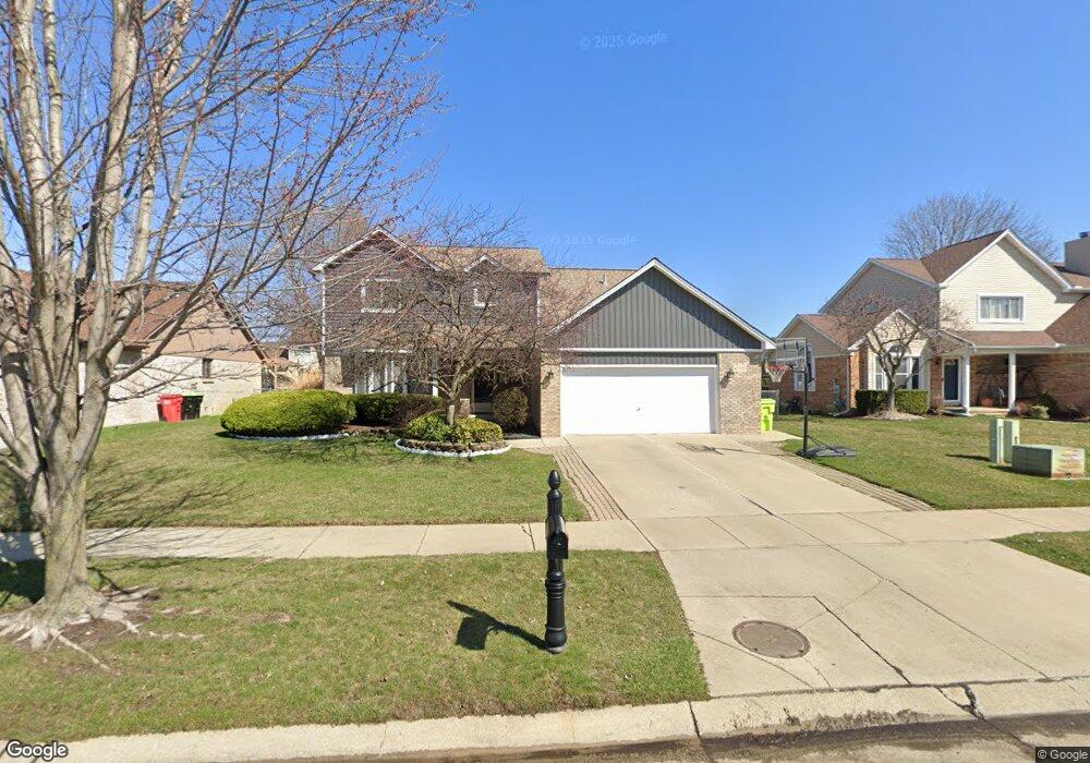
47787 Meadowbrook Dr Macomb, MI 48044
Estimated Value: $370,000 - $405,000
3
Beds
2
Baths
1,929
Sq Ft
$197/Sq Ft
Est. Value
About This Home
This home is located at 47787 Meadowbrook Dr, Macomb, MI 48044 and is currently estimated at $380,746, approximately $197 per square foot. 47787 Meadowbrook Dr is a home located in Macomb County with nearby schools including Mohawk Elementary School, Iroquois Middle School, and Dakota High School.
Ownership History
Date
Name
Owned For
Owner Type
Purchase Details
Closed on
Mar 27, 2007
Sold by
Lacoursiere Michael and Lacoursiere Dawn
Bought by
Karolski Kenneth A and Karolski Angela M
Current Estimated Value
Home Financials for this Owner
Home Financials are based on the most recent Mortgage that was taken out on this home.
Original Mortgage
$231,830
Outstanding Balance
$141,400
Interest Rate
6.31%
Mortgage Type
Purchase Money Mortgage
Estimated Equity
$239,346
Create a Home Valuation Report for This Property
The Home Valuation Report is an in-depth analysis detailing your home's value as well as a comparison with similar homes in the area
Home Values in the Area
Average Home Value in this Area
Purchase History
| Date | Buyer | Sale Price | Title Company |
|---|---|---|---|
| Karolski Kenneth A | $239,000 | Great Lakes Title Of Mi |
Source: Public Records
Mortgage History
| Date | Status | Borrower | Loan Amount |
|---|---|---|---|
| Open | Karolski Kenneth A | $231,830 |
Source: Public Records
Tax History Compared to Growth
Tax History
| Year | Tax Paid | Tax Assessment Tax Assessment Total Assessment is a certain percentage of the fair market value that is determined by local assessors to be the total taxable value of land and additions on the property. | Land | Improvement |
|---|---|---|---|---|
| 2025 | $2,916 | $175,900 | $0 | $0 |
| 2024 | $28 | $162,900 | $0 | $0 |
| 2023 | $2,689 | $142,800 | $0 | $0 |
| 2022 | $3,340 | $132,700 | $0 | $0 |
| 2021 | $3,250 | $119,800 | $0 | $0 |
| 2020 | $2,467 | $114,300 | $0 | $0 |
| 2019 | $3,006 | $113,900 | $0 | $0 |
| 2018 | $2,943 | $110,200 | $0 | $0 |
| 2017 | $2,883 | $103,110 | $32,500 | $70,610 |
| 2016 | $2,735 | $103,150 | $0 | $0 |
| 2015 | $2,699 | $100,670 | $0 | $0 |
| 2014 | $2,699 | $91,610 | $21,500 | $70,110 |
| 2011 | $513 | $91,990 | $18,500 | $73,490 |
Source: Public Records
Map
Nearby Homes
- 17903 Red Oaks Dr
- 47212 Blossom Ln
- 50675-50811 Romeo Plank Rd
- 47071 Savannah Dr
- 47474 Stephanie Dr
- 18534 Hollie Dr
- 18400 22 Mile Rd
- 16818 Glenhurst Dr
- 46730 Romeo Plank Rd
- 19251 Weathervane Dr
- 46930 Country Ln Unit 11
- 48711 Cross Creek Dr
- 46980 Country Ln Unit 8
- 48233 Lamplighter Trail
- 48194 Lamplighter Trail
- 19459 Willoway Dr
- 19312 River Valley Dr
- 17115 Scarborough Dr Unit 562
- 49001 Wingfield Dr
- 18894 Via Firenze
- 47779 Meadowbrook Dr
- 47795 Meadowbrook Dr
- 17970 White Plains Dr
- 17942 White Plains Dr
- 47771 Meadowbrook Dr
- 17998 White Plains Dr
- 47803 Meadowbrook Dr
- 17914 White Plains Dr
- 47780 Meadowbrook Dr
- 47788 Meadowbrook Dr
- 18026 White Plains Dr
- 47772 Meadowbrook Dr
- 47763 Meadowbrook Dr
- 47796 Meadowbrook Dr
- 17886 White Plains Dr
- 47764 Meadowbrook Dr
- 47755 Meadowbrook Dr
- 17858 White Plains Dr
- 18049 Riverhill Dr
- 47485 Greenbriar Dr
