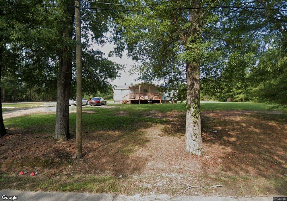
478 Airport Rd Clinton, SC 29325
Estimated Value: $44,576 - $144,000
3
Beds
2
Baths
1,400
Sq Ft
$55/Sq Ft
Est. Value
About This Home
This home is located at 478 Airport Rd, Clinton, SC 29325 and is currently estimated at $77,144, approximately $55 per square foot. 478 Airport Rd is a home located in Laurens County with nearby schools including Clinton High School, Thornwell Charter School, and Summit Classical School.
Ownership History
Date
Name
Owned For
Owner Type
Purchase Details
Closed on
Jul 12, 2023
Sold by
Chretien Gwen
Bought by
Dangerfield Tracy D and Dangerfield Darwin B
Current Estimated Value
Purchase Details
Closed on
Nov 11, 2022
Sold by
Chretien Gwen
Bought by
Chretien Gwen
Purchase Details
Closed on
Nov 19, 2020
Sold by
Robertson Rev Claudia
Bought by
Chentin Gwen
Purchase Details
Closed on
Apr 7, 2010
Sold by
Welch Richard K
Bought by
Clardy Jeremy W
Home Financials for this Owner
Home Financials are based on the most recent Mortgage that was taken out on this home.
Original Mortgage
$360,164
Interest Rate
5.03%
Mortgage Type
New Conventional
Purchase Details
Closed on
Apr 2, 2010
Sold by
Agnew E Harry
Bought by
Robertson Claudia and Robertson Gwen
Home Financials for this Owner
Home Financials are based on the most recent Mortgage that was taken out on this home.
Original Mortgage
$360,164
Interest Rate
5.03%
Mortgage Type
New Conventional
Create a Home Valuation Report for This Property
The Home Valuation Report is an in-depth analysis detailing your home's value as well as a comparison with similar homes in the area
Home Values in the Area
Average Home Value in this Area
Purchase History
| Date | Buyer | Sale Price | Title Company |
|---|---|---|---|
| Dangerfield Tracy D | $42,000 | None Listed On Document | |
| Chretien Gwen | -- | -- | |
| Chentin Gwen | -- | None Available | |
| Clardy Jeremy W | $86,757 | None Available | |
| Robertson Claudia | $1,000 | None Available |
Source: Public Records
Mortgage History
| Date | Status | Borrower | Loan Amount |
|---|---|---|---|
| Previous Owner | Agnew Edgar H | $360,164 |
Source: Public Records
Tax History Compared to Growth
Tax History
| Year | Tax Paid | Tax Assessment Tax Assessment Total Assessment is a certain percentage of the fair market value that is determined by local assessors to be the total taxable value of land and additions on the property. | Land | Improvement |
|---|---|---|---|---|
| 2024 | $152 | $430 | $430 | $0 |
| 2023 | $152 | $430 | $0 | $0 |
| 2022 | $149 | $430 | $430 | $0 |
| 2021 | $142 | $410 | $410 | $0 |
| 2020 | $140 | $410 | $410 | $0 |
| 2019 | $144 | $410 | $410 | $0 |
| 2018 | $140 | $410 | $410 | $0 |
| 2017 | $141 | $410 | $0 | $0 |
| 2015 | $135 | $410 | $0 | $0 |
| 2014 | $135 | $410 | $0 | $0 |
| 2013 | $135 | $410 | $0 | $0 |
Source: Public Records
Map
Nearby Homes
- 103 Martha Dendy Dr
- 400 N Bell Street Extension
- 101 Bond St Unit A & B
- 107 & 111 N Bell St
- 103 Mason St
- 509 W Carolina Ave
- 00 Dogwood Cir
- 121 Colleton Ln
- 215 Washington St
- 303 Beauregard St
- 0 Dogwood Cir Unit 1571962
- 0 Dogwood Cir Unit 20279463
- 00 Woodland Dr
- 219 Brandi Ln
- 203 Oak Street Cir
- 601 W Carolina Ave
- 0 U S 76
- 00 Oak St
- 106 Washington St
- 222 Brandi Ln
- 469 Airport Rd
- 497 Airport Rd
- 519 Airport Rd
- 395 Airport Rd
- 557 Airport Rd
- 50 Lewis St
- 55 Lewis St
- 577 Airport Rd
- 322 Airport Rd
- 145 Walden St
- 599 Airport Rd
- 73 Lewis St
- 354 Captain Guy Rd
- 321 Airport Rd
- 370 Captain Guy Rd
- 121 Walden St
- 305 Airport Rd
- 424 Captain Guy Rd
- 308 Captain Guy Rd
- 184 Walden St