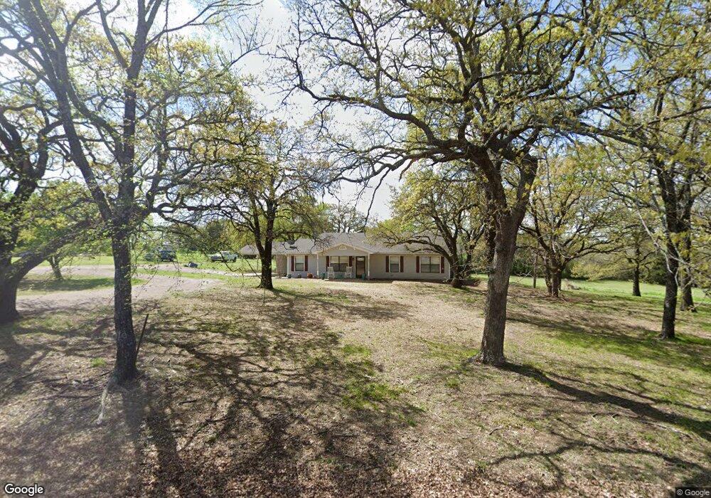
478 Anderson Rd Whitesboro, TX 76273
Estimated Value: $193,574 - $250,000
--
Bed
--
Bath
1,810
Sq Ft
$123/Sq Ft
Est. Value
About This Home
This home is located at 478 Anderson Rd, Whitesboro, TX 76273 and is currently estimated at $221,787, approximately $122 per square foot. 478 Anderson Rd is a home located in Grayson County with nearby schools including J.W. Hayes Primary School, Whitesboro Intermediate School, and Whitesboro Middle School.
Ownership History
Date
Name
Owned For
Owner Type
Purchase Details
Closed on
Jun 15, 2018
Sold by
Walker Joseph Price and Legate Brebda Lea Walker
Bought by
Batchelor Jerry
Current Estimated Value
Purchase Details
Closed on
Nov 10, 2010
Sold by
Harris Alice Alene
Bought by
Walsh Brad
Home Financials for this Owner
Home Financials are based on the most recent Mortgage that was taken out on this home.
Original Mortgage
$54,000
Interest Rate
4.23%
Mortgage Type
Commercial
Create a Home Valuation Report for This Property
The Home Valuation Report is an in-depth analysis detailing your home's value as well as a comparison with similar homes in the area
Home Values in the Area
Average Home Value in this Area
Purchase History
| Date | Buyer | Sale Price | Title Company |
|---|---|---|---|
| Batchelor Jerry | -- | Red River Title Co | |
| Walsh Brad | -- | None Available |
Source: Public Records
Mortgage History
| Date | Status | Borrower | Loan Amount |
|---|---|---|---|
| Previous Owner | Walsh Brad | $54,000 |
Source: Public Records
Tax History Compared to Growth
Tax History
| Year | Tax Paid | Tax Assessment Tax Assessment Total Assessment is a certain percentage of the fair market value that is determined by local assessors to be the total taxable value of land and additions on the property. | Land | Improvement |
|---|---|---|---|---|
| 2025 | $1,328 | $168,235 | -- | $168,235 |
| 2024 | $2,558 | $161,676 | $0 | $161,676 |
| 2023 | $1,020 | $147,609 | $0 | $0 |
| 2022 | $2,133 | $134,190 | $0 | $0 |
| 2021 | $2,193 | $128,006 | $0 | $128,006 |
| 2020 | $2,053 | $110,901 | $0 | $110,901 |
| 2019 | $2,200 | $110,870 | $0 | $110,870 |
| 2018 | $2,062 | $110,870 | $0 | $110,870 |
| 2017 | $1,901 | $99,032 | $0 | $99,032 |
| 2016 | $1,728 | $98,021 | $0 | $98,021 |
| 2015 | $1,153 | $82,180 | $0 | $82,180 |
| 2014 | $1,150 | $82,180 | $0 | $82,180 |
Source: Public Records
Map
Nearby Homes
- 649 Anderson Rd
- 205 Anderson Rd
- 400 Wild Wood Ln
- 53 ac U S Highway 82
- US U S Highway 82
- 873 Anderson Rd
- 313 Texoma Dr
- 203 Red River Dr
- 216 Red River Rd
- 707 N Union St
- 701 Park Place
- 790 Bones Chapel Rd
- 508 N Jordan St
- 115 D St
- TBD Center Park Dr
- TBD Bones Chapel Rd
- 605 Abney St
- 2403 Evelyn Rd
- 1052 Bones Chapel Rd
- 706 Abney St
- 388 Anderson Rd
- 485 Anderson Rd
- 367 Anderson Rd
- 636 Anderson Rd
- 487 Anderson Rd
- 29 Wild Wood Ln
- 1101 Highway 82 W
- 499 Anderson Rd
- 642 Anderson Rd
- 718 Anderson Rd
- 158 Wild Wood Ln
- 1111 Highway 82 W
- 2405 Highway 82 E
- 000 E Us 82 Hwy
- 232 Wild Wood Ln
- 247 Wild Wood Ln
- 722 U S 82
- 1201 Highway 82 W
- 314 Red River Dr
- 316 Red River Dr