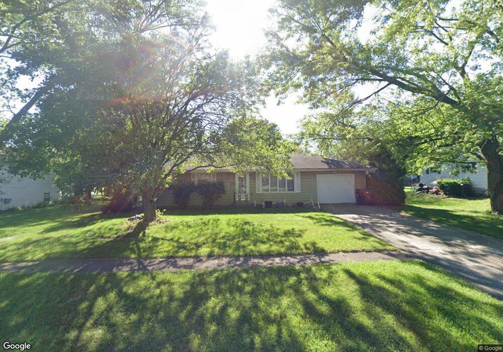
478 Bossert St Herscher, IL 60941
Estimated Value: $178,000 - $187,000
--
Bed
--
Bath
--
Sq Ft
0.34
Acres
About This Home
This home is located at 478 Bossert St, Herscher, IL 60941 and is currently estimated at $181,393. 478 Bossert St is a home located in Kankakee County with nearby schools including Herscher High School.
Ownership History
Date
Name
Owned For
Owner Type
Purchase Details
Closed on
Oct 3, 2025
Sold by
Schneider Ronald P
Bought by
Geiss Blake and Lehnert Samantha
Current Estimated Value
Home Financials for this Owner
Home Financials are based on the most recent Mortgage that was taken out on this home.
Original Mortgage
$169,750
Outstanding Balance
$169,750
Interest Rate
6.58%
Mortgage Type
New Conventional
Estimated Equity
$11,643
Purchase Details
Closed on
Aug 24, 2012
Sold by
Loughry Roger L and Loughry Delores K
Bought by
Schneider Ronald P
Create a Home Valuation Report for This Property
The Home Valuation Report is an in-depth analysis detailing your home's value as well as a comparison with similar homes in the area
Home Values in the Area
Average Home Value in this Area
Purchase History
| Date | Buyer | Sale Price | Title Company |
|---|---|---|---|
| Geiss Blake | $175,000 | Khs Title | |
| Schneider Ronald P | $98,000 | Homestar Title |
Source: Public Records
Mortgage History
| Date | Status | Borrower | Loan Amount |
|---|---|---|---|
| Open | Geiss Blake | $169,750 |
Source: Public Records
Tax History Compared to Growth
Tax History
| Year | Tax Paid | Tax Assessment Tax Assessment Total Assessment is a certain percentage of the fair market value that is determined by local assessors to be the total taxable value of land and additions on the property. | Land | Improvement |
|---|---|---|---|---|
| 2024 | $3,705 | $50,798 | $13,033 | $37,765 |
| 2023 | $3,684 | $49,310 | $12,011 | $37,299 |
| 2022 | $3,521 | $45,950 | $11,192 | $34,758 |
| 2021 | $3,449 | $43,662 | $10,635 | $33,027 |
| 2020 | $3,378 | $42,185 | $10,275 | $31,910 |
| 2019 | $3,282 | $40,759 | $9,928 | $30,831 |
| 2018 | $3,251 | $40,255 | $9,805 | $30,450 |
| 2017 | $2,283 | $39,178 | $9,543 | $29,635 |
| 2016 | $2,161 | $37,671 | $9,176 | $28,495 |
| 2015 | $1,945 | $35,775 | $8,714 | $27,061 |
| 2014 | $1,862 | $34,733 | $8,460 | $26,273 |
| 2013 | -- | $35,352 | $8,611 | $26,741 |
Source: Public Records
Map
Nearby Homes
- 464 E Pilot Dr
- 35 E Tobey Dr
- 301 N Main St
- 597 Jeanette St
- 431/441 E Myrtle Ave
- 476 E Kay St
- 587 Jeanette St
- 688 Jeanette St
- 473 E Kay St
- 577 Jeanette St
- 678 Jeanette St
- 567 Jeanette St
- 343 E Walnut Ct
- 547 Jeanette St
- 537 Jeanette St
- 477 Jeanette St
- 467 Jeanette St
- 457 Jeanette St
- 437 Jeanette St
- 407 Jeanette St
- 458 Bossert St
- 488 Bossert St
- 428 Bossert St
- 469 N Mulberry St
- 467 N Bossert St
- 487 Bossert St
- 447 Bossert St
- 487 N Bossert St
- 539 Pilot Dr
- 429 N Mulberry St
- 497 Bossert St
- 427 Bossert St
- 408 Bossert St
- 507 Pilot Dr
- 409 N Mulberry St
- 490 N Mulberry St
- 464 Pilot Dr
- 475 E 4th St
- 470 N Mulberry St
- 496 N Vernon St