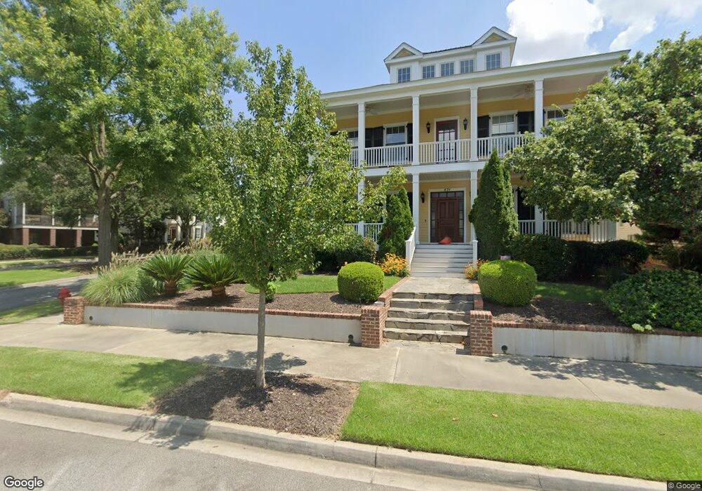
478 Front St North Augusta, SC 29841
Hammond's Ferry NeighborhoodEstimated Value: $677,000 - $1,531,185
4
Beds
4
Baths
5,610
Sq Ft
$197/Sq Ft
Est. Value
About This Home
This home is located at 478 Front St, North Augusta, SC 29841 and is currently estimated at $1,104,093, approximately $196 per square foot. 478 Front St is a home located in Aiken County with nearby schools including Hammond Hill Elementary School, Paul Knox Middle School, and North Augusta High School.
Ownership History
Date
Name
Owned For
Owner Type
Purchase Details
Closed on
Jan 25, 2008
Sold by
Krg Investments Llc
Bought by
Maund Mark T and Maund Christie Y
Current Estimated Value
Home Financials for this Owner
Home Financials are based on the most recent Mortgage that was taken out on this home.
Original Mortgage
$800,000
Interest Rate
6.12%
Mortgage Type
Purchase Money Mortgage
Purchase Details
Closed on
Mar 7, 2007
Sold by
North Augusta Riverfront Co Llc
Bought by
Krg Investments Llc
Create a Home Valuation Report for This Property
The Home Valuation Report is an in-depth analysis detailing your home's value as well as a comparison with similar homes in the area
Home Values in the Area
Average Home Value in this Area
Purchase History
| Date | Buyer | Sale Price | Title Company |
|---|---|---|---|
| Maund Mark T | $250,000 | None Available | |
| Krg Investments Llc | $240,000 | None Available |
Source: Public Records
Mortgage History
| Date | Status | Borrower | Loan Amount |
|---|---|---|---|
| Closed | Maund Mark T | $800,000 |
Source: Public Records
Tax History
| Year | Tax Paid | Tax Assessment Tax Assessment Total Assessment is a certain percentage of the fair market value that is determined by local assessors to be the total taxable value of land and additions on the property. | Land | Improvement |
|---|---|---|---|---|
| 2025 | $4,679 | $46,720 | -- | -- |
| 2023 | $4,688 | $46,720 | $10,280 | $974,740 |
| 2022 | $4,560 | $49,990 | $0 | $0 |
| 2021 | $4,569 | $49,990 | $0 | $0 |
| 2020 | $4,030 | $40,620 | $0 | $0 |
| 2019 | $4,030 | $40,620 | $0 | $0 |
| 2018 | $4,038 | $40,620 | $11,000 | $29,620 |
| 2017 | $3,835 | $0 | $0 | $0 |
| 2016 | $0 | $0 | $0 | $0 |
| 2015 | -- | $0 | $0 | $0 |
| 2014 | $3,699 | $0 | $0 | $0 |
| 2013 | -- | $0 | $0 | $0 |
Source: Public Records
Map
Nearby Homes
- 24 Crystal Lake Dr
- 380 Front St
- 384 Front St
- 61 Crystal Lake Dr
- Lot 12 Railroad Ave
- 162 Lafayette St
- 383 Blue Clay Dr
- 686 Railroad Ave
- 672 Front St
- Lot 10 Lafayette St
- Lot 9 Lafayette St
- 117 Alta Vista Ave Unit 115
- 119 Alta Vista Ave
- 306 Crystal Lake Dr
- 306 Alta Vista Ave Unit 5
- 406 Hamilton St
- 1643 Saint Luke St
- 1645 Saint Luke St
- 1117 Jones St
- 1702&1706 Hicks St
- 474 Front St
- 468 Front St
- 19 Crystal Lake Dr
- 6 Crystal Lake Dr
- 12 Crystal Lake Dr
- 463 Arrington Ave
- 2 Crystal Lake Dr
- 464 Front St
- 459 Arrington Ave
- 23 Crystal Lake Dr
- 16 Crystal Lake Dr
- 455 Arrington Ave
- 20 Crystal Lake Dr
- 508 Front St
- 460 Front St
- 451 Arrington Ave
- 456 Front St
- 447 Arrington Ave
- 27 Crystal Lake Dr
- 19 Phoenix St
Your Personal Tour Guide
Ask me questions while you tour the home.