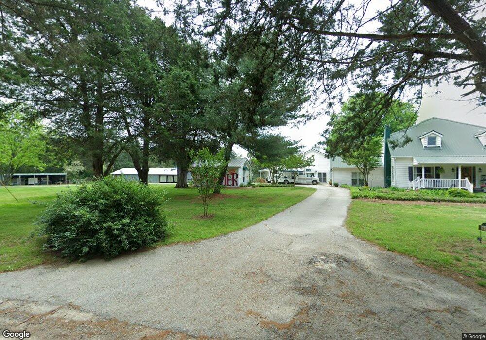
478 Mask Rd Brooks, GA 30205
Estimated Value: $798,678 - $1,417,000
--
Bed
--
Bath
5,456
Sq Ft
$179/Sq Ft
Est. Value
About This Home
This home is located at 478 Mask Rd, Brooks, GA 30205 and is currently estimated at $977,170, approximately $179 per square foot. 478 Mask Rd is a home located in Fayette County with nearby schools including Peeples Elementary School, Whitewater Middle School, and Whitewater High School.
Ownership History
Date
Name
Owned For
Owner Type
Purchase Details
Closed on
Jul 12, 2021
Sold by
Hanners Earl J Jr Estate
Bought by
Mcfarland Kevin and Mcfarland Deborah
Current Estimated Value
Home Financials for this Owner
Home Financials are based on the most recent Mortgage that was taken out on this home.
Original Mortgage
$400,000
Outstanding Balance
$367,150
Interest Rate
2.96%
Mortgage Type
New Conventional
Estimated Equity
$610,020
Purchase Details
Closed on
Feb 25, 2004
Sold by
Hanners Earl J
Bought by
Hanners Farm Lllp
Create a Home Valuation Report for This Property
The Home Valuation Report is an in-depth analysis detailing your home's value as well as a comparison with similar homes in the area
Home Values in the Area
Average Home Value in this Area
Purchase History
| Date | Buyer | Sale Price | Title Company |
|---|---|---|---|
| Mcfarland Kevin | $625,000 | -- | |
| Hanners Farm Lllp | $14,000 | -- |
Source: Public Records
Mortgage History
| Date | Status | Borrower | Loan Amount |
|---|---|---|---|
| Open | Mcfarland Kevin | $400,000 | |
| Previous Owner | Hanners Earl J | $115,000 |
Source: Public Records
Tax History Compared to Growth
Tax History
| Year | Tax Paid | Tax Assessment Tax Assessment Total Assessment is a certain percentage of the fair market value that is determined by local assessors to be the total taxable value of land and additions on the property. | Land | Improvement |
|---|---|---|---|---|
| 2024 | $5,349 | $260,000 | $72,756 | $187,244 |
| 2023 | $5,349 | $316,196 | $72,756 | $243,440 |
| 2022 | $6,876 | $250,000 | $56,040 | $193,960 |
| 2021 | $6,876 | $260,332 | $60,212 | $200,120 |
| 2020 | $4,098 | $227,648 | $51,528 | $176,120 |
| 2019 | $3,967 | $217,968 | $51,528 | $166,440 |
| 2018 | $3,650 | $198,944 | $44,504 | $154,440 |
| 2017 | $3,261 | $176,880 | $42,160 | $134,720 |
| 2016 | $3,029 | $160,000 | $42,160 | $117,840 |
| 2015 | $2,870 | $148,840 | $42,160 | $106,680 |
| 2014 | $2,678 | $135,800 | $42,160 | $93,640 |
| 2013 | -- | $129,896 | $0 | $0 |
Source: Public Records
Map
Nearby Homes
- LOT 8 Mask Road - Hanner's Farm S
- LOT 7 Mask Road - Hanner's Farm S
- LOT 5 Mask Road - Hanner's Farm S
- LOT 6 Mask Road - Hanner's Farm S
- 0 Mask and Lynch Rd Unit 10611467
- LOT 4 Mask Road - Hanner's Farm S
- LOT 5 Mask Road - Hanner's Farm N
- 460 Mask Rd
- LOT 6 Mask Road - Hanner's Farm N
- 423 Mask Rd
- LOT 3 Mask Road - Hanner's Farm S
- LOT 4 Mask Road - Hanner's Farm N
- LOT 3 Mask Road - Hanner's Farm N
- 1481 Highway 85 Connector
- 210 Mockingbird Ln
- 160 Carrington Ln
- 323 Hollonville Rd
- 152 Carson Rd
- LOT 2 Mask Road - Hanner's Farm S
- 231 Sandy Ln
- 478 Mask Rd
- 478 Mask Rd
- 495 Mask Rd
- 0 Mask and Lynch Rd Unit 10559731
- 535 Mask Rd
- LOT 6 Mask Road - 12 702 + - Acres
- 509 Mask Rd
- 136 Lynch Rd
- 153 Lynch Rd
- 0 Lynch Rd Unit 7153755
- 0 Lynch Rd Unit 7153776
- 0 Lynch Rd Unit 7337387
- 0 Lynch Rd Unit 8055459
- 515 Mask Rd
- 449 Mask Rd
- 144 Lynch Rd
- 175 Lynch Rd
- 441 Brooks Rd
- LOT 4 Mask Road - 27 635 + - Acres
- 211 Lynch Rd