Estimated Value: $260,000 - $276,000
3
Beds
3
Baths
1,615
Sq Ft
$166/Sq Ft
Est. Value
About This Home
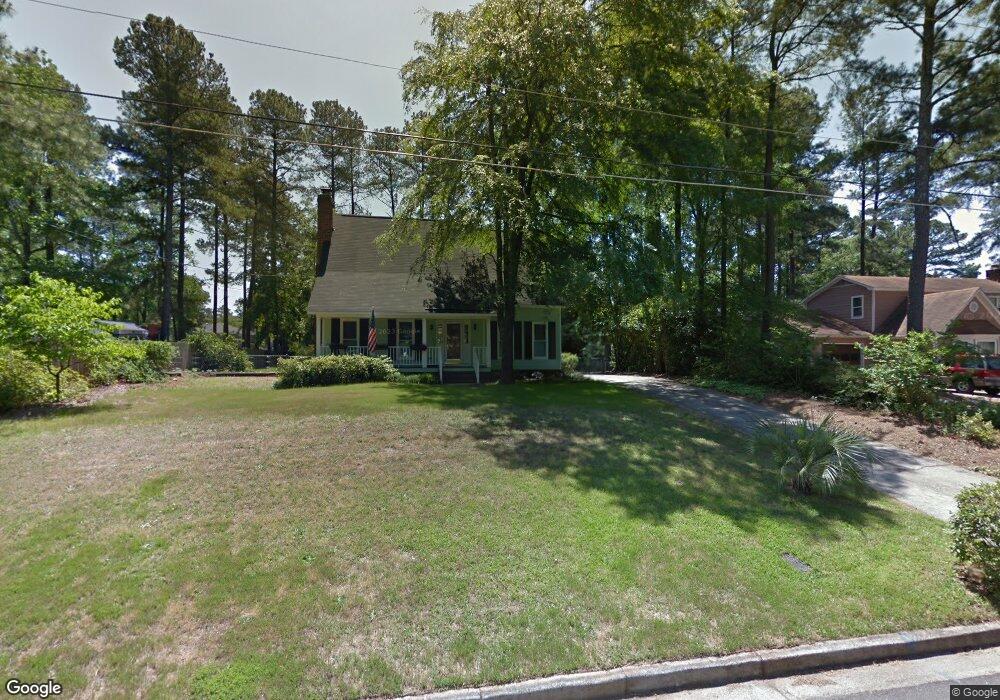
This home is located at 478 Pheasant Run Dr, Evans, GA 30809 and is currently estimated at $268,493, approximately $166 per square foot. 478 Pheasant Run Dr is a home located in Columbia County with nearby schools including Evans Elementary School, Evans Middle School, and Evans High School.
Ownership History
Date
Name
Owned For
Owner Type
Purchase Details
Closed on
Aug 8, 2022
Sold by
Thurber Catherine Sondag
Bought by
Thurber Catherine Sondag and Thurber Bruce Edward
Current Estimated Value
Purchase Details
Closed on
Jan 18, 2002
Sold by
Skinner Donald H and Skinner Susan R
Bought by
Tidwell Catherine M
Home Financials for this Owner
Home Financials are based on the most recent Mortgage that was taken out on this home.
Original Mortgage
$96,900
Interest Rate
6.85%
Mortgage Type
FHA
Create a Home Valuation Report for This Property
The Home Valuation Report is an in-depth analysis detailing your home's value as well as a comparison with similar homes in the area
Home Values in the Area
Average Home Value in this Area
Purchase History
| Date | Buyer | Sale Price | Title Company |
|---|---|---|---|
| Thurber Catherine Sondag | -- | -- | |
| Tidwell Catherine M | $98,500 | -- |
Source: Public Records
Mortgage History
| Date | Status | Borrower | Loan Amount |
|---|---|---|---|
| Previous Owner | Tidwell Catherine M | $96,900 |
Source: Public Records
Tax History
| Year | Tax Paid | Tax Assessment Tax Assessment Total Assessment is a certain percentage of the fair market value that is determined by local assessors to be the total taxable value of land and additions on the property. | Land | Improvement |
|---|---|---|---|---|
| 2025 | $1,603 | $104,742 | $18,804 | $85,938 |
| 2024 | $1,594 | $101,448 | $18,804 | $82,644 |
| 2023 | $1,594 | $83,387 | $15,204 | $68,183 |
| 2022 | $2,062 | $77,078 | $15,304 | $61,774 |
| 2021 | $1,813 | $64,507 | $13,604 | $50,903 |
| 2020 | $1,545 | $53,509 | $11,804 | $41,705 |
| 2019 | $1,591 | $55,170 | $12,204 | $42,966 |
| 2018 | $1,480 | $51,009 | $11,204 | $39,805 |
| 2017 | $1,468 | $50,409 | $10,704 | $39,705 |
| 2016 | $1,535 | $54,752 | $11,380 | $43,372 |
| 2015 | $1,365 | $48,351 | $8,480 | $39,871 |
| 2014 | $1,363 | $47,685 | $9,280 | $38,405 |
Source: Public Records
Map
Nearby Homes
- 525 Pheasant Run Dr
- 4421 Hereford Farm Rd
- 648 River Oaks Ln
- 854 Sparkleberry Rd
- 625 Dunloe Cir
- 4560 Mulberry Creek Dr
- 456 Connemara Trail
- 809 Woodberry Dr
- 4484 Woodberry Ct
- 726 Whitney Shoals Rd
- 881 Audubon Way
- 814 Audubon Way
- 4489 Woodberry Ct
- 4481 Woodberry Ct
- 2820 Old Riah Rd
- 829 Woodberry Dr
- 606 Ridge Way
- 435 Evans Mill Dr Unit 17
- 780 Springbrook Cir
- 4478 Cape Cod Dr
- 480 Pheasant Run Dr
- 474 Pheasant Run Dr
- 464 Skeet Ct
- 470 Pheasant Run Dr
- 473 Pheasant Run Dr
- 471 Pheasant Run Dr
- 484 Pheasant Run Dr
- 475 Pheasant Run Dr
- 488 Pheasant Run Dr
- 462 Skeet Ct
- 469 Pheasant Run Dr
- 468 Pheasant Run Dr
- 477 Pheasant Run Dr
- 467 Pheasant Run Dr
- 490 Pheasant Run Dr
- 490 Pheasant Run Dr
- 465 Pheasant Run Dr
- 463 Pheasant Run Dr
- 479 Pheasant Run Dr
- 461 Pheasant Run Dr
Your Personal Tour Guide
Ask me questions while you tour the home.